|
0 members (),
2,863
guests, and
19
robots. |
|
Key:
Admin,
Global Mod,
Mod
|
|
S |
M |
T |
W |
T |
F |
S |
|
1
|
2
|
3
|
4
|
5
|
6
|
7
|
|
8
|
9
|
10
|
11
|
12
|
13
|
14
|
|
15
|
16
|
17
|
18
|
19
|
20
|
21
|
|
22
|
23
|
24
|
25
|
26
|
27
|
28
|
|
29
|
30
|
|
|
|
|
|
|
There are no members with birthdays on this day. |
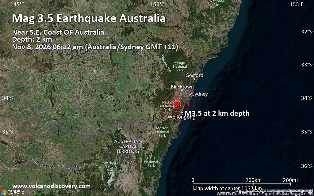
Small magnitude 3.5 earthquake 20 miles northwest of Wollongong, New South Wales, Australia
• Magnitude 3.5 earthquake 20 miles northwest of Wollongong, New South Wales,...
• Possible earthquake reported minutes ago near Wollongong, New South Wales, ...
• World Earthquake Report for Saturday, 7 November 2026
• M 1.3 - 64 km NW of Tatitlek, Alaska
• M 5.5 - 74 km NE of Hasaki, Japan
|
|
|
Joined: Feb 2001
Posts: 800,656
Launch Director
|
|
Launch Director
Joined: Feb 2001
Posts: 800,656 |
SPC Nov 7, 2026 1730 UTC Day 2 Convective OutlookSPC 1730Z Day 2 Outlook 
Day 2 Convective Outlook
NWS Storm Prediction Center Norman OK
1059 AM CST Sat Nov 07 2026

Valid 081200Z - 091200Z

...NO SEVERE THUNDERSTORM AREAS FORECAST...

...SUMMARY...
There appears little risk for severe thunderstorm activity across
the U.S. Sunday through Sunday night.

...Discussion...
Within one branch of split westerlies emanating from the eastern
Pacific, models indicate that mid-level ridging across the
Intermountain West will broaden eastward across the Great Plains and
Mississippi Valley through this period.  As it does, an increasingly
sheared mid-level low within a branch to the south may only slowly
redevelop east-northeastward across the northern Mexican Plateau,
toward the Texas Big Bend vicinity Sunday through Sunday night.

In higher latitudes, it appears that larger-scale mid-level
troughing will continue to evolve and be maintained across
southeastern Canada and the Northeast, with one notable embedded
short wave trough forecast to pivot north-northeastward from
offshore of the New England coast through the Canadian Maritimes,
while a significant upstream perturbation digs from near/north of
the upper Great Lakes region toward the northern Atlantic Seaboard.
A trailing short wave trough is forecast to continue inland across
the Canadian Rockies and Prairies.

In the wake of an initial developing surface cyclone associated with
the Northeastern mid-level troughing, a couple of reinforcing
intrusions of cool/dry air will continue to overspread much of the
Upper Midwest/Great Lakes/Northeast and Mid Atlantic, behind a
weakening lead frontal zone across the Florida Peninsula and Gulf
Basin.

...Southern Texas...
Southeasterly low-level flow along the slowing/stalling surface
front will maintain relatively high moisture content in a corridor
along and east of the Rio Grande Valley vicinity Sunday.  With the
approach of the remnant mid-level cyclonic circulation, forcing for
ascent and destabilization supported by differential thermal
advection will maintain an environment conducive to occasional
scattered thunderstorm development.  Even with at least some
mid-level cooling and drying possible by late afternoon,
thermodynamic profiles still appear unlikely to become supportive of
an appreciable risk for severe hail and/or wind.  But, this will
continue to be evaluated in later outlooks for this period.

...Pacific Northwest...
Latest model output suggests that an environment conducive to a risk
for convection capable of producing lightning (including strong,
moist low-level onshore flow beneath cool mid-levels) may be
maintained into the 15-18Z time frame Sunday morning.

...Lower Great Lakes vicinity...
Models suggest that mid-level cooling accompanying the digging short
wave trough will contribute to destabilization and occasional
scattered showers late Sunday afternoon through Sunday night.  By
late Sunday night, particularly near the southern lake shores to the
north of the Rochester and Syracuse vicinity, in association with
the mid-level cold core (-26 to -28C around 500 mb), this may
include some risk for weak thunderstorm activity.  However, due to
the probable short-lived and isolated nature of this risk,
thunderstorm probabilities will be maintained at less than 10
percent.

..Kerr.. 11/07/2026
Read morehttps://www.spc.noaa.gov/products/outlook/day2otlk_1730.html
|
|



CMS The Best Conveyancing solicitors conveyancing quotes throughout the UK
For any webhosting enquiries please email webmaster@aus-city.com
|
|
Forums60
Topics916,152
Posts950,949
Members2,960
| |
Most Online102,106
Jul 10th, 2026
|
|
|









































