|
0 members (),
1,768
guests, and
31
robots. |
|
Key:
Admin,
Global Mod,
Mod
|
|
S |
M |
T |
W |
T |
F |
S |
|
1
|
2
|
3
|
4
|
5
|
6
|
7
|
|
8
|
9
|
10
|
11
|
12
|
13
|
14
|
|
15
|
16
|
17
|
18
|
19
|
20
|
21
|
|
22
|
23
|
24
|
25
|
26
|
27
|
28
|
|
29
|
30
|
|
|
|
|
|
|
There are no members with birthdays on this day. |
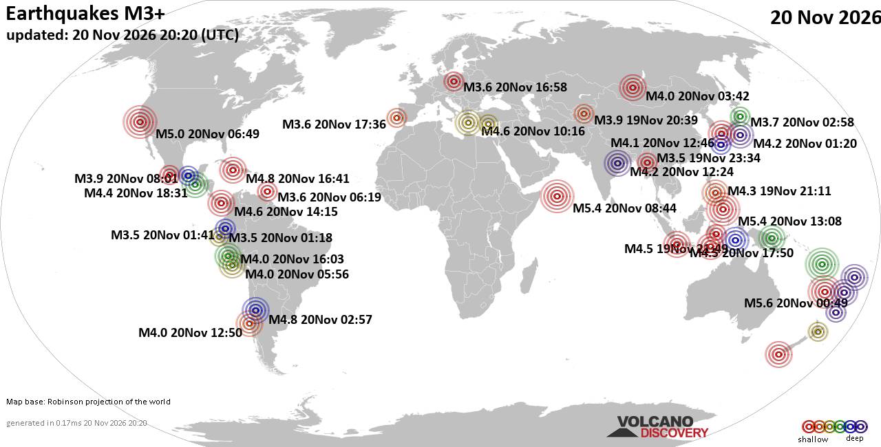
World Earthquake Report for Friday, 20 November 2026
• M 1.6 - 8 km NW of The Geysers, CA
• M 4.4 - 109 km NNE of Lospalos, Timor Leste
• M 3.9 - 1 km NW of Commerce, CA
• M 2.0 - 8 km NE of Aguanga, CA
• M 1.5 - 28 km NNE of Montecito, CA
|
|
|
Joined: Feb 2001
Posts: 800,656
Launch Director
|
|
Launch Director
Joined: Feb 2001
Posts: 800,656 |
SPC Day 2 Fire Weather OutlookSPC Day 2 Fire Weather Outlook 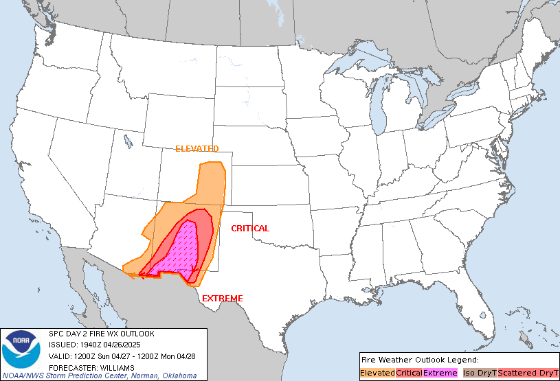
Day 2 Fire Weather Outlook
NWS Storm Prediction Center Norman OK
0122 PM CST Fri Nov 20 2026

Valid 211200Z - 221200Z

...NO CRITICAL AREAS...

The forecast remains on track with no changes for this update.
Surface high pressure will remain over the eastern U.S. through
D2/Saturday as a coastal low lifts northwards towards the Carolinas.
This will translate into slightly increased southeasterly winds
tonight into Saturday although wind speeds will remain light at 10
mph or less. Albeit light, this southeasterly flow will contribute
to poor RH recoveries tonight across portions of eastern TN, eastern
KY into WV, with daytime RH falling close to 15%. Fuels remain
receptive across the Appalachians and adjacent Ohio River Valley
areas where ERC values in the 90-95th percentile are present. The
light winds will limit a broader fire weather threat but localized
elevated fire weather concerns are likely in favored terrain gaps,
potentially impacting existing wildfires.

..Williams.. 11/20/2026

.PREV DISCUSSION... /ISSUED 1133 PM CST Thu Nov 19 2026/

...Synopsis...
A mid-level trough will eject into the Plains states as a second
upper trough moves ashore the West Coast tomorrow (Saturday). A
surface trough will traverse the Mississippi Valley while a surface
low undergoes rapid intensification off of the Carolina coastline.
At the moment, the stronger surface wind field accompanying the East
Coast low should remain displaced to the south of a low-level dry
plume over the central Appalachians, characterized by 25-45 percent
RH. Over the central Appalachians, prolonged dry conditions will
foster localized wildfire growth potential, but the chances for
widespread conditions favoring rapid wildfire spread appear too low
for the introduction of fire weather highlights this outlook.

...Please see www.spc.noaa.gov/fire for graphic product...
Read morehttps://www.spc.noaa.gov/products/fire_wx/fwdy2.html
|
|



CMS The Best Conveyancing solicitors conveyancing quotes throughout the UK
For any webhosting enquiries please email webmaster@aus-city.com
|
|
Forums60
Topics937,862
Posts972,659
Members2,960
| |
Most Online102,106
Jul 10th, 2026
|
|
|









































