|
0 members (),
1,472
guests, and
25
robots. |
|
Key:
Admin,
Global Mod,
Mod
|
|
S |
M |
T |
W |
T |
F |
S |
|
1
|
2
|
3
|
4
|
5
|
6
|
7
|
|
8
|
9
|
10
|
11
|
12
|
13
|
14
|
|
15
|
16
|
17
|
18
|
19
|
20
|
21
|
|
22
|
23
|
24
|
25
|
26
|
27
|
28
|
|
29
|
30
|
|
|
|
|
|
|
There are no members with birthdays on this day. |
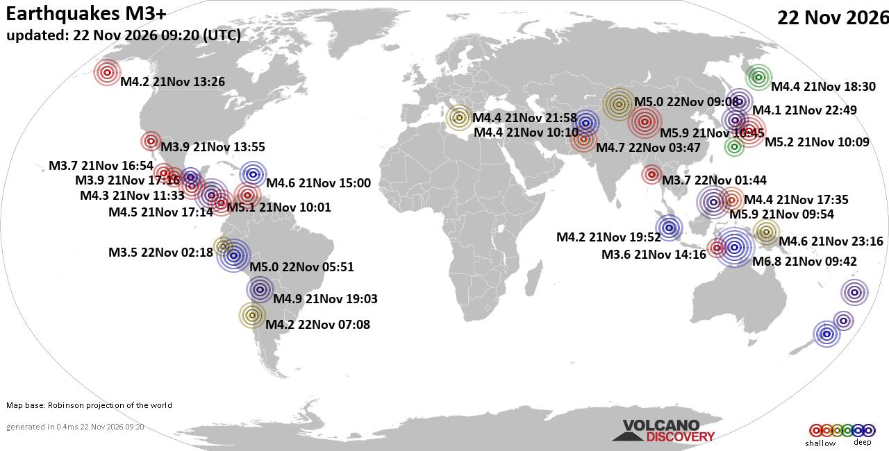
World Earthquake Report for Sunday, 22 November 2026
• M 2.8 - 152 km S of Cordova, Alaska
• M 5.4 - 159 km E of Masohi, Indonesia
• M 4.2 - south of the Fiji Islands
• M 0.7 - 5 km WNW of The Geysers, CA
• Strong mag. 5.0 earthquake - 47 km southeast of Ürümqi, Xinjiang, China, ...
|
|
|
Joined: Feb 2001
Posts: 800,656
Launch Director
|
|
Launch Director
Joined: Feb 2001
Posts: 800,656 |
SPC MD 2461MD 2461 CONCERNING TORNADO WATCH 706... FOR PARTS OF THE EASTERN FLORIDA PENINSULA 
Mesoscale Discussion 2461
NWS Storm Prediction Center Norman OK
0607 PM CST Sat Nov 21 2026

Areas affected...Parts of the eastern Florida Peninsula

Concerning...Tornado Watch 706...

Valid 220007Z - 220200Z

The severe weather threat for Tornado Watch 706 continues.

SUMMARY...The potential for brief tornadoes continues across
portions of the eastern Florida Peninsula as thunderstorms continue
to develop and intensify.

DISCUSSION...Regional radar and MRMS echo top imagery show
additional thunderstorm development over Lake Okeechobee along a
surface trough and along a sea-breeze boundary near the Fort
Lauderdale area. Although these cells have shown gradual
intensification so far, latest mesoanalysis estimates suggest that
adequate MLCAPE remains in place for deep/intense convection, and
surface observations have shown only limited nocturnal cooling over
the past hour. Consequently, further intensification appears
probable as these cells continue east/northeast over the next hour
or so.

The KMLB and TFLL VWPs, as well as a 22:40 UTC ACARS sounding from
KFLL, continue to sample 0-1 km SRH on the order of 100-150 m2/s2
downstream or in proximity to the intensifying convection. This
environment has already yielded a couple of strong, albeit
transient, low-level mesocyclones within the past hour, and will
likely continue to support the potential for brief tornadoes as
storms deepen before moving off shore in the coming hours.

..Moore.. 11/22/2026

...Please see www.spc.noaa.gov for graphic product...

ATTN...WFO...MFL...MLB...

LAT...LON   26618092 27058091 27438086 27588083 27688073 27708049
            27658033 26958001 26627994 26437998 26298009 26308037
            26348058 26448081 26618092

MOST PROBABLE PEAK TORNADO INTENSITY...85-110 MPH
MOST PROBABLE PEAK WIND GUST...UP TO 60 MPH
Read morehttps://www.spc.noaa.gov/products/md/md2461.html
|
|



CMS The Best Conveyancing solicitors conveyancing quotes throughout the UK
For any webhosting enquiries please email webmaster@aus-city.com
|
|
Forums60
Topics940,015
Posts974,812
Members2,960
| |
Most Online102,106
Jul 10th, 2026
|
|
|









































