|
|
|
0 members (),
162
guests, and
17
robots. |
|
Key:
Admin,
Global Mod,
Mod
|
|
S |
M |
T |
W |
T |
F |
S |
|
|
|
|
1
|
2
|
3
|
4
|
|
5
|
6
|
7
|
8
|
9
|
10
|
11
|
|
12
|
13
|
14
|
15
|
16
|
17
|
18
|
|
19
|
20
|
21
|
22
|
23
|
24
|
25
|
|
26
|
27
|
28
|
29
|
30
|
31
|
|
|
There are no members with birthdays on this day. |

#748978
Mon 30 Dec 2024 09:34:AM
|
Joined: Feb 2001
Posts: 381,904
Launch Director
|
OP

Launch Director
Joined: Feb 2001
Posts: 381,904 |
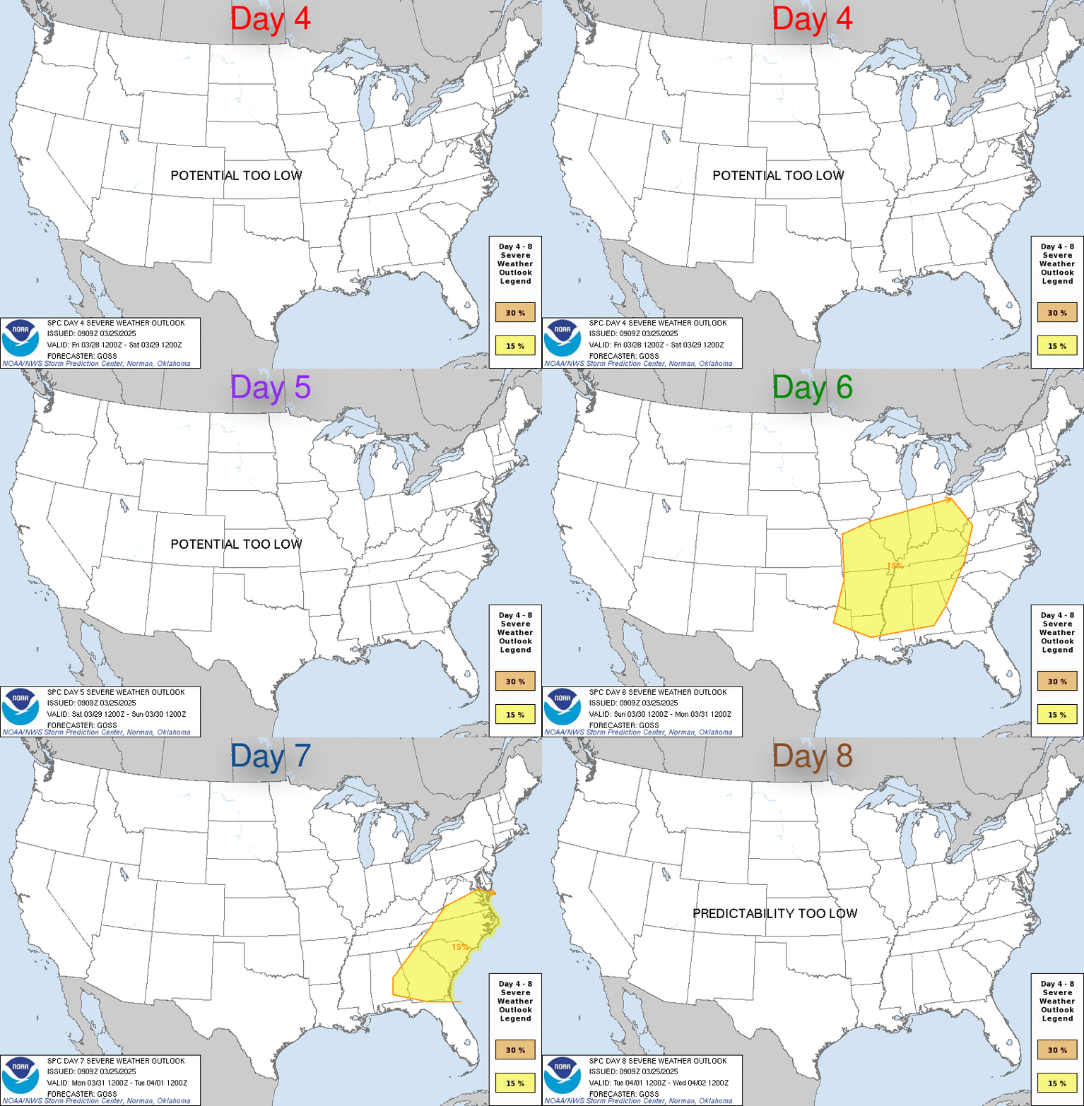
SPC Dec 30, 2024 Day 4-8 Severe Weather OutlookDay 4-8 Outlook 
Day 4-8 Convective Outlook
NWS Storm Prediction Center Norman OK
0331 AM CST Mon Dec 30 2024

Valid 021200Z - 071200Z

...DISCUSSION...
Thunderstorm chances will likely be limited on D4/Thursday and
D5/Friday as airmass over the CONUS remains too cold and dry. Some
airmass modification may begin across the southern Plains late
d5/Friday or early D6/Saturday as a shortwave trough progresses
across the western CONUS. As the upper pattern trends more zonal
across the central CONUS, surface lee troughing will sharpen, with
low-level flow forecast to strengthen amid the increasing surface
pressure gradient. The approaching shortwave trough is expected to
continue its eastward progression into the Plains on D6/Saturday and
D7/Sunday, resulting in potential interaction with this return
moisture from central/eastern portions of TX/OK into the Lower MS
Valley. All aspects of the approaching shortwave trough remain
uncertain, with deterministic guidance showing large run-to-run
variability and notable difference between the GEFS and EPS. As
such, overall forecast confidence is low. However, the overall
trends suggests some severe potential may materialize late this
weekend into early next week.
Read morehttps://www.spc.noaa.gov/products/exper/day4-8/
|
|


CMS The Best Conveyancing solicitors conveyancing quotes throughout the UK
For any webhosting enquiries please email webmaster@aus-city.com
|
|
Forums60
Topics713,002
Posts747,618
Members2,957
| |
Most Online4,158
Jun 21st, 2024
|
|
|
|
|
Copyright 1996 - 2024 by David Cottle. Designed by David Bate Jr. All Rights Reserved.
By using this forum, the user agrees not to transfer any data or technical information received under the agreement, to any other entity without the express approval of the AUS-CITY Forum Admins and/or authors of individual posts (Forum Admins and DoD/USSPACECOM for the analysis of satellite tracking data).
Two-line elements (TLE) and all other satellite data presented and distributed via this forum and e-mail lists of AUS-CITY are distributed with permission from DoD/USSTRATCOM.


Reprise Hosting


|

|