|
0 members (),
803
guests, and
35
robots. |
|
Key:
Admin,
Global Mod,
Mod
|
|
S |
M |
T |
W |
T |
F |
S |
|
|
|
|
1
|
2
|
3
|
4
|
|
5
|
6
|
7
|
8
|
9
|
10
|
11
|
|
12
|
13
|
14
|
15
|
16
|
17
|
18
|
|
19
|
20
|
21
|
22
|
23
|
24
|
25
|
|
26
|
27
|
28
|
29
|
30
|
31
|
|
|
There are no members with birthdays on this day. |
|
|
|
|
|
|
|
|
|
|
|
|
|
|
by Webmaster - Mon 06 Jul 2026 04:49:PM
|
by Webmaster - Mon 06 Jul 2026 04:49:PM
|
by Webmaster - Mon 06 Jul 2026 04:49:PM
|
|
|
|
|
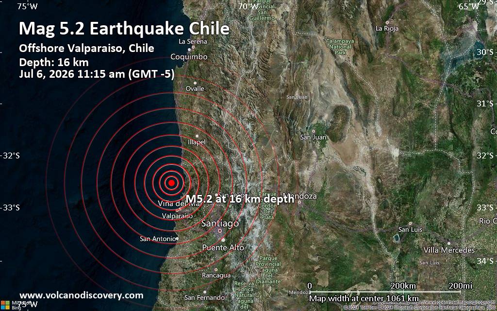
Significant magnitude 5.2 earthquake 58 km north of Valparaiso, Chile
• Small earthquake of magnitude 3.7 just reported 10 km southwest of Glogow, ...
• World Earthquake Report for Monday, 6 July 2026
• Significant 5.3 quake hits near Valparaiso, Provincia de Valparaíso, Regio...
• Moderate mag. 4.6 earthquake - South Pacific Ocean, 45 km north of Valparai...
• Strong mag. 5.2 earthquake - South Pacific Ocean, 58 km north of Valparaiso...
|
|
|
Joined: Feb 2001
Posts: 678,976
Launch Director
|
OP

Launch Director
Joined: Feb 2001
Posts: 678,976 |
SPC Day 1 Fire Weather OutlookSPC Day 1 Fire Weather Outlook 
Day 1 Fire Weather Outlook
NWS Storm Prediction Center Norman OK
1133 AM CDT Mon Jul 06 2026

Valid 061700Z - 071200Z

...Morning Update...
The forecast remains on track for dry/windy conditions and isolated
dry thunderstorms across portions of the Four Corners and Great
Basin this afternoon. Residual mid-level moisture -- as portrayed by
REV's 12z sounding and various afternoon forecast soundings for the
rest of the region -- will interact with an ejecting shortwave
trough and daytime instability to develop high based convection. Dry
sub-cloud layers and 0.6-0.8" PWATs will encourage less
precipitation efficiency initially, maintaining lightning ignition
potential where critically dry fuels exist. A transition to a mixed
wet/dry thunderstorm threat will occur in the evening as PWATs
increase, most likely in northwestern NM and eastern AZ. See the
previous discussion for more information.

..Elizalde-Garcia.. 07/06/2026

.PREV DISCUSSION... /ISSUED 0120 AM CDT Mon Jul 06 2026/

...Synopsis...
A combination of dry thunderstorms and dry/windy conditions will
pose fire weather concerns for portions of the Four Corners and
northern Great Basin for today. Early-morning water-vapor imagery
continues to show an upper ridge over the Four Corners region with
an embedded shortwave trough evident across the northern Great
Basin. This feature will promote not only thunderstorm chances
across much of the Great Basin, but should also result in dry/windy
conditions across parts of NV, UT, and AZ.

...Dry Thunderstorms...
The 00 UTC MFR RAOB sampled a PWAT value of 0.96 inches, which is
higher than previously anticipated by model guidance. Consequently,
MRMS QPE and surface stations have reported pockets of wetting
rainfall up to 0.25 inches associated with thunderstorms across
southern OR late Sunday evening/early Monday morning. Regional
soundings further east into the Four Corners region sampled a drier
air mass (especially within the boundary layer), but GOES PWAT
imagery suggests higher-quality moisture is advecting northward into
western NV ahead of the upper-level disturbance. This will likely
favor wet thunderstorms across northern CA into southern OR where
most guidance shows a consistent signal for wetting rainfall, which
warranted removal from the dry thunderstorm risk area. A mix of wet
and dry thunderstorms across the CA/OR/NV tri-state region should
transition to predominantly dry thunderstorms with southeastward
extent towards the Four Corners region on the fringe of the
mid-level moisture plume. In general, fuels remain very dry across
the broader region and should support lightning ignitions outside of
where heavier precipitation cores have occurred (mainly over
northern NV/southern OR) over the past 12-24 hours.

...Eastern Nevada into Utah and Arizona...
Modest surface pressure falls across the northern Great Basin
through the afternoon will result in increasing southerly winds
across southeast NV into adjacent portions of UT and AZ. Latest
ensemble guidance continues to show reasonably strong probabilities
for sustained winds near 15 mph with gusts upwards of 20-30 mph.
Relative humidity values should fall to near 15% as temperatures
climb into the 90s, resulting in areas of elevated fire weather
conditions. While confidence in elevated conditions is greatest
across southeast NV into southwest UT, more aggressive solutions
suggests elevated conditions may extend into eastern UT.

...Please see www.spc.noaa.gov/fire for graphic product...
Read morehttps://www.spc.noaa.gov/products/fire_wx/fwdy1.html
|
|



CMS The Best Conveyancing solicitors conveyancing quotes throughout the UK
For any webhosting enquiries please email webmaster@aus-city.com
|
|
Forums60
Topics786,926
Posts821,700
Members2,960
| |
Most Online22,463
May 9th, 2026
|
|
|