|
|
|
0 members (),
1,300
guests, and
91
robots. |
|
Key:
Admin,
Global Mod,
Mod
|
|
S |
M |
T |
W |
T |
F |
S |
|
|
|
|
|
|
|
1
|
|
2
|
3
|
4
|
5
|
6
|
7
|
8
|
|
9
|
10
|
11
|
12
|
13
|
14
|
15
|
|
16
|
17
|
18
|
19
|
20
|
21
|
22
|
|
23
|
24
|
25
|
26
|
27
|
28
|
29
|
|
30
|
31
|
|
|
|
|
|
|
There are no members with birthdays on this day. |
|
|
|
|
|
|
by Webmaster - Wed 05 Aug 2026 03:55:PM
|
by Webmaster - Wed 05 Aug 2026 03:55:PM
|
by Webmaster - Wed 05 Aug 2026 03:55:PM
|
|
|
|
|
|
|
|
|
|
|
|
|
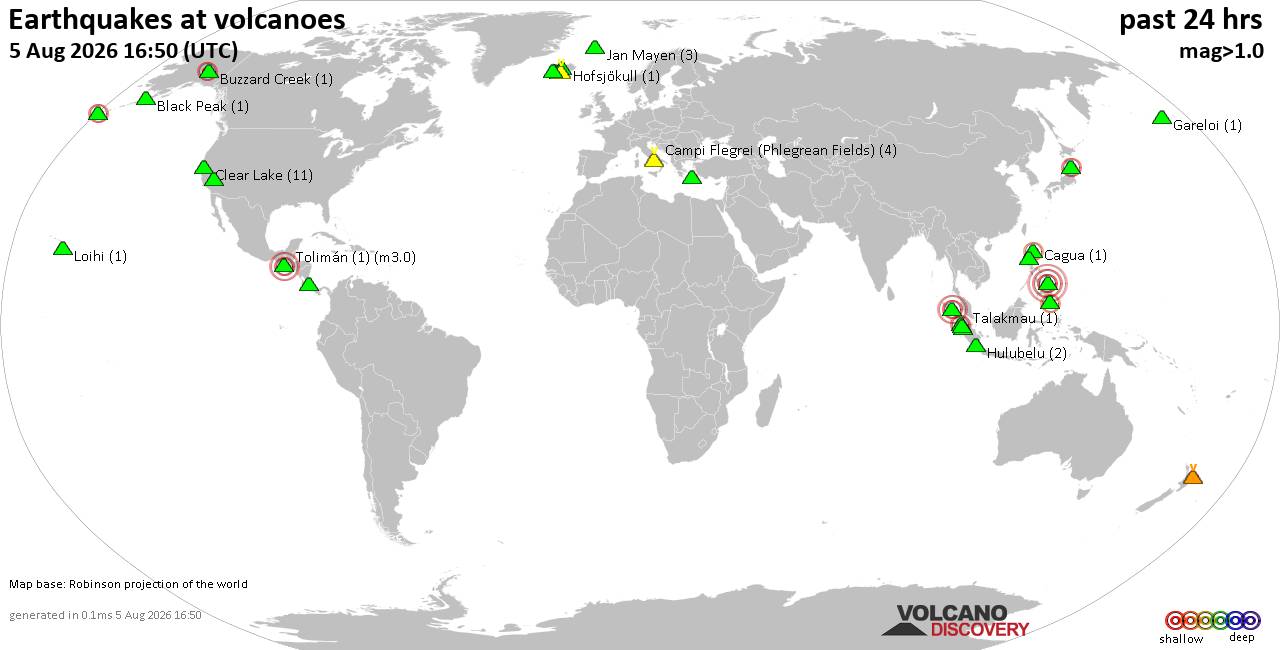
Volcano earthquake report for Wednesday, 5 Aug 2026
• World Earthquake Report for Wednesday, 5 August 2026
• Significant 5.3 quake hits near Tasikmalaya, Kota Tasikmalaya, Jawa Barat, ...
• Moderate mag. 4.1 earthquake - Near North Coast of West Papua on Wednesday,...
• Strong mag. 5.0 earthquake - Java, Indonesia, on Wednesday, Aug 5, 2026, at...
• Moderate mag. 4.0 earthquake - Banda Sea on Wednesday, Aug 5, 2026, at 10:3...
|
|
|
Joined: Feb 2001
Posts: 678,976
Launch Director
|
OP

Launch Director
Joined: Feb 2001
Posts: 678,976 |
Significant 6.3 quake hits near Malapatan, Province of Sarangani, Soccsksargen, Philippines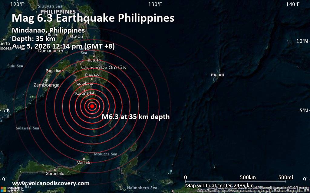 A magnitude 6.3 earthquake near Malapatan, Province of Sarangani, Soccsksargen, Philippines, was reported only 7 minutes ago by the European-Mediterranean Seismological Centre (EMSC), considered one of the key international agencies that monitor seismic activity worldwide. The earthquake occurred at a moderately shallow depth of 35. km beneath the epicenter around noon on Wednesday, August 5th, 2026, at 12:14 pm local time. The exact magnitude, epicenter, and depth of the quake might be revised within the next few hours or minutes as seismologists review data and refine their calculations, or as other agencies issue their report.
Our monitoring service identified a second report from Indonesia's Meteorology, Climatology, and Geophysical Agency which listed the quake at magnitude 6.5. A third agency, the German Research Centre for Geosciences (GFZ), reported the same quake at magnitude 6.3.
Based on the preliminary seismic data, the quake should have been widely felt by almost everyone in the area of the epicenter. It might have caused light to moderate damage.
Towns or cities where the quake likely caused strong ground shaking include
Moderate shaking probably occurred in Glan (pop. 24,300) located 65 km from the epicenter, Sapu Padidu (pop. 9,800) 72 km away, Caburan (pop. 12,600) 73 km away, Malapatan (pop. 82,600) 77 km away, Alabel (pop. 90,100) 91 km away, and General Santos (pop. 722,100) 96 km away.
Weak shaking might have been felt in Malita (pop. 118,400) located 126 km from the epicenter.
VolcanoDiscovery will automatically update magnitude and depth if these change and follow up if other significant news about the quake become available. If you’re in the area, please send us your experience through our reporting mechanism, either online or via our mobile app. This will help us provide more first-hand updates to anyone around the globe who wants to know more about this quake.
Earthquake data: Date & time: Aug 5, 2026 04:14 am (Universal Time) local time (5 Aug 2026 04:14 GMT)Magnitude: 6.3 Depth: 35.00 km Epicenter latitude / longitude: 5.26°N / 125.44°E  ( Davao Occidental, Davao, Philippines) Primary data source: EMSChttps://www.volcanodiscovery.com/earthquake/news/322815/Significant-63-quake-hits-near-Malapatan-Province-of-Sarangani-Soccsksargen-Philippines.html
|
|



CMS The Best Conveyancing solicitors conveyancing quotes throughout the UK
For any webhosting enquiries please email webmaster@aus-city.com
|
|
Forums60
Topics794,206
Posts828,994
Members2,960
| |
Most Online102,106
Jul 10th, 2026
|
|
|
|
|

|