|
0 members (),
1,599
guests, and
27
robots. |
|
Key:
Admin,
Global Mod,
Mod
|
|
S |
M |
T |
W |
T |
F |
S |
|
|
|
|
|
1
|
2
|
3
|
|
4
|
5
|
6
|
7
|
8
|
9
|
10
|
|
11
|
12
|
13
|
14
|
15
|
16
|
17
|
|
18
|
19
|
20
|
21
|
22
|
23
|
24
|
|
25
|
26
|
27
|
28
|
29
|
30
|
31
|
|
There are no members with birthdays on this day. |
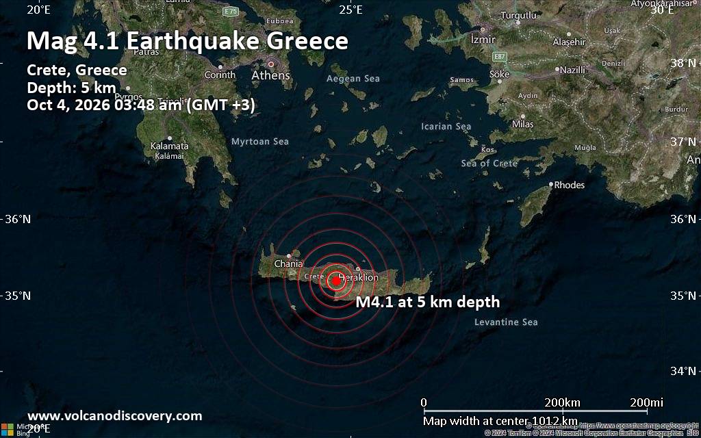
Magnitude 4.1 earthquake strikes near Irakleion, Crete, Greece
• Volcano earthquake report for Sunday, 4 October 2026
• Small magnitude 3.3 quake hits 13 km southeast of Hafnarfjordur, Iceland af...
• Moderate mag. 4.1 earthquake - 38 km southwest of Irakleion, Heraklion Regi...
• M 4.3 - Izu Islands, Japan region
• Seismic-like event, possible earthquake, reported minutes ago near Reykjavi...
|
|
|
Joined: Feb 2001
Posts: 678,977
Launch Director
|
|
Launch Director
Joined: Feb 2001
Posts: 678,977 |
Issued at 800 PM MST Sat Oct 03 2026 612
WTPZ43 KNHC 040253
TCDEP3
Hurricane Rachel Discussion Number 28
NWS National Hurricane Center Miami FL EP182026
800 PM MST Sat Oct 03 2026
Satellite imagery suggests that Rachel's convective organization has
improved since the previous advisory. The hurricane now shows a
large, defined eye surrounded by a symmetric ring of deep convection
with cloud top temperatures as cold as -80 C. The latest subjective
Dvorak estimate from TAFB came in at T4.5/77 kt, closely mirroring
many of the UW-CIMSS objective intensity estimates that range from
70 to 97 kt. Based on a compromise of these data, the initial
intensity is raised to 80 kt.
The initial motion continues west-northwestward, or 300/4 kt.
Rachel's slow motion over the next two days will be governed by a
ridge extending southwestward from a mid- to upper-level high over
the western United States. Rachel is forecast to accelerate slightly
after 60 h, continuing on a west to west-northwestward trajectory
through the remainder of the forecast period. The updated NHC track
forecast was largely unchanged from the previous advisory, roughly
in between the corrected consensus (HCCA) and the Google DeepMind
ensemble mean.
Rachel is forecast to experience weakening in the next 24 h as it
enters an unfavorable environment of cooler sea surface temperatures
associated with Hurricane Polo's cold wake, moderate northwesterly
vertical wind shear, and mid-level dry air. However, the cyclone
could be at the early stage of acquiring structural characteristics
typical of an annular hurricane, as outer rainbands have dissipated
in favor of a thick, uniform central core. This could temper any
weakening, as long as the easterly wind shear remains relatively
low, and the new forecast is a bit higher than the last one. As
Rachel continues on a westward motion, vertical wind shear
decreases, allowing environmental conditions to improve and offering
the chance for some re-intensification through 72 h. Beyond 72 h,
however, Rachel should encounter an even drier air mass, with
mid-level relative humidity values dipping below 40 percent,
alongside SSTs dropping below 26 C. These conditions are forecast
to cause the cyclone to gradually weaken through at the end of the
forecast period, similar to the last advisory.
FORECAST POSITIONS AND MAX WINDS
INIT 04/0300Z 20.0N 112.8W 80 KT 90 MPH
12H 04/1200Z 20.3N 113.5W 75 KT 85 MPH
24H 05/0000Z 20.5N 114.7W 70 KT 80 MPH
36H 05/1200Z 20.6N 116.1W 75 KT 85 MPH
48H 06/0000Z 20.6N 117.9W 75 KT 85 MPH
60H 06/1200Z 20.6N 119.5W 70 KT 80 MPH
72H 07/0000Z 20.7N 121.1W 60 KT 70 MPH
96H 08/0000Z 21.6N 124.2W 50 KT 60 MPH
120H 09/0000Z 22.5N 127.0W 50 KT 60 MPH
$$
Forecaster Pierce/Blake Source: Hurricane Rachel Forecast Discussion Number 28
|
|



CMS The Best Conveyancing solicitors conveyancing quotes throughout the UK
For any webhosting enquiries please email webmaster@aus-city.com
|
|
Forums60
Topics855,583
Posts890,378
Members2,960
| |
Most Online102,106
Jul 10th, 2026
|
|
|









































