|
0 members (),
1,893
guests, and
19
robots. |
|
Key:
Admin,
Global Mod,
Mod
|
|
S |
M |
T |
W |
T |
F |
S |
|
|
|
|
|
1
|
2
|
3
|
|
4
|
5
|
6
|
7
|
8
|
9
|
10
|
|
11
|
12
|
13
|
14
|
15
|
16
|
17
|
|
18
|
19
|
20
|
21
|
22
|
23
|
24
|
|
25
|
26
|
27
|
28
|
29
|
30
|
31
|
|
There are no members with birthdays on this day. |
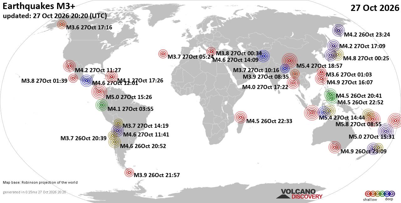
World Earthquake Report for Tuesday, 27 October 2026
• M 2.6 - 7 km SW of Nelson, Nevada
• M 1.9 - 16 km NW of Nanwalek, Alaska
• M 1.3 - 18 km NNW of Four Mile Road, Alaska
• Moderate mag. 4.0 earthquake - Banda Sea, 147 km north of Dili, Dili, Timor...
• M 1.8 - 11 km W of Wadsworth, Nevada
|
|
|
Joined: Feb 2001
Posts: 678,977
Launch Director
|
|
Launch Director
Joined: Feb 2001
Posts: 678,977 |
SPC MD 2412MD 2412 CONCERNING SEVERE POTENTIAL...WATCH UNLIKELY FOR PARTS OF SOUTHEASTERN NEW MEXICO AND SOUTHWESTERN TEXAS 
Mesoscale Discussion 2412
NWS Storm Prediction Center Norman OK
0217 PM CDT Tue Oct 27 2026

Areas affected...parts of southeastern New Mexico and southwestern
Texas

Concerning...Severe potential...Watch unlikely

Valid 271917Z - 272145Z

Probability of Watch Issuance...5 percent

SUMMARY...Isolated strong to severe thunderstorm development appears
possible by 3-4 PM MDT into early evening near the Guadalupe and
Davis Mountains vicinity.  These may pose a risk for large hail and
localized strong surface gusts.

DISCUSSION...Destabilization is ongoing in response to continuing
insolation along the Guadalupe and Davis Mountains, where surface
dew points are in the upper 50s to near 60 F, beneath modestly cool
cyclonic mid-level flow.  Orographic forcing, aided by lift
associated with weak low-level warm advection, is already supporting
the initiation of isolated thunderstorm development.  This is likely
to continue into early evening.

Beneath 30-40+ kt west-southwesterly around 7-8 km AGL and higher,
deep-layer shear near the higher terrain is strong, with elongated
hodographs.  This may support the occasional evolution of isolated
supercell structures with potential to produce large hail, in the
presence of thermodynamic profiles with steep lower/mid-tropospheric
lapse rates supporting CAPE in excess of 1500 J/kg.

It remains unclear how far east of the higher terrain activity will
develop.  Influenced by generally weak lower to mid-tropospheric
wind fields, veering with height, storm motions may remain modest to
slow, with a tendency to propagate east/southeastward.

..Kerr/Smith.. 10/27/2026

...Please see www.spc.noaa.gov for graphic product...

ATTN...WFO...MAF...ABQ...EPZ...

LAT...LON   33500486 32090376 30720300 30630396 32690526 33500486

MOST PROBABLE PEAK WIND GUST...55-70 MPH
MOST PROBABLE PEAK HAIL SIZE...1.50-2.50 IN
Read morehttps://www.spc.noaa.gov/products/md/md2412.html
|
|



CMS The Best Conveyancing solicitors conveyancing quotes throughout the UK
For any webhosting enquiries please email webmaster@aus-city.com
|
|
Forums60
Topics897,255
Posts932,052
Members2,960
| |
Most Online102,106
Jul 10th, 2026
|
|
|









































