|
|
|
0 members (),
1,504
guests, and
24
robots. |
|
Key:
Admin,
Global Mod,
Mod
|
|
S |
M |
T |
W |
T |
F |
S |
|
|
|
|
|
1
|
2
|
3
|
|
4
|
5
|
6
|
7
|
8
|
9
|
10
|
|
11
|
12
|
13
|
14
|
15
|
16
|
17
|
|
18
|
19
|
20
|
21
|
22
|
23
|
24
|
|
25
|
26
|
27
|
28
|
29
|
30
|
31
|
|
There are no members with birthdays on this day. |
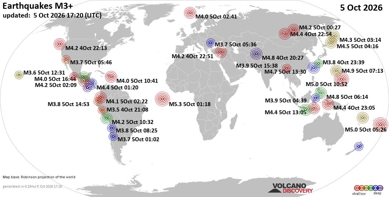
World Earthquake Report for Monday, 5 October 2026
• Strong mag. 5.0 earthquake - Iceland on Monday, Oct 5, 2026, at 05:28 pm (R...
• M -0.1 - 57 km W of Tyonek, Alaska
• M 4.4 - 62 km ENE of Shikotan, Russia
• M 0.7 - 21 km SSE of Midland, Texas
• M 1.0 - 6 km NW of The Geysers, CA
|

#494659
Thu 21 Mar 2019 11:33:AM
|
Joined: Feb 2001
Posts: 678,977
Launch Director
|
|
Launch Director
Joined: Feb 2001
Posts: 678,977 |
Abstract: The southeastern U.S. produces the most industrial roundwood in the U.S. each year, largely from commercial pine plantations. The extent of plantation forests and management dynamics can be difficult to ascertain from periodic forest inventories, yet short-rotation tree plantations also present challenges for remote sensing. Here, we integrated spectral, temporal, and structural information from airborne and satellite platforms to distinguish pine plantations from natural forests and evaluate... Source: Mapping Pine Plantations in the Sou...ectral, and Temporal Remote Sensing Data
|
|



CMS The Best Conveyancing solicitors conveyancing quotes throughout the UK
For any webhosting enquiries please email webmaster@aus-city.com
|
|
Entire Thread
|
 Mapping Pine Plantations in the Southeastern U.S. Using Structural, Spectral, and Temporal Remote Sensing Data
|
Webmaster
|
Thu 21 Mar 2019 11:33:AM
|
|
Forums60
Topics858,207
Posts893,002
Members2,960
| |
Most Online102,106
Jul 10th, 2026
|
|
|
|
|

|









































