|
|
|
0 members (),
2,772
guests, and
26
robots. |
|
Key:
Admin,
Global Mod,
Mod
|
|
S |
M |
T |
W |
T |
F |
S |
|
1
|
2
|
3
|
4
|
5
|
6
|
7
|
|
8
|
9
|
10
|
11
|
12
|
13
|
14
|
|
15
|
16
|
17
|
18
|
19
|
20
|
21
|
|
22
|
23
|
24
|
25
|
26
|
27
|
28
|
|
29
|
30
|
|
|
|
|
|
|
There are no members with birthdays on this day. |
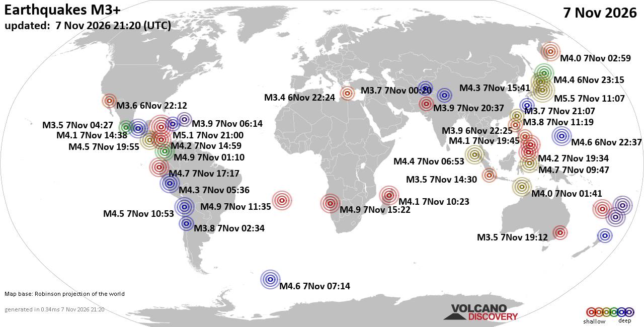
World Earthquake Report for Saturday, 7 November 2026
• Light mag. 3.9 earthquake - Indian Ocean, 115 km south of Banjar, Kabupaten...
• M 1.3 - 6 km NW of The Geysers, CA
• M 4.7 - 43 km ESE of Ambon, Indonesia
• M 5.5 - 10 km NW of Hamakita, Japan
• M 1.8 - 13 km W of Kalifornsky, Alaska
|

#51826
Sat 29 Jan 2011 11:08:AM
|
Joined: Feb 2001
Posts: 800,656
Launch Director
|
|
Launch Director
Joined: Feb 2001
Posts: 800,656 |
Magnitude
5.2
Date-Time
Saturday, January 29, 2011 at 12:38:59 UTC
Saturday, January 29, 2011 at 10:38:59 PM at epicenter
Time of Earthquake in other Time Zones
Location
21.604°N, 142.952°E
Depth
318.8 km (198.1 miles)
Region
MARIANA ISLANDS REGION
Distances
235 km (145 miles) WNW of Farallon de Pajaros, N. Mariana Islands
390 km (240 miles) SSE of Iwo Jima, Volcano Islands, Japan
765 km (475 miles) NNW of SAIPAN, Northern Mariana Islands
915 km (570 miles) NNW of HAGATNA, Guam
Location Uncertainty
horizontal +/- 3.6 km (2.2 miles); depth +/- 6 km (3.7 miles)
Parameters
NST=197, Nph=197, Dmin=613.3 km, Rmss=0.69 sec, Gp= 29°,
M-type=body wave magnitude (Mb), Version=6
Source
USGS NEIC (WDCS-D)
Event ID
usb00015zp
David Cottle
UBB Owner & Administrator
|
|



CMS The Best Conveyancing solicitors conveyancing quotes throughout the UK
For any webhosting enquiries please email webmaster@aus-city.com
|
|
Entire Thread
|
 5.2 earthquake struck Mariana Islands Region on Sat Jan 29, 2011 at 23:39:00 AEDT. |
Webmaster
|
Sat 29 Jan 2011 11:08:AM
|
|
Forums60
Topics916,253
Posts951,050
Members2,960
| |
Most Online102,106
Jul 10th, 2026
|
|
|
|
|

|









































