|
0 members (),
1,756
guests, and
30
robots. |
|
Key:
Admin,
Global Mod,
Mod
|
|
S |
M |
T |
W |
T |
F |
S |
|
1
|
2
|
3
|
4
|
5
|
6
|
7
|
|
8
|
9
|
10
|
11
|
12
|
13
|
14
|
|
15
|
16
|
17
|
18
|
19
|
20
|
21
|
|
22
|
23
|
24
|
25
|
26
|
27
|
28
|
|
29
|
30
|
|
|
|
|
|
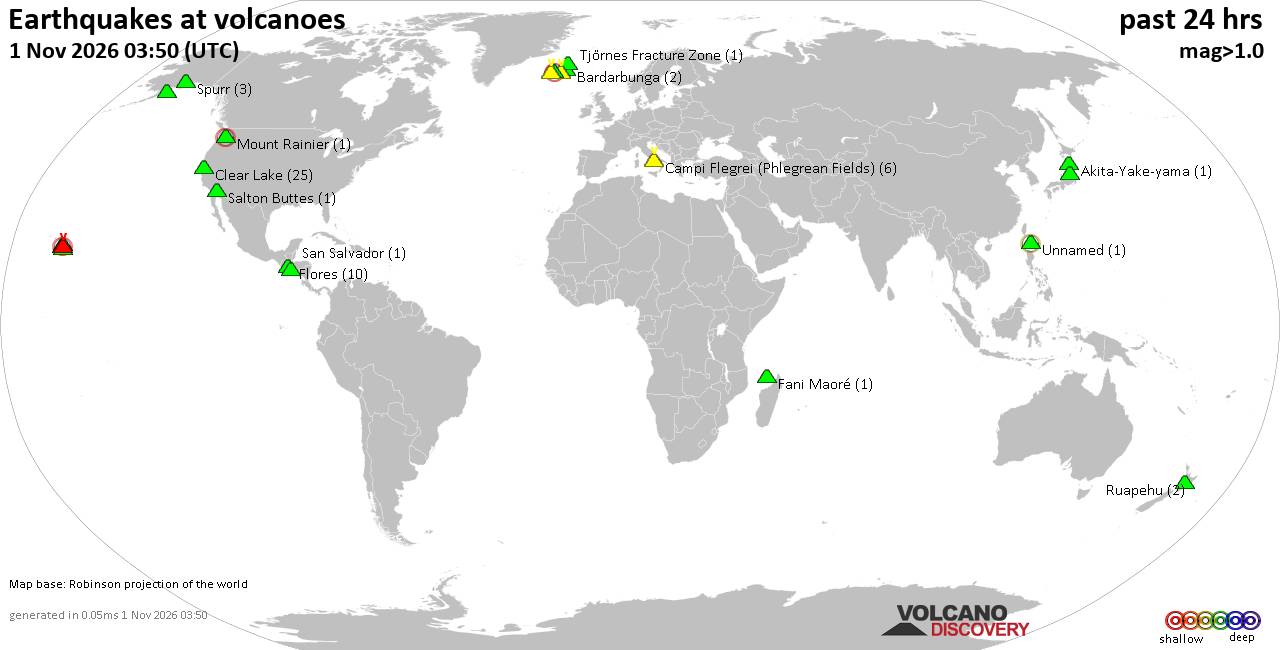
Volcano earthquake report for Sunday, 1 November 2026
• M 4.4 - 95 km WNW of Isangel, Vanuatu
• M 3.7 - 17 km SSW of Weston, Colorado
• M 0.9 - 32 km NNE of Kernville, CA
• M 4.4 - 4 km SSE of La Mesa, Panama
• M 4.2 - 0 km N of Aquiles Serdán 1ra. Sección, Mexico
|

#699701
Thu 12 Oct 2023 02:41:AM
|
Joined: Feb 2001
Posts: 678,977
Launch Director
|
|
Launch Director
Joined: Feb 2001
Posts: 678,977 |
SPC MD 2240MD 2240 CONCERNING SEVERE POTENTIAL...WATCH POSSIBLE FOR PORTIONS OF THE WESTERN FLORIDA PENINSULA 
Mesoscale Discussion 2240
NWS Storm Prediction Center Norman OK
0940 PM CDT Wed Oct 11 2023

Areas affected...Portions of the western Florida Peninsula

Concerning...Severe potential...Watch possible

Valid 120240Z - 120415Z

Probability of Watch Issuance...40 percent

SUMMARY...Portions of the western Florida Peninsula are being
monitored for increasing severe-storm potential during the next
couple of hours. The primary concern is the potential for a tornado
or two in the near term.

DISCUSSION...Latest surface analysis depicts an east/west-oriented
warm front extending from the northeastern Gulf of Mexico into
portions of central FL. Weak warm-air advection amid deep/rich
tropospheric moisture (2.3 inch PW sampled by 00Z TBW sounding) and
minimal inhibition are supporting isolated low-topped convection
along the FL west coast. While poor deep-layer lapse rates and the
weak forcing for ascent have limited updraft intensity/longevity
thus far, a couple updrafts have shown signs of organization along
the immediate coastal areas during the last 30 minutes. This is
being aided by gradually expanding, clockwise-curved low-level
hodographs (250-300 m2/s2 0-1 km SRH per TBW VWP). During the next
couple of hours, isolated low-topped supercells will pose a threat
of a tornado or two -- especially along/south of the warm front
where antecedent heating amid upper 70s dewpoints is yielding
moderate surface-based instability. With time, convection should
further increase in intensity and coverage across portions of west
FL and the FL Big Bend, as a surface low and strong low-level jet
approach from the west.

..Weinman/Guyer.. 10/12/2023

...Please see www.spc.noaa.gov for graphic product...

ATTN...WFO...TBW...

LAT...LON   27598208 26868190 26698203 26638228 26948252 27408279
            27928291 28778289 28958266 28958242 28798211 28508203
            27598208
Read morehttps://www.spc.noaa.gov/products/md/md2240.html
|
|



CMS The Best Conveyancing solicitors conveyancing quotes throughout the UK
For any webhosting enquiries please email webmaster@aus-city.com
|
|
Entire Thread
|
 SPC MD 2240 |
Webmaster
|
Thu 12 Oct 2023 02:41:AM
|
|
Forums60
Topics905,636
Posts940,433
Members2,960
| |
Most Online102,106
Jul 10th, 2026
|
|
|









































