|
|
|
0 members (),
1,816
guests, and
23
robots. |
|
Key:
Admin,
Global Mod,
Mod
|
|
S |
M |
T |
W |
T |
F |
S |
|
1
|
2
|
3
|
4
|
5
|
6
|
7
|
|
8
|
9
|
10
|
11
|
12
|
13
|
14
|
|
15
|
16
|
17
|
18
|
19
|
20
|
21
|
|
22
|
23
|
24
|
25
|
26
|
27
|
28
|
|
29
|
30
|
|
|
|
|
|
|
There are no members with birthdays on this day. |
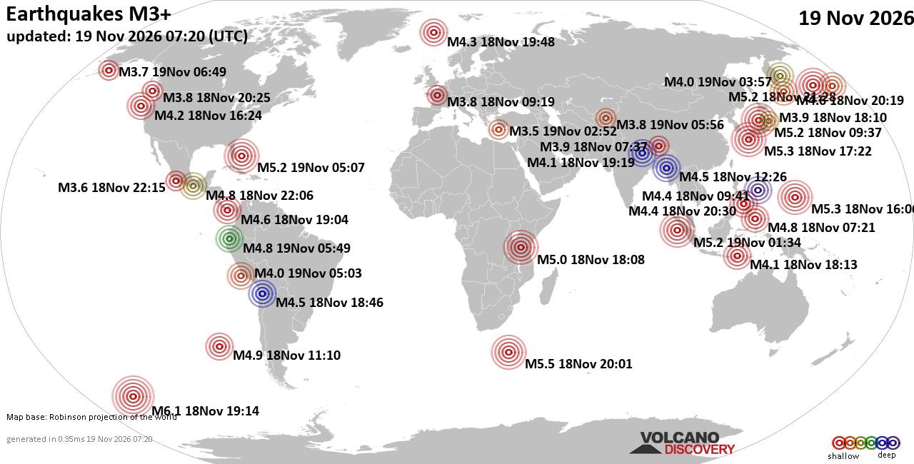
World Earthquake Report for Thursday, 19 November 2026
• M 4.4 - south of the Kermadec Islands
• M 3.4 - 18 km ENE of Borrego Springs, CA
• M 3.4 - 42 km N of Kernville, CA
• M 2.5 - 70 km S of Ugashik, Alaska
• M 2.5 - 70 km S of Ugashik, Alaska
|

#715521
Tue 12 Mar 2024 07:53:PM
|
Joined: Feb 2001
Posts: 800,656
Launch Director
|
|
Launch Director
Joined: Feb 2001
Posts: 800,656 |
SPC Mar 12, 2024 2000 UTC Day 1 Convective OutlookSPC 2000Z Day 1 Outlook 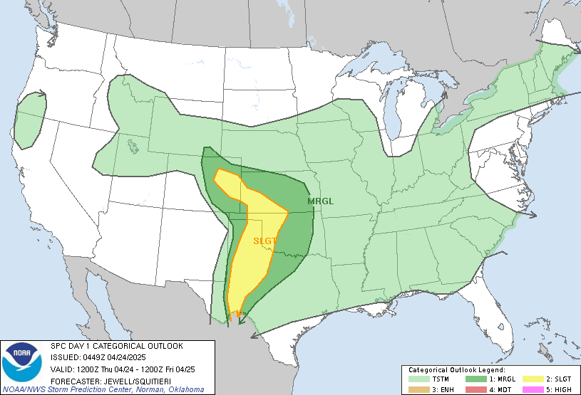
Day 1 Convective Outlook
NWS Storm Prediction Center Norman OK
0250 PM CDT Tue Mar 12 2024

Valid 122000Z - 131200Z

...THERE IS A MARGINAL RISK OF SEVERE THUNDERSTORMS ACROSS THE
SOUTH-CENTRAL PLAINS/OZARKS...

...SUMMARY...
Isolated severe thunderstorms are possible late this afternoon and
evening from eastern Kansas/northeast Oklahoma and the western
Ozarks to northern Missouri.

...Discussion...
No change was made to the previously issued convective outlook.

..Smith.. 03/12/2024

.PREV DISCUSSION... /ISSUED 1126 AM CDT Tue Mar 12 2024/

...Eastern Kansas/Northeast Oklahoma and Missouri...
A low-amplitude shortwave trough over the south-central Plains this
morning will continue eastward, crossing the Ozarks this evening and
reaching the lower Ohio River Valley by Wednesday morning. This
shortwave trough will generally overlie an increasing, but
immature/only modestly moist (50s F surface dewpoints) warm sector,
to the east of a southwest/northeast-oriented dryline across the
southern Plains toward the Ozarks/lower Missouri Valley.

Isolated to widely scattered thunderstorms are possible over the
region late this afternoon, and more so this evening, with a
marginal large-hail and locally damaging-wind risk where storms
develop. The most probable area for such development is expected
across far eastern Kansas into Missouri, potentially beginning by
around 530pm-6pm CDT. More uncertainty regarding storm development
exists with south-southwestward extent across northeast/east-central
Oklahoma. Little if any development through late afternoon/early
evening may be the most probable outcome within this corridor across
Oklahoma, but various forecast soundings (including 12z NAM, which
admittedly may be a bit overly moist and under-mixed) suggest some
plausibility to very isolated convective development preceding the
mid-level trough.

Farther north, thunderstorm development is most probable this
evening on the north edge of the modestly moist warm sector across
central/northern Missouri, near a weak/modestly delineated warm
front. Increasing elevated buoyancy (750-1000 J/kg MUCAPE) and
steadily steepening lapse rates will be favorable for potentially
severe hail (and even strong winds). However, weak effective shear
(attributable to a 3-6km AGL flow weakness) should limit the
magnitude and overall extent/duration of the large hail risk with
northward extent (roughly north of 38N latitude including the I-70
vicinity).
Read morehttps://www.spc.noaa.gov/products/outlook/day1otlk_2000.html
|
|



CMS The Best Conveyancing solicitors conveyancing quotes throughout the UK
For any webhosting enquiries please email webmaster@aus-city.com
|
|
Entire Thread
|
 SPC Mar 12, 2024 2000 UTC Day 1 Convective Outlook |
Webmaster
|
Tue 12 Mar 2024 07:53:PM
|
|
Forums60
Topics935,059
Posts969,856
Members2,960
| |
Most Online102,106
Jul 10th, 2026
|
|
|
|
|

|









































