|
0 members (),
1,773
guests, and
22
robots. |
|
Key:
Admin,
Global Mod,
Mod
|
|
S |
M |
T |
W |
T |
F |
S |
|
|
|
|
1
|
2
|
3
|
4
|
|
5
|
6
|
7
|
8
|
9
|
10
|
11
|
|
12
|
13
|
14
|
15
|
16
|
17
|
18
|
|
19
|
20
|
21
|
22
|
23
|
24
|
25
|
|
26
|
27
|
28
|
29
|
30
|
31
|
|
|
There are no members with birthdays on this day. |

Volcano earthquake report for Friday, 10 Jul 2026
• Moderate mag. 4.2 earthquake - 133 km northwest of Ternate, Kota Ternate, N...
• World Earthquake Report for Friday, 10 July 2026
• Moderate mag. 4.6 earthquake - 17 km southwest of Comalapa, Estado de Chiap...
• Moderate mag. 4.1 earthquake - Olyutorskiy Rayon, 47 km northwest of Tilich...
• Moderate mag. 4.0 earthquake - Hawke's Bay, New Zealand, on Saturday, Jul 1...
|

#732509
Fri 30 Aug 2024 05:54:PM
|
Joined: Feb 2001
Posts: 678,976
Launch Director
|
OP

Launch Director
Joined: Feb 2001
Posts: 678,976 |
NHC Atlantic Outlook
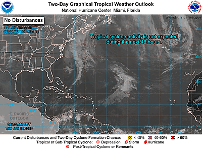
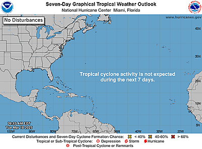
ZCZC MIATWOAT ALL
TTAA00 KNHC DDHHMM
Tropical Weather Outlook
NWS National Hurricane Center Miami FL
200 PM EDT Fri Aug 30 2024
For the North Atlantic...Caribbean Sea and the Gulf of Mexico:
1. Northwestern Gulf of Mexico:
A surface trough of low pressure over the northwestern Gulf of
Mexico is producing a large area of disorganized showers and
thunderstorms along and just offshore the coasts of Texas and
Louisiana. This system is expected to meander near the coast
through much of next week, and some slow development is possible if
it remains offshore. Regardless of development, heavy rains could
cause some flash flooding across portions of coastal Louisiana and
the upper Texas coast during the next few days.
* Formation chance through 48 hours...low...10 percent.
* Formation chance through 7 days...low...20 percent.
2. Near the Lesser Antilles and Caribbean Sea:
Showers and thunderstorms associated with a tropical wave over the
central tropical Atlantic remain disorganized. Gradual development
of this system is possible during the next few days, and a tropical
depression could form some time next week while it moves westward,
reaching the Lesser Antilles on Monday and continuing across the
Caribbean Sea through the middle to latter part of the week.
* Formation chance through 48 hours...low...near 0 percent.
* Formation chance through 7 days...medium...40 percent.
3. Eastern Tropical Atlantic:
Another tropical wave between the west coast of Africa and the Cabo
Verde Islands is producing minimal shower and thunderstorm
activity. Some slow development of this system is possible through
late next week while it moves slowly to the west-northwest over the
eastern and central tropical Atlantic.
* Formation chance through 48 hours...low...near 0 percent.
* Formation chance through 7 days...low...20 percent.
Forecaster Berg
|
|



CMS The Best Conveyancing solicitors conveyancing quotes throughout the UK
For any webhosting enquiries please email webmaster@aus-city.com
|
|
Entire Thread
|
 NHC Atlantic Outlook
|
Webmaster
|
Fri 30 Aug 2024 05:54:PM
|
|
Forums60
Topics790,530
Posts825,312
Members2,960
| |
Most Online102,106
Jul 10th, 2026
|
|
|





































