|
|
|
1 members (Alisa),
976
guests, and
415
robots. |
|
Key:
Admin,
Global Mod,
Mod
|
|
S |
M |
T |
W |
T |
F |
S |
|
|
|
|
|
|
|
1
|
|
2
|
3
|
4
|
5
|
6
|
7
|
8
|
|
9
|
10
|
11
|
12
|
13
|
14
|
15
|
|
16
|
17
|
18
|
19
|
20
|
21
|
22
|
|
23
|
24
|
25
|
26
|
27
|
28
|
29
|
|
30
|
31
|
|
|
|
|
|
|
There are no members with birthdays on this day. |
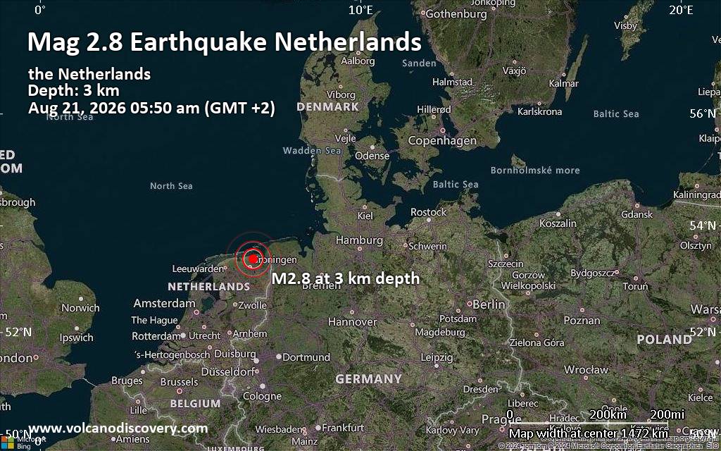
Small tremor of magnitude 2.8 just reported 20 km northeast of Groningen, Netherlands
|

#733840
Wed 04 Sep 2024 08:13:AM
|
Joined: Feb 2001
Posts: 678,976
Launch Director
|
OP

Launch Director
Joined: Feb 2001
Posts: 678,976 |
SPC Sep 4, 2024 Day 4-8 Severe Weather OutlookDay 4-8 Outlook 
Day 4-8 Convective Outlook
NWS Storm Prediction Center Norman OK
0310 AM CDT Wed Sep 04 2024

Valid 071200Z - 121200Z

...DISCUSSION...
...D4/Saturday - D5/Sunday: Northeast/Mid Atlantic...
An amplifying trough is forecast to evolve into a rather deep
mid/upper-level cyclone over parts of Ontario into the eastern Great
Lakes region on Saturday, and then begin moving eastward on Sunday.
Uncertainty remains regarding the intensity/location of related
surface cyclogenesis, and the timing of an attendant cold front into
parts of the Northeast and Mid Atlantic. There will be some
potential for low-level moisture to be drawn northward in advance of
the cold front, though instability will likely remain weak. If
adequate buoyancy can develop, then increasing flow fields could
support some increase in severe potential across parts of the Mid
Atlantic and Northeast on D4/Saturday. Uncertainty regarding frontal
position increases into D5/Sunday, though some guidance suggests
potential for frontal convection to develop across parts of New
England before moving offshore.

...D6/Monday - D8/Wednesday...
The deep trough over the eastern CONUS is generally forecast to
weaken and move offshore early next week. Farther west, an upper
ridge is forecast to amplify over the Southwest, while an upper
trough deepens over the eastern Pacific and eventually begins to
impinge upon the Pacific Coast. A persistent surface ridge over the
East is expected to keep richer low-level moisture confined to near
the Gulf Coast, which will tend to limit moisture return and
severe-thunderstorm potential across much of the CONUS.
Read morehttps://www.spc.noaa.gov/products/exper/day4-8/
|
|



CMS The Best Conveyancing solicitors conveyancing quotes throughout the UK
For any webhosting enquiries please email webmaster@aus-city.com
|
|
Entire Thread
|
 SPC Sep 4, 2024 Day 4-8 Severe Weather Outlook
|
Webmaster
|
Wed 04 Sep 2024 08:13:AM
|
|
Forums60
Topics800,994
Posts835,785
Members2,960
| |
Most Online102,106
Jul 10th, 2026
|
|
|
|
|

|





































