|
0 members (),
1,414
guests, and
23
robots. |
|
Key:
Admin,
Global Mod,
Mod
|
|
S |
M |
T |
W |
T |
F |
S |
|
|
|
|
|
1
|
2
|
3
|
|
4
|
5
|
6
|
7
|
8
|
9
|
10
|
|
11
|
12
|
13
|
14
|
15
|
16
|
17
|
|
18
|
19
|
20
|
21
|
22
|
23
|
24
|
|
25
|
26
|
27
|
28
|
29
|
30
|
31
|
|
There are no members with birthdays on this day. |
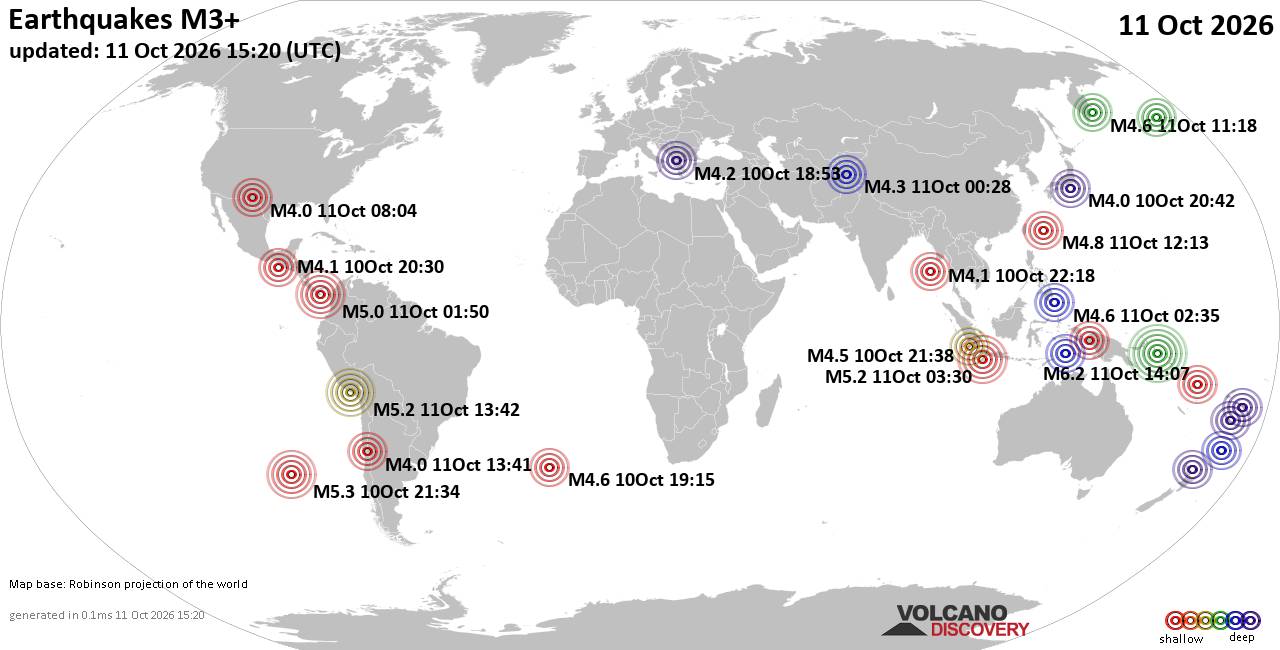
World Earthquake Report for Sunday, 11 October 2026
• M 2.1 - 50 km NE of Chignik, Alaska
• M 3.1 - 4 km E of San Jacinto, CA
• M 7.7 - 12 km WSW of Pitaloza Arriba, Panama
• Moderate mag. 4.4 earthquake - Papua, Indonesia, on Sunday, Oct 11, 2026, a...
• M 1.7 - 0 km NE of May Creek, Washington
|

#736939
Fri 13 Sep 2024 12:47:PM
|
Joined: Feb 2001
Posts: 678,977
Launch Director
|
|
Launch Director
Joined: Feb 2001
Posts: 678,977 |
SPC Sep 13, 2024 1300 UTC Day 1 Convective OutlookSPC 1300Z Day 1 Outlook 
Day 1 Convective Outlook
NWS Storm Prediction Center Norman OK
0743 AM CDT Fri Sep 13 2024

Valid 131300Z - 141200Z

...THERE IS A MARGINAL RISK OF SEVERE THUNDERSTORMS FROM MIDDLE
TENNESSEE TO THE FLORIDA PANHANDLE...

...SUMMARY...
A marginal tornado threat is expected to develop this morning and
afternoon across parts of Alabama, western Georgia and middle
Tennessee.  Isolated damaging to severe gusts will be possible in
parts of Alabama, southwest Georgia and the Florida Panhandle.

...Synopsis...
In mid/upper levels, the CONUS portion of the large-scale pattern
this period will be characterized by a "dirty" Rex block in the
East, and troughing in the West.  The block will be composed of an
anticyclone drifting eastward over the Upper Great Lakes, and a
small, deep-layer cyclone -- resulting from the merger of a weak,
midlatitude, mid/upper-tropospheric low with the low/middle-level
remnants of post-tropical cyclone Francine -- centered currently
near BVX.  This low should weaken gradually and meander slowly over
the Mid-South, possibly drifting east-southeastward back across the
MEM area through the period, but with negligible movement on the
synoptic scale.

In the northern stream, a mid/upper-level cyclone -- evident in
moisture-channel imagery over southern SK -- will eject
northeastward to northern MB and devolve to an open-wave trough by
12Z tomorrow.  In its wake, broadly cyclonic flow aloft, with mostly
minor embedded shortwaves/vorticity maxima -- will cover the
northwestern 1/4 of the CONUS.  To its east, midlevel DCVA/ascent
from a weak trough trailing the cyclone, combined with low-level
warm advection and gradual moistening, will support general thunder
potential over portions of the northern Plains to upper Mississippi
Valley.

At the surface, 11Z analysis showed a wavy, quasistationary to warm
front extending from off the SC Coast across southern GA and
eastern/northern AL, intersecting a weak cold front there, then as
an occluded front into the low over AR.  This boundary should drift
diffusely northward through the period, while weakening.  A
stationary to slow cold front was drawn from southern MB across
central ND and western SD, and should drift eastward over the
central Dakotas today through tonight.

...Southeast...
Isolated, mostly short-lived supercells will be possible today,
mainly in a belt of low-level convergence from parts of central/
eastern AL and western GA into the Tennessee Valley, with a marginal
tornado threat.  Farther south, in weaker shear (but greater
instability), a few of the stronger cells or small clusters may
produce damaging gusts.

A corridor of relatively maximized low-level shear/SRH remains near
the old, diffuse warm-frontal zone well southeast of the center of
Francine's remnants.  Both that and a moisture/buoyancy axis to its
west (centered roughly over the axis of the outlooked corridor)
should move little today, given the slow filling and lack of motion
of the related deep-layer cyclone over the Mid-South.  Rich low-
level moisture will persist in this corridor, with surface dewpoints
commonly in the 70s F, and low LCLs.  Weaknesses of both surface
winds and midlevel flow will sandwich a 35-40-kt east-southeasterly
to southeasterly LLJ that keeps hodographs somewhat enlarged and
effective SRH in the 150-300 J/kg range over eastern/northern AL
into southern mid TN.  With some localized help from boundaries
(outflow or differential-heating), a brief tornado is possible.  A
few of the most vigorous, water-loaded downdrafts will be capable of
localized strong to marginally severe gusts, especially over
southern areas where peak MLCAPE may reach about 2000 J/kg.
Activity generally should weaken this evening and overnight as the
airmass stabilizes and the remnants of Francine continue to decay.

..Edwards/Mosier.. 09/13/2024
Read morehttps://www.spc.noaa.gov/products/outlook/day1otlk_1300.html
|
|



CMS The Best Conveyancing solicitors conveyancing quotes throughout the UK
For any webhosting enquiries please email webmaster@aus-city.com
|
|
Entire Thread
|
 SPC Sep 13, 2024 1300 UTC Day 1 Convective Outlook
|
Webmaster
|
Fri 13 Sep 2024 12:47:PM
|
|
Forums60
Topics869,241
Posts904,037
Members2,960
| |
Most Online102,106
Jul 10th, 2026
|
|
|









































