|
0 members (),
887
guests, and
22
robots. |
|
Key:
Admin,
Global Mod,
Mod
|
|
S |
M |
T |
W |
T |
F |
S |
|
|
|
|
|
|
|
1
|
|
2
|
3
|
4
|
5
|
6
|
7
|
8
|
|
9
|
10
|
11
|
12
|
13
|
14
|
15
|
|
16
|
17
|
18
|
19
|
20
|
21
|
22
|
|
23
|
24
|
25
|
26
|
27
|
28
|
29
|
|
30
|
31
|
|
|
|
|
|
|
There are no members with birthdays on this day. |
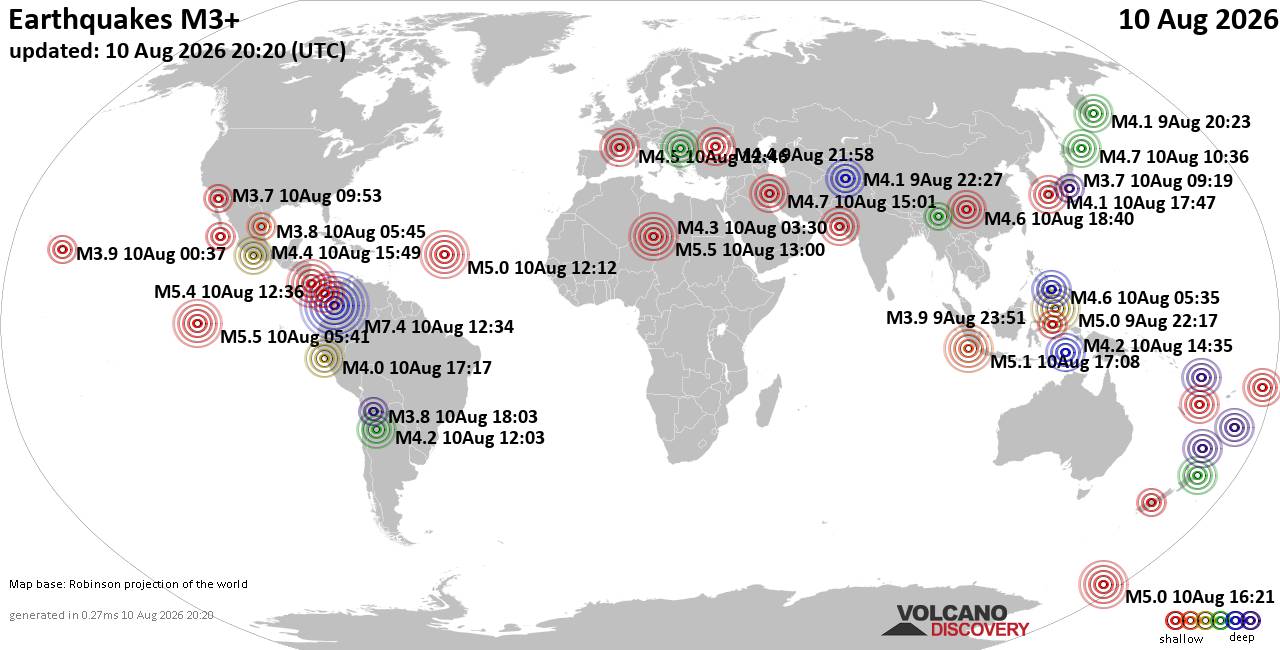
World Earthquake Report for Monday, 10 August 2026
• Volcano earthquake report for Monday, 10 Aug 2026
• Moderate mag. 4.0 earthquake - Zangilan Rayon, 58 km southwest of Ganja, Ga...
• Moderate mag. 4.6 earthquake - 31 km northeast of Xunchang, Sichuan, China,...
• Moderate mag. 4.2 earthquake - New Zealand on Tuesday, Aug 11, 2026, at 06:...
• World Earthquake Report for August 2026
|

#737565
Sun 15 Sep 2024 04:00:PM
|
Joined: Feb 2001
Posts: 678,976
Launch Director
|
OP

Launch Director
Joined: Feb 2001
Posts: 678,976 |
SPC Day 1 Fire Weather OutlookSPC Day 1 Fire Weather Outlook 
Day 1 Fire Weather Outlook
NWS Storm Prediction Center Norman OK
1059 AM CDT Sun Sep 15 2024

Valid 151700Z - 161200Z

The previous forecast remains on track, with minor changes made to
the Elevated areas to reflect the latest guidance consensus.
Additionally, a couple of dry strikes may accompany isolated
thunderstorms along the Front Range in eastern Colorado (and
surrounding areas), but overall modest fuel receptiveness suggests
that lightning-induced fire ignitions should remain a localized
concern, so no isolated dry thunderstorm highlights have been added.

..Squitieri.. 09/15/2024

.PREV DISCUSSION... /ISSUED 0150 AM CDT Sun Sep 15 2024/

...Synopsis...
Preceding an amplifying large-scale trough over the West Coast,
enhanced deep-layer meridional flow will overspread the Great Basin,
while a related surface cyclone evolves over northern NV. Deep
boundary-layer mixing into the enhanced flow aloft, along with a
tightening pressure gradient peripheral to the surface cyclone, will
yield 20-25 mph sustained southerly surface winds and 15-20 percent
RH over southern/central NV. Given modestly receptive fuels here,
elevated fire-weather conditions are expected during the afternoon.

Additionally, large-scale ascent accompanying the amplifying
midlevel trough will promote a mix of wet/dry thunderstorms across
the northern Great Basin/Intermountain West. While quick storm
motions and limited precipitation with some of this activity could
yield a risk of lightning-induced ignitions, marginal fuels should
generally limit the threat.

Over the southern High Plains, breezy/gusty southerly surface winds
will develop amid a warm/dry boundary layer near a lee trough during
the afternoon. This will favor a few hours of elevated fire-weather
conditions.

...Please see www.spc.noaa.gov/fire for graphic product...
Read morehttps://www.spc.noaa.gov/products/fire_wx/fwdy1.html
|
|



CMS The Best Conveyancing solicitors conveyancing quotes throughout the UK
For any webhosting enquiries please email webmaster@aus-city.com
|
|
Entire Thread
|
 SPC Day 1 Fire Weather Outlook
|
Webmaster
|
Sun 15 Sep 2024 04:00:PM
|
|
Forums60
Topics796,363
Posts831,153
Members2,960
| |
Most Online102,106
Jul 10th, 2026
|
|
|





































