|
0 members (),
1,330
guests, and
25
robots. |
|
Key:
Admin,
Global Mod,
Mod
|
|
S |
M |
T |
W |
T |
F |
S |
|
|
|
|
|
1
|
2
|
3
|
|
4
|
5
|
6
|
7
|
8
|
9
|
10
|
|
11
|
12
|
13
|
14
|
15
|
16
|
17
|
|
18
|
19
|
20
|
21
|
22
|
23
|
24
|
|
25
|
26
|
27
|
28
|
29
|
30
|
31
|
|
There are no members with birthdays on this day. |
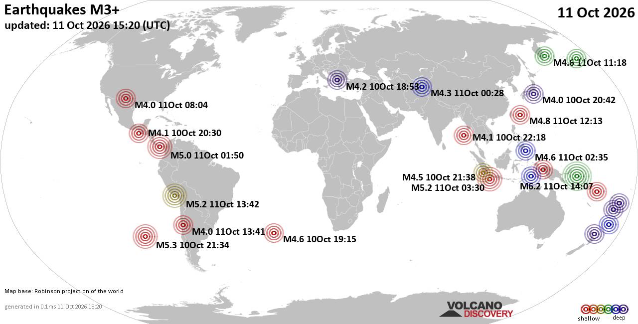
World Earthquake Report for Sunday, 11 October 2026
• M 1.7 - 9 km N of Hollister, CA
• M 1.2 - 9 km N of Borrego Springs, CA
• M 7.7 - 12 km WSW of Pitaloza Arriba, Panama
• M 0.3 - 4 km WSW of Anza, CA
• M 1.4 - 8 km W of Cobb, CA
• M 1.5 - 4 km NNE of Susitna North, Alaska
|

#737907
Mon 16 Sep 2024 04:39:PM
|
Joined: Feb 2001
Posts: 678,977
Launch Director
|
|
Launch Director
Joined: Feb 2001
Posts: 678,977 |
SPC Day 1 Fire Weather OutlookSPC Day 1 Fire Weather Outlook 
Day 1 Fire Weather Outlook
NWS Storm Prediction Center Norman OK
1138 AM CDT Mon Sep 16 2024

Valid 161700Z - 171200Z

...17z Update...
The prior forecast remains largely on track with only minor changes.
The Elevated area over parts of NV was expanded northward where
gusty winds and pockets of low humidity are expected to be slightly
more prevalent.

Over the central High Plains, recent rainfall and additional storms
are likely to temper fuels somewhat. However, strong southerly winds
(gusts as high as 30 mph) may still overlap with areas of drier
fuels and humidity below 30%. While uncertain in areal extent, some
fire-weather risk will continue this afternoon and evening.
Otherwise, see the prior discussion for more information.

..Lyons.. 09/16/2024

.PREV DISCUSSION... /ISSUED 0156 AM CDT Mon Sep 16 2024/

...Synopsis...
Within the base of a deep midlevel cyclone moving eastward across
the Great Basin, a related jet streak will overspread the Lower CO
River Valley. Here, boundary-layer mixing into the strengthening
flow aloft, coupled with a tightening pressure gradient peripheral
to an evolving surface cyclone, will favor 20-25 mph sustained
southerly surface winds. Despite a gradual increase in moisture/RH,
diurnal heating should still support a corridor of around 20 percent
RH amid the strong surface winds along the Lower CO River Valley --
favoring elevated fire-weather conditions.

Elevated fire-weather conditions are also expected over portions of
the central High Plains -- where breezy/gusty southerly surface
winds will overlap 20 percent RH near a lee trough during the
afternoon. While spotty rainfall during the past 24 hours could
limit fuel receptiveness over parts of the area, mostly receptive
fuels should still yield some fire-weather risk.

Farther east, warm/dry conditions are expected over portions of OH
and KY -- along the southwestern periphery of an expansive surface
anticyclone. While sustained surface winds around 10 mph should
limit the overall fire-weather threat, around 20 percent RH and very
dry/receptive fuels will still pose localized fire-weather concerns
during the afternoon.

...Please see www.spc.noaa.gov/fire for graphic product...
Read morehttps://www.spc.noaa.gov/products/fire_wx/fwdy1.html
|
|



CMS The Best Conveyancing solicitors conveyancing quotes throughout the UK
For any webhosting enquiries please email webmaster@aus-city.com
|
|
Entire Thread
|
 SPC Day 1 Fire Weather Outlook
|
Webmaster
|
Mon 16 Sep 2024 04:39:PM
|
|
Forums60
Topics869,309
Posts904,105
Members2,960
| |
Most Online102,106
Jul 10th, 2026
|
|
|









































