|
0 members (),
821
guests, and
23
robots. |
|
Key:
Admin,
Global Mod,
Mod
|
|
S |
M |
T |
W |
T |
F |
S |
|
|
|
1
|
2
|
3
|
4
|
5
|
|
6
|
7
|
8
|
9
|
10
|
11
|
12
|
|
13
|
14
|
15
|
16
|
17
|
18
|
19
|
|
20
|
21
|
22
|
23
|
24
|
25
|
26
|
|
27
|
28
|
29
|
30
|
|
|
|
|
There are no members with birthdays on this day. |
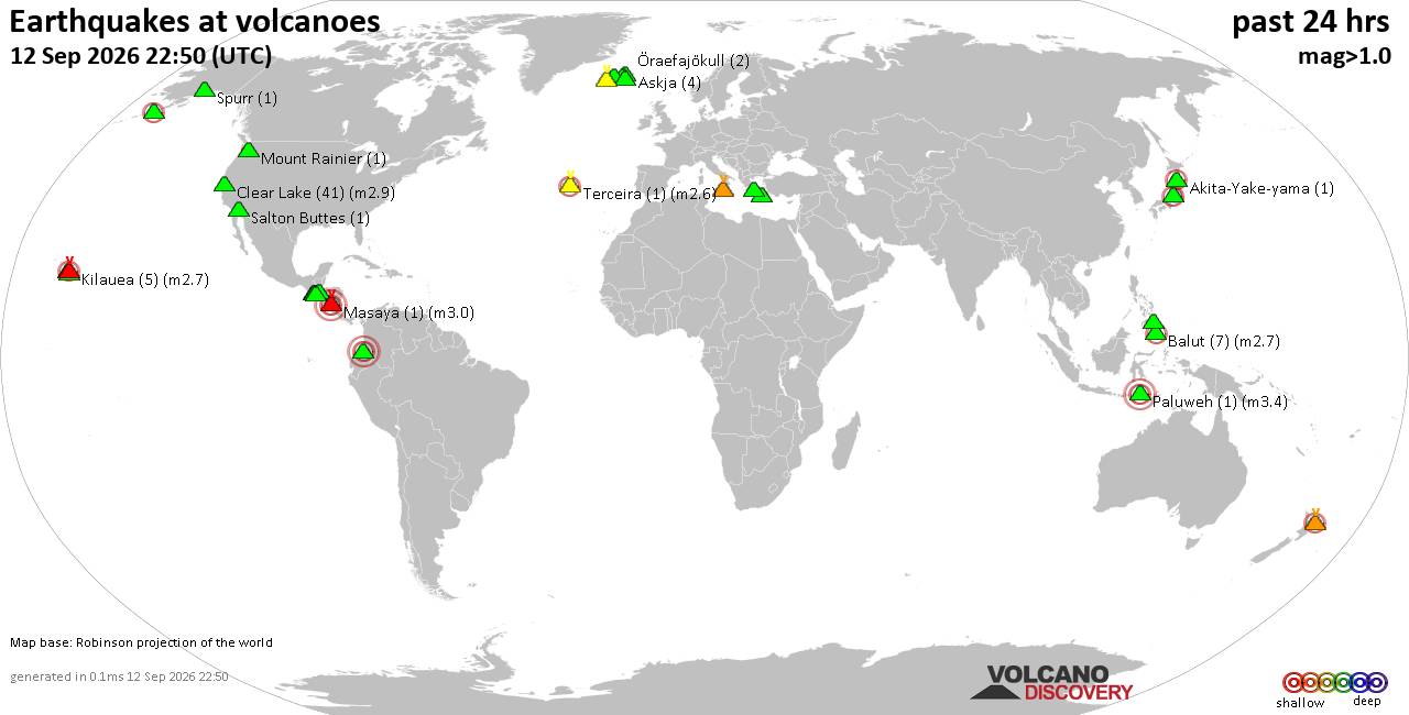
Volcano earthquake report for Saturday, 12 September 2026
• World Earthquake Report for Saturday, 12 September 2026
• Moderate but deep magnitude 5.3 quake hits 74 km southeast of Nakanoshima, ...
• Strong mag. 5.3 earthquake - Ryukyu Islands, Japan, on Sunday, Sep 13, 2026...
• Seismic-like event, possible earthquake, reported minutes ago near Pasto, N...
• Moderate mag. 4.3 earthquake - Philippine Sea, 34 km south of Miyake, Tokyo...
|

#764524
Mon 09 Jun 2025 02:35:AM
|
Joined: Feb 2001
Posts: 678,977
Launch Director
|
|
Launch Director
Joined: Feb 2001
Posts: 678,977 |
Issued at 900 PM CST Sun Jun 08 2025 000
WTPZ32 KNHC 090235
TCPEP2
BULLETIN
Tropical Storm Barbara Advisory Number 4
NWS National Hurricane Center Miami FL EP022025
900 PM CST Sun Jun 08 2025
...BARBARA EXPECTED TO BECOME A HURRICANE ON MONDAY...
SUMMARY OF 900 PM CST...0300 UTC...INFORMATION
----------------------------------------------
LOCATION...16.5N 104.9W
ABOUT 235 MI...375 KM WSW OF ZIHUATANEJO MEXICO
MAXIMUM SUSTAINED WINDS...65 MPH...100 KM/H
PRESENT MOVEMENT...WNW OR 300 DEGREES AT 10 MPH...17 KM/H
MINIMUM CENTRAL PRESSURE...995 MB...29.39 INCHES
WATCHES AND WARNINGS
--------------------
There are no coastal watches or warnings in effect.
DISCUSSION AND OUTLOOK
----------------------
At 900 PM CST (0300 UTC), the center of Tropical Storm Barbara was
located near latitude 16.5 North, longitude 104.9 West. Barbara is
moving toward the west-northwest near 10 mph (17 km/h), and this
general motion is expected to continue for the next couple of days.
Maximum sustained winds have increased to near 65 mph (100
km/h) with higher gusts. Barbara is forecast to become a
hurricane by early Monday.
Tropical-storm-force winds extend outward up to 70 miles (110 km)
from the center.
The estimated minimum central pressure is 995 mb (29.39 inches).
HAZARDS AFFECTING LAND
----------------------
RAINFALL: Outer bands of Barbara may bring total rainfall
amounts of 2 to 4 inches to coastal portions of the Mexican states
of Guerrero, Michoacan, Colima and Jalisco through Monday. This
rainfall may lead to localized areas of flooding and mudslides.
For a complete depiction of forecast rainfall associated with
Tropical Storm Barbara, please see the National Weather Service
Storm Total Rainfall Graphic available at
hurricanes.gov/graphics_ep2.shtml?rainqpf
SURF: Swells generated by Barbara will affect portions of the coast
of southwestern Mexico during the next few days. These swells are
likely to cause life-threatening surf and rip current conditions.
Please consult products from your local weather office.
WIND: Gusty winds are likely along coastal areas of southwestern
Mexico during the next day or so.
NEXT ADVISORY
-------------
Next complete advisory at 300 AM CST.
$$
Forecaster Pasch Source: Tropical Storm Barbara Public Advisory Number 4
|
|



CMS The Best Conveyancing solicitors conveyancing quotes throughout the UK
For any webhosting enquiries please email webmaster@aus-city.com
|
|
Entire Thread
|
 Tropical Storm Barbara Public Advisory Number 4
|
Webmaster
|
Mon 09 Jun 2025 02:35:AM
|
|
Forums60
Topics825,435
Posts860,228
Members2,960
| |
Most Online102,106
Jul 10th, 2026
|
|
|





































