|
|
|
0 members (),
3,615
guests, and
23
robots. |
|
Key:
Admin,
Global Mod,
Mod
|
|
S |
M |
T |
W |
T |
F |
S |
|
|
|
1
|
2
|
3
|
4
|
5
|
|
6
|
7
|
8
|
9
|
10
|
11
|
12
|
|
13
|
14
|
15
|
16
|
17
|
18
|
19
|
|
20
|
21
|
22
|
23
|
24
|
25
|
26
|
|
27
|
28
|
29
|
30
|
|
|
|
|
There are no members with birthdays on this day. |

Small magnitude 3.6 earthquake strikes near Great Falls, Cascade County, Montana, USA
• Volcano earthquake report for Friday, 18 September 2026
• Possible earthquake reported minutes ago near Great Falls, Montana, USA
• Magnitude 4.6 earthquake strikes near Ponce, Segundo Barrio, Ponce Municipi...
• Small magnitude 3.4 earthquake strikes near Skegness, Lincolnshire, England...
• World Earthquake Report for Friday, 18 September 2026
|

#768172
Thu 17 Jul 2025 07:32:PM
|
Joined: Feb 2001
Posts: 678,977
Launch Director
|
|
Launch Director
Joined: Feb 2001
Posts: 678,977 |
SPC Jul 17, 2025 1930 UTC Day 3 Severe Thunderstorm OutlookSPC 1930Z Day 3 Outlook 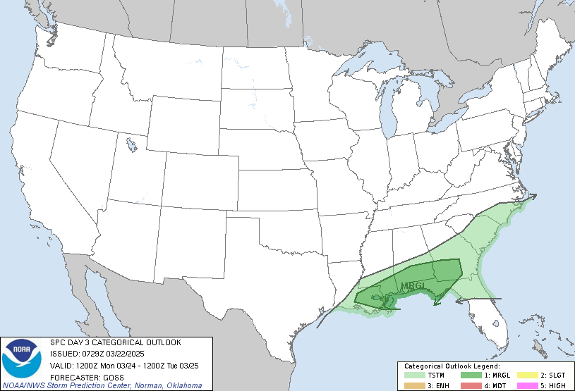
Day 3 Convective Outlook
NWS Storm Prediction Center Norman OK
0230 PM CDT Thu Jul 17 2025

Valid 191200Z - 201200Z

...THERE IS A SLIGHT RISK OF SEVERE THUNDERSTORMS ROUGHLY FROM IOWA
INTO ILLINOIS AND INDIANA...

...SUMMARY...
Corridors of strong to severe storms are expected from the northern
and central High Plains to the Mid-Mississippi and Lower Ohio
Valleys on Saturday.

...IA/IL/IN...
Model QPF differences aside, the overarching theme is for a large
area of strong instability to develop near a stalled front from
southern IA/northern MO into IL and IN Saturday afternoon with mid
70s F dewpoints. This will exist beneath the southern fringe of
perhaps 40 kt west/northwest midlevel flow, and the combination of
strong instability and favorable deep-layer mean winds will favor
corridors of severe storms with damaging winds. Shear may also favor
severe hail, and even a few supercells given such large CAPE over
IA/IL/IN. The risk area will likely be adjusted in subsequent
outlook cycles as the event nears.

...High Plains...
Modest westerly midlevel flow of 30-40 kt will exist over the
northern High Plains, ahead of a broad upper trough over the Pacific
Northwest/northern Rockies. Cool midlevel temperatures will also
exist, steepening lapse rates. Strong heating is likely within a
surface trough from eastern MT southward across the High Plains,
with a ribbon of 1500-2000 J/kg MUCAPE wrapping northwestward around
a MN surface high. Cells capable of hail and localized severe gusts
will be possible, and a severe MCS is not out of the question
overnight into ND as the low-level jet increases. Greater
probabilities may be required in later updates.

..Jewell.. 07/17/2025
Read morehttps://www.spc.noaa.gov/products/outlook/day3otlk_1930.html
|
|



CMS The Best Conveyancing solicitors conveyancing quotes throughout the UK
For any webhosting enquiries please email webmaster@aus-city.com
|
|
Entire Thread
|
 SPC Jul 17, 2025 1930 UTC Day 3 Severe Thunderstorm Outlook
|
Webmaster
|
Thu 17 Jul 2025 07:32:PM
|
|
Forums60
Topics830,760
Posts865,555
Members2,960
| |
Most Online102,106
Jul 10th, 2026
|
|
|
|
|

|





































