|
0 members (),
947
guests, and
25
robots. |
|
Key:
Admin,
Global Mod,
Mod
|
|
S |
M |
T |
W |
T |
F |
S |
|
|
|
1
|
2
|
3
|
4
|
5
|
|
6
|
7
|
8
|
9
|
10
|
11
|
12
|
|
13
|
14
|
15
|
16
|
17
|
18
|
19
|
|
20
|
21
|
22
|
23
|
24
|
25
|
26
|
|
27
|
28
|
29
|
30
|
|
|
|
|
There are no members with birthdays on this day. |
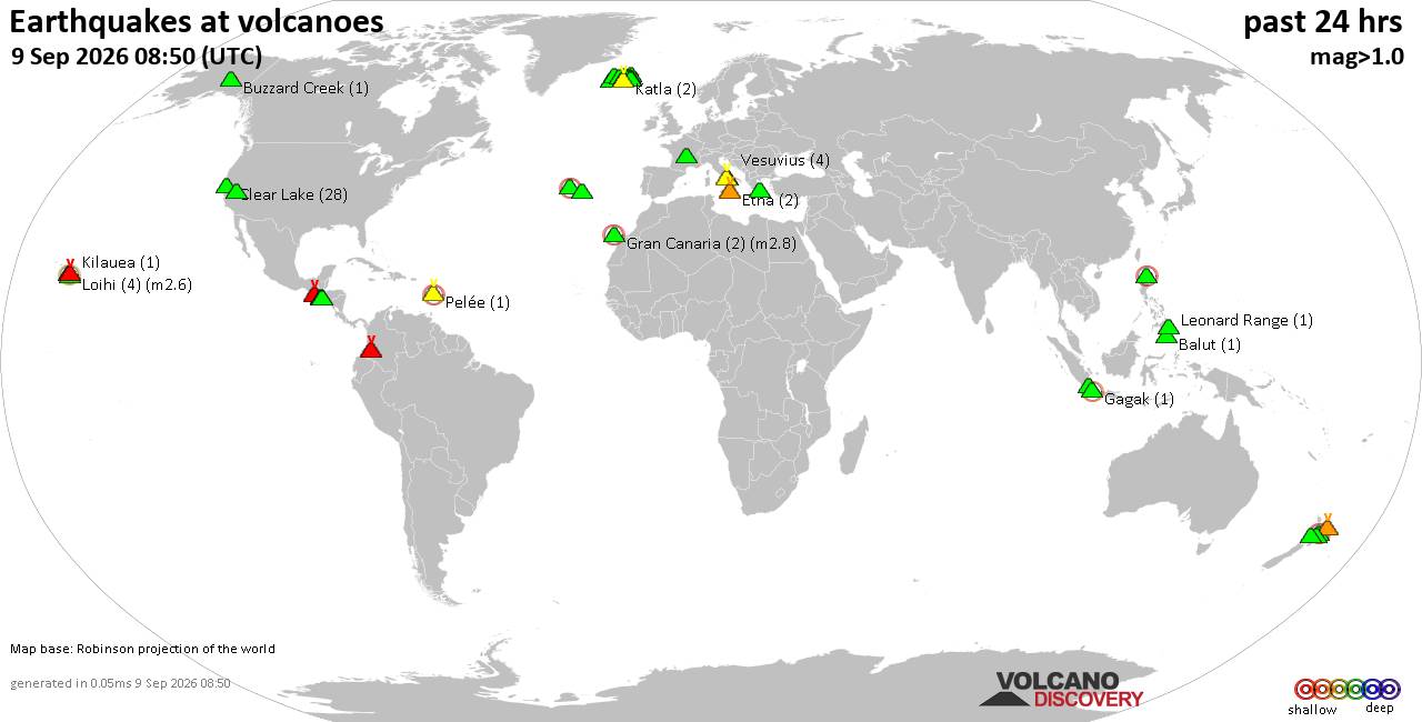
Volcano earthquake report for Wednesday, 9 September 2026
• World Earthquake Report for Wednesday, 9 September 2026
• Strong mag. 5.0 earthquake - Celebes Sea, 49 km north of Tahuna, Indonesia,...
• Moderate mag. 4.7 earthquake - Philippine Sea, 135 km southeast of Shima, M...
• The 10 most powerful earthquakes in the world since 1900
• Moderate mag. 4.0 earthquake - Indian Ocean, 80 km southwest of Labuan, Kab...
|

#770903
Fri 08 Aug 2025 02:51:AM
|
Joined: Feb 2001
Posts: 678,977
Launch Director
|
|
Launch Director
Joined: Feb 2001
Posts: 678,977 |
Issued at 800 PM MST Thu Aug 07 2025 048
WTPZ34 KNHC 080250
TCPEP4
BULLETIN
Tropical Storm Ivo Advisory Number 6
NWS National Hurricane Center Miami FL EP092025
800 PM MST Thu Aug 07 2025
...IVO FORECAST TO STRENGTHEN AS IT PULLS AWAY FROM MEXICO...
SUMMARY OF 800 PM MST...0300 UTC...INFORMATION
----------------------------------------------
LOCATION...19.7N 107.3W
ABOUT 275 MI...445 KM SE OF THE SOUTHERN TIP OF BAJA CALIFORNIA
MAXIMUM SUSTAINED WINDS...60 MPH...95 KM/H
PRESENT MOVEMENT...NW OR 305 DEGREES AT 22 MPH...35 KM/H
MINIMUM CENTRAL PRESSURE...1001 MB...29.56 INCHES
WATCHES AND WARNINGS
--------------------
Interests along the coast of southwestern Mexico and the southern
portion of the Baja California peninsula should continue to monitor
the progress of Ivo.
DISCUSSION AND OUTLOOK
----------------------
At 800 PM MST (0300 UTC), the center of Tropical Storm Ivo was
located near latitude 19.7 North, longitude 107.3 West. Ivo is
moving toward the northwest near 22 mph (35 km/h). A decrease in
forward speed and a turn to the west-northwest are expected during
the next few days. On the forecast track, Ivo is expected to pull
away from mainland Mexico and pass well south of the Baja
California peninsula.
Maximum sustained winds remain near 60 mph (95 km/h) with higher
gusts. Strengthening is forecast for the next day or so, and Ivo
could become a hurricane on Friday. Weakening should begin over the
weekend.
Tropical-storm-force winds extend outward up to 45 miles (75 km)
from the center.
The estimated minimum central pressure is 1001 mb (29.56 inches).
HAZARDS AFFECTING LAND
----------------------
RAINFALL: Tropical Storm Ivo is expected to produce additional
rainfall of 1 to 2 inches across coastal portions of the Mexican
states of Michoacán de Ocampo, Colima, and Jalisco through tonight.
The additional rainfall may result in localized flash flooding.
For a complete depiction of forecast rainfall associated with
Tropical Storm Ivo please see the National Weather Service Storm
Total Rainfall Graphic available at
hurricanes.gov/graphics_ep4.shtml?rainqpf
SURF: Swells generated by Ivo will continue to affect the
southwestern coast of Mexico during the next day or so, and are
forecast to reach the southern portion of the Baja California
peninsula on Friday. These swells are likely to cause
life-threatening surf and rip current conditions. Please consult
products from your local weather office.
A depiction of rip current risk for the United States can be found
at: hurricanes.gov/graphics_ep4.shtml?ripCurrnets
NEXT ADVISORY
-------------
Next complete advisory at 200 AM MST.
$$
Forecaster Cangialosi Source: Tropical Storm Ivo Public Advisory Number 6
|
|



CMS The Best Conveyancing solicitors conveyancing quotes throughout the UK
For any webhosting enquiries please email webmaster@aus-city.com
|
|
Entire Thread
|
 Tropical Storm Ivo Public Advisory Number 6
|
Webmaster
|
Fri 08 Aug 2025 02:51:AM
|
|
Forums60
Topics822,449
Posts857,242
Members2,960
| |
Most Online102,106
Jul 10th, 2026
|
|
|





































