|
|
|
0 members (),
887
guests, and
22
robots. |
|
Key:
Admin,
Global Mod,
Mod
|
|
S |
M |
T |
W |
T |
F |
S |
|
|
|
|
|
|
|
1
|
|
2
|
3
|
4
|
5
|
6
|
7
|
8
|
|
9
|
10
|
11
|
12
|
13
|
14
|
15
|
|
16
|
17
|
18
|
19
|
20
|
21
|
22
|
|
23
|
24
|
25
|
26
|
27
|
28
|
29
|
|
30
|
31
|
|
|
|
|
|
|
There are no members with birthdays on this day. |
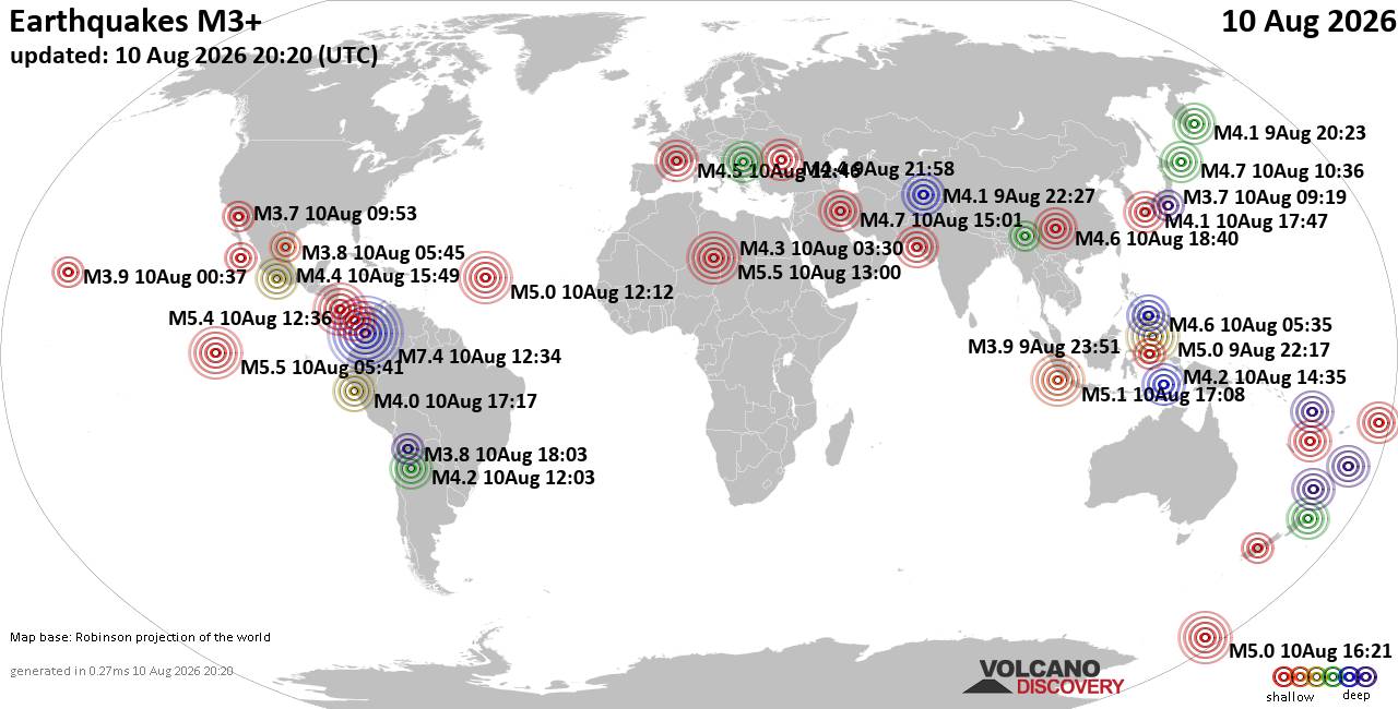
World Earthquake Report for Monday, 10 August 2026
• Volcano earthquake report for Monday, 10 Aug 2026
• Moderate mag. 4.0 earthquake - Zangilan Rayon, 58 km southwest of Ganja, Ga...
• Moderate mag. 4.6 earthquake - 31 km northeast of Xunchang, Sichuan, China,...
• Moderate mag. 4.2 earthquake - New Zealand on Tuesday, Aug 11, 2026, at 06:...
• World Earthquake Report for August 2026
|

#781550
Sun 02 Nov 2025 12:39:AM
|
Joined: Feb 2001
Posts: 678,976
Launch Director
|
OP

Launch Director
Joined: Feb 2001
Posts: 678,976 |
SPC Nov 2, 2025 0100 UTC Day 1 Convective OutlookSPC 0100Z Day 1 Outlook 
Day 1 Convective Outlook
NWS Storm Prediction Center Norman OK
0735 PM CDT Sat Nov 01 2025

Valid 020100Z - 021200Z

...THERE IS A SLIGHT RISK OF SEVERE THUNDERSTORMS ACROSS PORTIONS OF
SOUTH TEXAS...

...SUMMARY...
Isolated to scattered severe thunderstorms capable of producing
large hail and locally damaging winds remain possible this evening
across portions of south Texas.

...01z Update...

Weak short-wave trough is digging southeast toward the south TX
Coast early this evening. As this feature continues to dig
southeast, coastal boundary and deeper convergence will shift
offshore over the next few hours. Cooling midlevel temperatures and
steepening lapse rates have aided buoyancy across this portion of TX
and scattered robust convection has matured ahead of the short wave.
00z sounding from BRO exhibits roughly 1500 J/kg MLCAPE, but a
notable warm layer is observed near 3km. Midlevel cooling should
dampen this warm layer and profiles will remain favorable for robust
deep convection through 06-08z across deep South TX. Latest radar
data suggests several supercell structures are digging toward the
coast, with a few likely generating severe hail in excess of golf
ball size. Greatest risk for severe will be prior to 06z before the
short wave encourages deep convection to focus offshore.

..Darrow.. 11/02/2025
Read morehttps://www.spc.noaa.gov/products/outlook/day1otlk_0100.html
|
|



CMS The Best Conveyancing solicitors conveyancing quotes throughout the UK
For any webhosting enquiries please email webmaster@aus-city.com
|
|
Entire Thread
|
 SPC Nov 2, 2025 0100 UTC Day 1 Convective Outlook
|
Webmaster
|
Sun 02 Nov 2025 12:39:AM
|
|
Forums60
Topics796,363
Posts831,153
Members2,960
| |
Most Online102,106
Jul 10th, 2026
|
|
|
|
|

|





































