|
1 members (Alisa),
1,629
guests, and
28
robots. |
|
Key:
Admin,
Global Mod,
Mod
|
|
S |
M |
T |
W |
T |
F |
S |
|
|
|
|
|
|
|
1
|
|
2
|
3
|
4
|
5
|
6
|
7
|
8
|
|
9
|
10
|
11
|
12
|
13
|
14
|
15
|
|
16
|
17
|
18
|
19
|
20
|
21
|
22
|
|
23
|
24
|
25
|
26
|
27
|
28
|
29
|
|
30
|
31
|
|
|
|
|
|
|
There are no members with birthdays on this day. |
|
|
|
|
|
|
|
|
|
|
|
|
|
|
|
|
|
|
|
|
|
|
a cake
by Webmaster - Sat 22 Aug 2026 12:00:AM
|
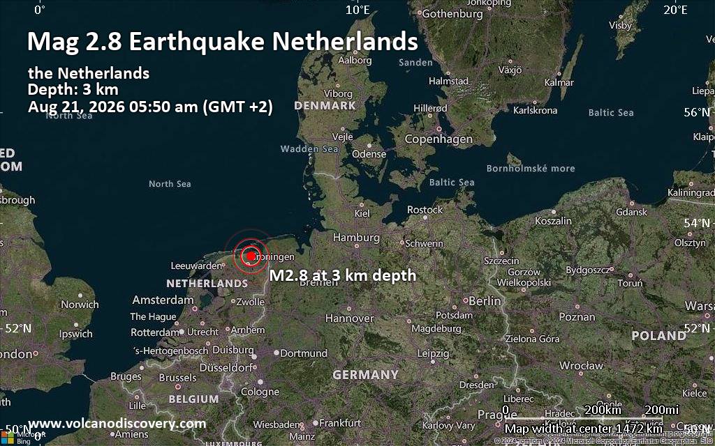
Small tremor of magnitude 2.8 just reported 20 km northeast of Groningen, Netherlands
|

#791411
Wed 07 Jan 2026 09:25:PM
|
Joined: Feb 2001
Posts: 678,976
Launch Director
|
OP

Launch Director
Joined: Feb 2001
Posts: 678,976 |
SPC Day 3-8 Fire Weather OutlookSPC Day 3-8 Fire Weather Outlook 
Day 3-8 Fire Weather Outlook
NWS Storm Prediction Center Norman OK
0320 PM CST Wed Jan 07 2026

Valid 091200Z - 151200Z

A longwave trough will begin to progress out of the western US on
D2/Thursday, with a surface low developing across the Oklahoma/Texas
Panhandles into western Kansas. Widespread rain/thunderstorm
activity can be expected across some portions of the central/eastern
Southern Plains into the Mississippi/Missouri River Valley. Less
precipitation is likely across portions of western Texas, where fire
concerns are possible D3/Friday.

...D3/Friday - Southwestern/West-Central Texas...
Model guidance has been consistent in forecasting a steep gradient
in precipitation amounts across the Southern Plains but has wavered
on overall amounts and exactly where this will be. Confidence is
moderate that portions of western Texas into western Oklahoma will
receive little to no precipitation. Latest fuels guidance suggests
grass loading is high with freeze cured grasses present and ERCs
around the 80th percentile within these regions. Strong and dry post
frontal northwesterly flow will overspread the Plains behind the
departing low on D3/Friday. Relative humidity reductions to 15-20
percent are expected to overlap sustained northwesterly flow around
20 mph across portions of north-central and southwestern Texas. A 40
percent area was maintained with this outlook, given some continued
uncertainty in where the gradient of higher precipitation will be.
Another factor would be the duration of any Critical conditions as
relative humidity increases with colder air coming in behind the
departing cold front. Depending on how much precipitation occurs, a
Critical area may be warranted for the upcoming transition from D3
to D2.

Beyond D3/Friday, the trough will progress eastward, with heights
rising across the Southern Plains. The front will have ushered
moisture largely offshore, with dry conditions remaining across much
of the Southern Plains. A few localized areas of breezy/dry
conditions will be possible D4/Saturday and D5/Sunday before lighter
winds return.

..Thornton/Elizalde-Garcia.. 01/07/2026

...Please see www.spc.noaa.gov/fire for graphic product...
Read morehttps://www.spc.noaa.gov/products/exper/fire_wx/
|
|



CMS The Best Conveyancing solicitors conveyancing quotes throughout the UK
For any webhosting enquiries please email webmaster@aus-city.com
|
|
Entire Thread
|
 SPC Day 3-8 Fire Weather Outlook
|
Webmaster
|
Wed 07 Jan 2026 09:25:PM
|
|
Forums60
Topics800,637
Posts835,427
Members2,960
| |
Most Online102,106
Jul 10th, 2026
|
|
|





































