|
|
|
0 members (),
1,408
guests, and
24
robots. |
|
Key:
Admin,
Global Mod,
Mod
|
|
S |
M |
T |
W |
T |
F |
S |
|
|
|
|
|
1
|
2
|
3
|
|
4
|
5
|
6
|
7
|
8
|
9
|
10
|
|
11
|
12
|
13
|
14
|
15
|
16
|
17
|
|
18
|
19
|
20
|
21
|
22
|
23
|
24
|
|
25
|
26
|
27
|
28
|
29
|
30
|
31
|
|
There are no members with birthdays on this day. |
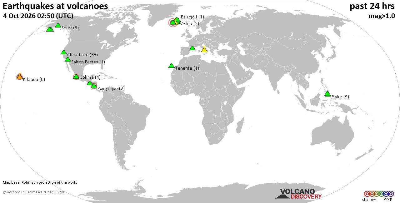
Volcano earthquake report for Sunday, 4 October 2026
• M 0.3 - 9 km SW of Beaumont, CA
• M 0.8 - 8 km NW of The Geysers, CA
• M 4.5 - 57 km S of Buala, Solomon Islands
• M 2.0 - 2 km NE of Almanor, CA
• M 0.9 - 15 km N of California City, CA
• M 1.9 - 22 km SSE of Pāhala, Hawaii
|

#800620
Sat 28 Feb 2026 05:17:PM
|
Joined: Feb 2001
Posts: 678,977
Launch Director
|
|
Launch Director
Joined: Feb 2001
Posts: 678,977 |
SPC Feb 28, 2026 1730 UTC Day 2 Convective OutlookSPC 1730Z Day 2 Outlook 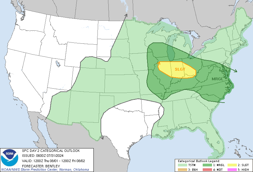
Day 2 Convective Outlook
NWS Storm Prediction Center Norman OK
1114 AM CST Sat Feb 28 2026

Valid 011200Z - 021200Z

...NO SEVERE THUNDERSTORM AREAS FORECAST...

...SUMMARY...
Thunderstorms will be possible on Sunday across parts of south
Florida, the southern and central Plains, and in northern California
Sunday afternoon and evening.

...Synopsis...
A strong cyclone traversing eastern Canada this morning will be
followed by strengthening surface high pressure across the eastern
two-thirds of the CONUS tomorrow. A weak trailing cold front
associated with the Canadian cyclone will gradually migrate south
into the Southeast and southern Plains. Isentropic ascent over the
frontal zone will support isolated thunderstorms across portions of
OK into southeast KS, southwest MO, and northwest AR tomorrow
afternoon and evening. Although the kinematic environment is
conditionally favorable for organized convection, meager moisture
return and poor mid-level lapse rates should mitigate severe
thunderstorm potential. There is a low chance for a strong
thunderstorm across central OK during the evening hours per latest
RRFS solutions, which depict better low-level moisture/buoyancy into
OK and are aligned with recent RAP solutions environmentally.
However, the consensus among other HREF members and calibrated
guidance is that the RRFS is the outlier solution, which
substantially limits confidence in the severe potential.

Elsewhere, lingering showers and isolated thunderstorms are expected
within a residual frontal zone across the southern FL Peninsula
where an unstable, but weakly capped, environment should be in
place. Along the West Coast, an upper-level trough pushing into
northern CA and southern OR will support isolated thunderstorms as
instability increases due to cooling temperatures aloft within a
fairly moist air mass.

..Moore.. 02/28/2026
Read morehttps://www.spc.noaa.gov/products/outlook/day2otlk_1730.html
|
|



CMS The Best Conveyancing solicitors conveyancing quotes throughout the UK
For any webhosting enquiries please email webmaster@aus-city.com
|
|
Entire Thread
|
 SPC Feb 28, 2026 1730 UTC Day 2 Convective Outlook
|
Webmaster
|
Sat 28 Feb 2026 05:17:PM
|
|
Forums60
Topics856,655
Posts891,450
Members2,960
| |
Most Online102,106
Jul 10th, 2026
|
|
|
|
|

|









































