|
|
|
0 members (),
1,345
guests, and
25
robots. |
|
Key:
Admin,
Global Mod,
Mod
|
|
S |
M |
T |
W |
T |
F |
S |
|
|
|
|
|
1
|
2
|
3
|
|
4
|
5
|
6
|
7
|
8
|
9
|
10
|
|
11
|
12
|
13
|
14
|
15
|
16
|
17
|
|
18
|
19
|
20
|
21
|
22
|
23
|
24
|
|
25
|
26
|
27
|
28
|
29
|
30
|
31
|
|
There are no members with birthdays on this day. |
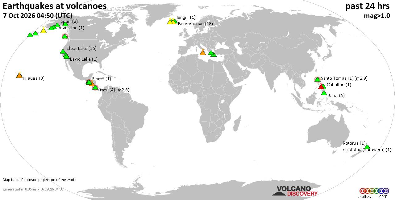
Volcano earthquake report for Wednesday, 7 October 2026
• M 1.2 - 10 km SSW of Idyllwild, CA
• M 1.7 - 10 km W of Boonville, CA
• M 2.4 - 6 km SE of Chickasha, Oklahoma
• M 1.5 - 1 km WNW of Loma Linda, CA
• M 1.5 - 49 km SSE of Tanana, Alaska
• M 1.7 - 8 km ESE of Prunedale, CA
|

#808987
Fri 08 May 2026 12:38:AM
|
Joined: Feb 2001
Posts: 678,977
Launch Director
|
|
Launch Director
Joined: Feb 2001
Posts: 678,977 |
SPC May 8, 2026 0100 UTC Day 1 Convective OutlookSPC 0100Z Day 1 Outlook 
Day 1 Convective Outlook
NWS Storm Prediction Center Norman OK
0735 PM CDT Thu May 07 2026

Valid 080100Z - 081200Z

...NO SEVERE THUNDERSTORM AREAS FORECAST...

...SUMMARY...
Severe storms are not expected through tonight.

...MT/WY...

Forcing for ascent attendant to a short-wave trough moving southeast
through the region has fostered widely scattered thunderstorms from
portions of northwest MT into central WY as of 00z. Moisture is
limited, but the presence of steep lapse rates (ref. 00z RIW
sounding) may be sufficient to support briefly strong storms capable
of gusty winds and/or small hail for the next couple of hours.

...Carolinas...

A small cluster of showers and thunderstorms is ongoing across parts
of southern and central NC along a cold front settling south through
the area. Weakening, low-level lapse rates and resultant instability
should limit any severe-weather threat as the convection continues
east tonight.

...LA...

A few thunderstorms have recently developed in the vicinity of the
surface front in far southeast LA amidst a moist low-level air mass.
The 00z LIX sounding located to the immediate north of the front
sampled MUCAPE of around 1500 J/kg for parcels lifted from around 1
KM. Moreover, deep-layer shear remains strong (effective bulk shear
of 60 kt), which would conditionally support some storm
organization. Current thinking is that nebulous forcing for ascent
and poor low/mid-level lapse rates will tend to limit updraft vigor
in an otherwise seemingly favorable, severe-storm environment. As
such, no severe-weather probabilities will be included for this
forecast.

...Southern AZ/NM into TX...

Isolated thunderstorms remain possible overnight from southern parts
of AZ and NM into western and southern TX, near and ahead of a
mid-level low drifting east across Sonora and Chihuahua, Mexico.

..Mead.. 05/08/2026
Read morehttps://www.spc.noaa.gov/products/outlook/day1otlk_0100.html
|
|



CMS The Best Conveyancing solicitors conveyancing quotes throughout the UK
For any webhosting enquiries please email webmaster@aus-city.com
|
|
Entire Thread
|
 SPC May 8, 2026 0100 UTC Day 1 Convective Outlook
|
Webmaster
|
Fri 08 May 2026 12:38:AM
|
|
Forums60
Topics862,367
Posts897,162
Members2,960
| |
Most Online102,106
Jul 10th, 2026
|
|
|
|
|

|









































