|
1 members (Alisa),
1,122
guests, and
26
robots. |
|
Key:
Admin,
Global Mod,
Mod
|
|
S |
M |
T |
W |
T |
F |
S |
|
|
|
1
|
2
|
3
|
4
|
5
|
|
6
|
7
|
8
|
9
|
10
|
11
|
12
|
|
13
|
14
|
15
|
16
|
17
|
18
|
19
|
|
20
|
21
|
22
|
23
|
24
|
25
|
26
|
|
27
|
28
|
29
|
30
|
|
|
|
|
There are no members with birthdays on this day. |
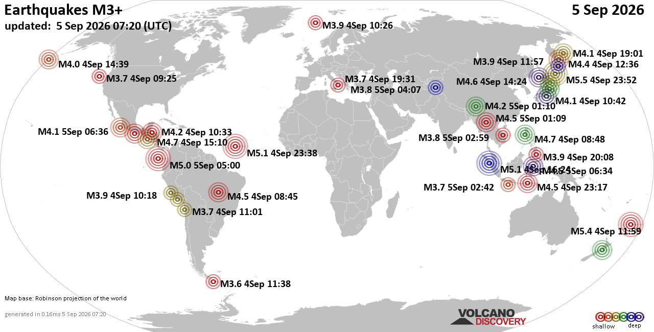
World Earthquake Report for Saturday, 5 September 2026
• Moderate mag. 4.0 earthquake - Provincia de Iquique, Tarapacá, Chile, on S...
• Volcano earthquake report for Saturday, 5 September 2026
• Moderate magnitude 4.6 earthquake 77 km southeast of Gorontalo, Indonesia
• Moderate mag. 4.1 earthquake - North Pacific Ocean, 152 km west of Manzanil...
• Moderate mag. 4.5 earthquake - Sulawesi Tengah, 77 km south of Gorontalo, K...
|

#809365
Sun 10 May 2026 05:35:AM
|
Joined: Feb 2001
Posts: 678,977
Launch Director
|
|
Launch Director
Joined: Feb 2001
Posts: 678,977 |
SPC May 10, 2026 0600 UTC Day 1 Convective OutlookSPC 1200Z Day 1 Outlook 
Day 1 Convective Outlook
NWS Storm Prediction Center Norman OK
1233 AM CDT Sun May 10 2026

Valid 101200Z - 111200Z

...THERE IS AN ENHANCED RISK OF SEVERE THUNDERSTORMS SUNDAY
AFTERNOON THROUGH LATE EVENING ACROSS PARTS OF CENTRAL AND NORTH
TEXAS...

...SUMMARY...
Large hail (some in excess of 2 inches in diameter) and severe wind
gusts (potentially in excess of 75 mph) will be possible Sunday
afternoon/evening across parts of central and north Texas. More
sporadic occurrences of damaging wind and large hail are possible
farther east into the lower Mississippi Valley, portions of the
Florida Peninsula, and central New Mexico into far West Texas.

...Synopsis...

A mid/upper-level low initially over James Bay will progress
northeast through the forecast period, with a belt of strong,
cyclonic flow persisting across the Great Lakes and New England. On
the periphery of the broader-scale troughing, late evening water
vapor imagery shows a short-wave trough over WY with a more subtle
disturbance noted near the Four Corners region. Those two features
are expected to progress into the southern Plains by Sunday
afternoon, contributing to modest, mid-level height falls across the
region.

At the surface, a cold front initially from the lower Great Lakes
southwest through the OH Valley and Ozark Plateau into the southern
High Plains at 12z Sunday will advance east/southeast during the
day. A few strong storms capable of small hail and gusty winds may
occur along and ahead of that boundary Sunday afternoon over
northern New England and the central Appalachians into mid-Atlantic.
Greater severe-storm potential is expected along the cold front and
any preceding convective outflow boundaries from the southern Plains
into lower MS Valley Sunday afternoon and evening.


...Southern Plains into Lower MS Valley...

Clusters of thunderstorms (some of which could be strong to severe)
are likely to be ongoing Sunday morning from the ArkLaTex into OK,
with outflow associated with that activity preceding the cold front
across north Texas. By early to mid afternoon, the composite
boundary is expected to extend from the TX South Plains across north
Texas through the ArkLaTex into central or eastern AR. A dryline is
expected to stretch south from the front through the eastern Permian
Basin into the Edwards Plateau region.

A steep, mid-level lapse rate plume will overlie the warm sector
characterized by increasing boundary-layer moisture content with
eastward extent across TX, with afternoon MLCAPE of 2500-3500 J/kg.
Slightly less instability (MLCAPE of 1000-2000 J/kg) is forecast
from AR and LA into MS as that region will reside east of the EML
plume.

The combination of daytime heating and increasing forcing for ascent
(see synopsis) are expected to support thunderstorm development by
mid afternoon from the vicinity of the surface triple point over
west-central TX, east along the composite boundary. Vertical shear
will be maximized along the west-to-east-oriented front with
decreasing bulk shear magnitudes with southward extent across the
warm sector. As such, supercell storm modes and an associated large
to very large hail (2+" in diameter) threat are most probable in the
vicinity of the front within the first couple of hours after storm
initiation.

By late afternoon into Sunday evening, there is a consistent signal
across convection-allowing model guidance for upscale growth into a
forward-propagating QLCS that accelerates southeast through central
TX before reaching the TX Coast and deep South TX early Monday
morning. The degree of parcel buoyancy and presence of a dry,
mid-level air mass will support the potential for organized cold
pool development with corridors of damaging winds in excess of 75
mph appearing possible from late afternoon through evening. The
damaging wind threat is expected to become more isolated with time
Sunday night into early Monday as the boundary layer gradually
stabilizes. Generally weak low-level shear (effective SRH < 150
m2/s2) and 0-3-km bulk-shear magnitudes <25-30 kt are expected to
limit tornado/meso-vortex potential with the QLCS.

Farther to the east across AR and LA into MS, convective evolution
and associated severe-weather potential are a bit more uncertain.
Some model guidance suggests that morning storms across portions of
AR could intensify by afternoon while spreading east/southeast into
parts of northwest MS and northern LA. Additional strong to severe
storms will also be possible Sunday afternoon and evening along the
front moving through the area. Damaging wind gusts appear to be the
primary severe hazard, though isolated occurrences of severe hail
will also be possible.


...Central NM into far West Texas...

Height falls aloft coupled with enhanced orographic ascent with the
cold-frontal surge are expected to contribute to isolated to widely
scattered storm development Sunday afternoon and evening. Steep,
low/mid-level lapse rates will contribute to MLCAPE of around 500
J/kg amidst 30-35 kt of effective bulk shear may favor  a few strong
to severe storms capable of hail and/or locally damaging wind gusts.


...FL Peninsula...

Isolated to widely scattered, diurnally enhanced thunderstorms
appear possible along the front stalled across the northern
Peninsula, and south along the Atlantic Coast sea breeze. The
presence of a moist environment with MLCAPE up to 1500-2500 J/kg
will support water-loaded downdrafts capable of locally damaging
wind gusts during the afternoon and early evening hours.

..Mead/Weinman.. 05/10/2026
Read morehttps://www.spc.noaa.gov/products/outlook/day1otlk_1200.html
|
|



CMS The Best Conveyancing solicitors conveyancing quotes throughout the UK
For any webhosting enquiries please email webmaster@aus-city.com
|
|
Entire Thread
|
 SPC May 10, 2026 0600 UTC Day 1 Convective Outlook
|
Webmaster
|
Sun 10 May 2026 05:35:AM
|
|
Forums60
Topics820,513
Posts855,306
Members2,960
| |
Most Online102,106
Jul 10th, 2026
|
|
|





































