|
0 members (),
1,207
guests, and
23
robots. |
|
Key:
Admin,
Global Mod,
Mod
|
|
S |
M |
T |
W |
T |
F |
S |
|
|
|
|
|
|
1
|
2
|
|
3
|
4
|
5
|
6
|
7
|
8
|
9
|
|
10
|
11
|
12
|
13
|
14
|
15
|
16
|
|
17
|
18
|
19
|
20
|
21
|
22
|
23
|
|
24
|
25
|
26
|
27
|
28
|
29
|
30
|
|
31
|
|
|
|
|
|
|
|
There are no members with birthdays on this day. |
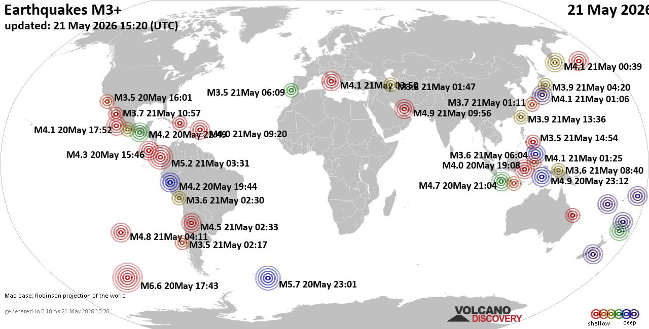
World Earthquake Report for Thursday, 21 May 2026
• Volcano earthquake report for Thursday, 21 May 2026
• Light mag. 3.9 earthquake - 48 km southwest of Coatepeque, Departamento de ...
• Moderate mag. 4.4 earthquake - New Zealand on Friday, May 22, 2026, at 02:1...
• Moderate mag. 4.4 earthquake - Gisborne, New Zealand, on Friday, May 22, 20...
• Moderate mag. 4.0 earthquake - Bay of Plenty, New Zealand, on Friday, May 2...
|

#810543
Thu 14 May 2026 07:58:PM
|
Joined: Feb 2001
Posts: 381,904
Launch Director
|
OP

Launch Director
Joined: Feb 2001
Posts: 381,904 |
SPC May 14, 2026 2000 UTC Day 1 Convective OutlookSPC 2000Z Day 1 Outlook 
Day 1 Convective Outlook
NWS Storm Prediction Center Norman OK
0255 PM CDT Thu May 14 2026

Valid 142000Z - 151200Z

...THERE IS A SLIGHT RISK OF SEVERE THUNDERSTORMS ACROSS PORTIONS OF
THE CENTRAL AND SOUTHERN HIGH PLAINS...

...SUMMARY...
Thunderstorms with hail and severe wind gusts are possible from
Kansas/Missouri southwest into west Texas, mainly late this
afternoon and evening.

...20z Update central Plains and mid MS Valley...
Isolated convection may develop across portions of central KS late
this afternoon/evening northeast of the effective triple point.
Low-level moisture continues to rapidly advect northward across
central KS but deep mixing will likely limit the extent of the more
robust 60s F dewpoints. With moderate forecast MLCAPE (1500-2000
J/kg) amid veering wind profiles, isolated, high-based supercells
remain possible, mainly with a large hail and damaging wind risk.
Additional storms are also possible later tonight at the terminus of
a forecast 40-50 kt low-level jet across far eastern KS into MO. It
remains unclear if these storms will be robustly organized, but some
risk for hail and damaging winds may exist. Wind and hail
probabilities were expanded slightly eastward to capture this
threat.

...Southern and central High Plains...
High-based showers and a few thunderstorms have begun developing and
should gradually increase in coverage this afternoon. Weak buoyancy
(500-1000 J/kg MUCAPE) atop a very deep mixed layer is evident on 12
and 18z area RAOBs supporting the risk for damaging/severe gusts. A
few stronger high-based storms could also produce marginally severe
hail across parts of western KS where buoyancy is somewhat better.
See MCD#718 for additional short term information.

..Lyons.. 05/14/2026

.PREV DISCUSSION... /ISSUED 1121 AM CDT Thu May 14 2026/

...Central Plains including Kansas...
An upper trough over the Canadian Prairies and northern Plains will
glancingly influence the region later today, along with an embedded
disturbance or two emerging from the central Rockies early today.
Surface cyclogenesis will occur across Kansas, while a front spreads
east-southeastward across the central High Plains, and low-level
moisture steadily increases ahead of a dryline.

Initiation/sustenance of deep convection is mostly likely to
initially occur late this afternoon through around sunset across
west-central into southwest Kansas in vicinity of the surface triple
point, and to a lesser extent, along the southwestward-extending
dryline. Beneath a stout elevated mixed layer, moderate buoyancy
with 2000 J/kg MLCAPE is expected across central Kansas, which will
be coincident with a belt of 35-40 kt mid-level winds/effective
shear. Where storms do develop, forecast parameters will be quite
favorable for supercells capable of large hail and damaging winds
across much of central toward eastern Kansas. Other higher-based
severe storms are possible south-southwestward along the dryline.

...Southern High Plains including OK/TX Panhandles and West TX...
Widely scattered high-based storms should develop in vicinity of the
dryline late this afternoon/early evening. Somewhat higher
probabilities/storm coverage should exist across the Oklahoma/Texas
Panhandles and Texas South Plains. Various forecast soundings
regionally near the dryline reflect a hot and very deeply mixed
peak-heating boundary layer, to upwards of 4-4.5km AGL/500mb, with
residual CAPE and moderately strong westerlies atop the boundary
layer. Strong to potentially severe wind gusts will be possible
where storms develop in this hot/steep lapse rate environment, with
a diminishing storm intensity through the post-sunset evening hours
as the boundary layer cools.
Read morehttps://www.spc.noaa.gov/products/outlook/day1otlk_2000.html
|
|



CMS The Best Conveyancing solicitors conveyancing quotes throughout the UK
For any webhosting enquiries please email webmaster@aus-city.com
|
|
Entire Thread
|
 SPC May 14, 2026 2000 UTC Day 1 Convective Outlook
|
Webmaster
|
Thu 14 May 2026 07:58:PM
|
|
Forums60
Topics776,490
Posts811,285
Members2,960
| |
Most Online22,463
May 9th, 2026
|
|
|