|
0 members (),
1,730
guests, and
20
robots. |
|
Key:
Admin,
Global Mod,
Mod
|
|
S |
M |
T |
W |
T |
F |
S |
|
|
|
|
1
|
2
|
3
|
4
|
|
5
|
6
|
7
|
8
|
9
|
10
|
11
|
|
12
|
13
|
14
|
15
|
16
|
17
|
18
|
|
19
|
20
|
21
|
22
|
23
|
24
|
25
|
|
26
|
27
|
28
|
29
|
30
|
31
|
|
|
There are no members with birthdays on this day. |
|
|
|
|
|
|
|
|
by Webmaster - Sun 26 Jul 2026 08:45:PM
|
by Webmaster - Sun 26 Jul 2026 08:45:PM
|
by Webmaster - Sun 26 Jul 2026 08:45:PM
|
|
|
|
|
|
|
|
|
|
|
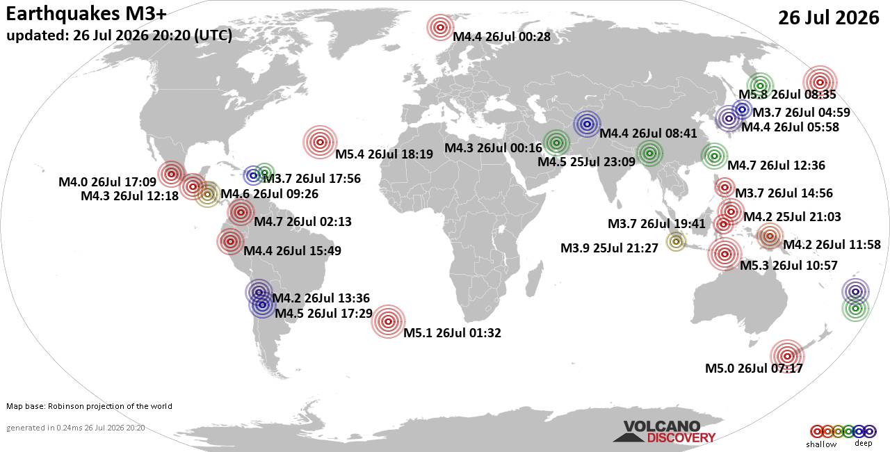
World Earthquake Report for Sunday, 26 July 2026
• Moderate mag. 4.5 earthquake - Estado de Veracruz-Llave, Mexico, on 2026-07...
• Volcano earthquake report for Sunday, 26 Jul 2026
• Moderate mag. 4.0 earthquake - Kabupaten Kepulauan Talaud, 148 km northeast...
• Light mag. 3.9 earthquake - North Pacific Ocean, 65 km south of Puerto San ...
• Strong mag. 5.4 earthquake - Northern Mid-Atlantic Ridge on Sunday, Jul 26,...
|

#810545
Thu 14 May 2026 07:57:PM
|
Joined: Feb 2001
Posts: 678,976
Launch Director
|
OP

Launch Director
Joined: Feb 2001
Posts: 678,976 |
SPC Day 2 Fire Weather OutlookSPC Day 2 Fire Weather Outlook 
Day 2 Fire Weather Outlook
NWS Storm Prediction Center Norman OK
0256 PM CDT Thu May 14 2026

Valid 151200Z - 161200Z

...CRITICAL FIRE WEATHER AREA FOR PORTIONS OF THE TEXAS PANHANDLE
AND SOUTHEASTERN NEW MEXICO...

The Critical area and coincident Elevated area located over southern
NM, portions of western TX, and far southwestern OK were both
expanded primarily to the west. This was in agreement with the
timing of the latest forecast guidance indicating stronger southwest
winds over the region. Across the far northern Plains and into the
Great Lakes region, the latest forecast guidance indicates strong
westerly winds aloft, continued well above normal surface
temperatures, and a resultant deeply mixed boundary layer.
Accordingly, the Elevated area was expanded eastward to account for
stronger winds over much of MN and northern WI. Additionally,
ongoing convection, potentially leading to ignitions, on Day
1/Thursday followed by dry and windy conditions on Day 2/Friday
could amplify this risk. Over the central High Plains in the
vicinity of Wyoming, the Elevated area was expanded to include
portions of northwestern CO as well as far southwestern SD and much
of the NE Panhandle.

..Stearns.. 05/14/2026

.PREV DISCUSSION... /ISSUED 1211 AM CDT Thu May 14 2026/

...Synopsis...
Broadly zonal flow aloft with an embedded shortwave will traverse
the Upper Midwest on Friday. At the surface, a continued post
frontal environment beneath a departing deep surface low in Ontario
will promote strong westerly winds within a dry airmass across the
northern Plains and Upper Midwest. A mid-level impulse and emerging
lee surface low across the southern Plains will further enhance
downslope drying and breezy surface winds, supporting fire weather
concerns across southeastern NM into the TX Panhandle.

...Northern Plains...
Deep westerly flow aloft and tightening surface pressure gradients
beneath a departing Canadian surface low will encourage widespread
dry and breezy conditions. Westerly winds of up to 20 mph and RH
values of 25-30% support fire weather concerns across the region.
Adjustments to the Elevated risk may be needed in future outlooks as
precipitation continues into the early morning hours of Day
1/Thursday across portions of eastern MT.

...Southern Plains...
South of a developing lee surface low over western OK, enhanced
downslope winds of 15-20 mph will align with RH reductions to less
than 15% across southeastern NM into the southern TX Panhandle.
Elevated highlights have been introduced where these conditions
overlap dry and receptive fuels. Furthermore, a narrow region of
likely 20-25 mph winds and 10-15% RH (single digits locally) has
prompted the introduction of Critical highlights across the Caprock
and upper Rolling Plains.

...Please see www.spc.noaa.gov/fire for graphic product...
Read morehttps://www.spc.noaa.gov/products/fire_wx/fwdy2.html
|
|



CMS The Best Conveyancing solicitors conveyancing quotes throughout the UK
For any webhosting enquiries please email webmaster@aus-city.com
|
|
Entire Thread
|
 SPC Day 2 Fire Weather Outlook
|
Webmaster
|
Thu 14 May 2026 07:57:PM
|
|
Forums60
Topics792,808
Posts827,590
Members2,960
| |
Most Online102,106
Jul 10th, 2026
|
|
|





































