|
1 members (Alisa),
1,122
guests, and
26
robots. |
|
Key:
Admin,
Global Mod,
Mod
|
|
S |
M |
T |
W |
T |
F |
S |
|
|
|
1
|
2
|
3
|
4
|
5
|
|
6
|
7
|
8
|
9
|
10
|
11
|
12
|
|
13
|
14
|
15
|
16
|
17
|
18
|
19
|
|
20
|
21
|
22
|
23
|
24
|
25
|
26
|
|
27
|
28
|
29
|
30
|
|
|
|
|
There are no members with birthdays on this day. |
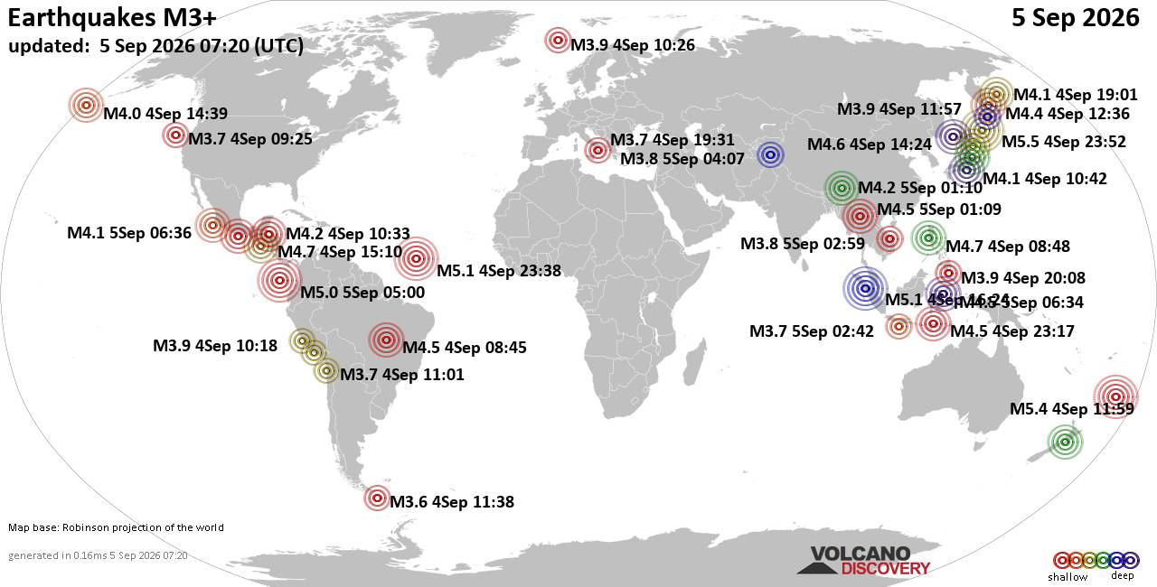
World Earthquake Report for Saturday, 5 September 2026
• Moderate mag. 4.0 earthquake - Provincia de Iquique, Tarapacá, Chile, on S...
• Volcano earthquake report for Saturday, 5 September 2026
• Moderate magnitude 4.6 earthquake 77 km southeast of Gorontalo, Indonesia
• Moderate mag. 4.1 earthquake - North Pacific Ocean, 152 km west of Manzanil...
• Moderate mag. 4.5 earthquake - Sulawesi Tengah, 77 km south of Gorontalo, K...
|

#810881
Fri 15 May 2026 09:56:PM
|
Joined: Feb 2001
Posts: 678,977
Launch Director
|
|
Launch Director
Joined: Feb 2001
Posts: 678,977 |
SPC Day 3-8 Fire Weather OutlookSPC Day 3-8 Fire Weather Outlook 
Day 3-8 Fire Weather Outlook
NWS Storm Prediction Center Norman OK
0451 PM CDT Fri May 15 2026

Valid 171200Z - 231200Z

Quasi-zonal flow will prevail across a large portion of the eastern
US beginning Day 3/Sunday. Concurrently, a pronounced mid-level
trough is forecast to dig through the Intermountain West and lift
northeast across the Plains through the week. This evolution will
establish a prolonged period of Critical fire weather potential
across parts of the Southwest and southern High Plains. Medium-range
forecast guidance indicates the synoptic pattern will deamplify by
late next week, introducing lower confidence in fire weather threats
as a cooler airmass settles over much of the CONUS. By the following
weekend, surface temperatures begin to rebound back above normal
over the far western CONUS.

...Southwest/Southern Plains...
From Day 3/Sunday through Day 4/Monday, the previously mentioned
robust mid-level trough will drive a multi-day stretch of what will
likely become Elevated to Critical fire weather conditions spanning
the Southwest into the adjacent southern Plains. Warm temperatures
and dry antecedent conditions, driven by recent upper-level ridging,
support cured fuels and have primed the region for ignitions.
West-southwesterly surface winds are progged to sustain at 20-30
mph, overlapping with minimum relative humidity values falling into
the single digits to low teens for prolonged afternoon periods.
Forecast guidance continues to highlight poor overnight moisture
recovery, with RH values largely remaining below 30% through the
entire Day 2/Saturday through Day 4/Monday period. This will extend
active burn windows well into the overnight hours. By Day 5/Tuesday,
lingering stronger-than-typical daytime winds will contribute to
another day of potential fire weather concerns over the region,
albeit less intense than on Day 3/Sunday and Day 4/Monday.

...California...
On Day 4/Monday, tightening surface gradient flow supported by the
jet stream overhead behind the deepening Great Basin trough will
produce strong and dry northerly surface winds (sustained at 15-20
mph) across the CA Central Valley. When paired with afternoon
humidity dropping into the teens, receptive fine fuels, and an
unseasonably warm/dry airmass over the preceding days, the threat
for rapid fire spread remains evident. Therefore, 40% probabilities
have been retained to highlight this fire weather risk.

..Stearns.. 05/15/2026

...Please see www.spc.noaa.gov/fire for graphic product...
Read morehttps://www.spc.noaa.gov/products/exper/fire_wx/
|
|



CMS The Best Conveyancing solicitors conveyancing quotes throughout the UK
For any webhosting enquiries please email webmaster@aus-city.com
|
|
Entire Thread
|
 SPC Day 3-8 Fire Weather Outlook
|
Webmaster
|
Fri 15 May 2026 09:56:PM
|
|
Forums60
Topics820,513
Posts855,306
Members2,960
| |
Most Online102,106
Jul 10th, 2026
|
|
|





































