|
|
|
0 members (),
994
guests, and
534
robots. |
|
Key:
Admin,
Global Mod,
Mod
|
|
S |
M |
T |
W |
T |
F |
S |
|
|
|
|
|
|
|
1
|
|
2
|
3
|
4
|
5
|
6
|
7
|
8
|
|
9
|
10
|
11
|
12
|
13
|
14
|
15
|
|
16
|
17
|
18
|
19
|
20
|
21
|
22
|
|
23
|
24
|
25
|
26
|
27
|
28
|
29
|
|
30
|
31
|
|
|
|
|
|
|
There are no members with birthdays on this day. |
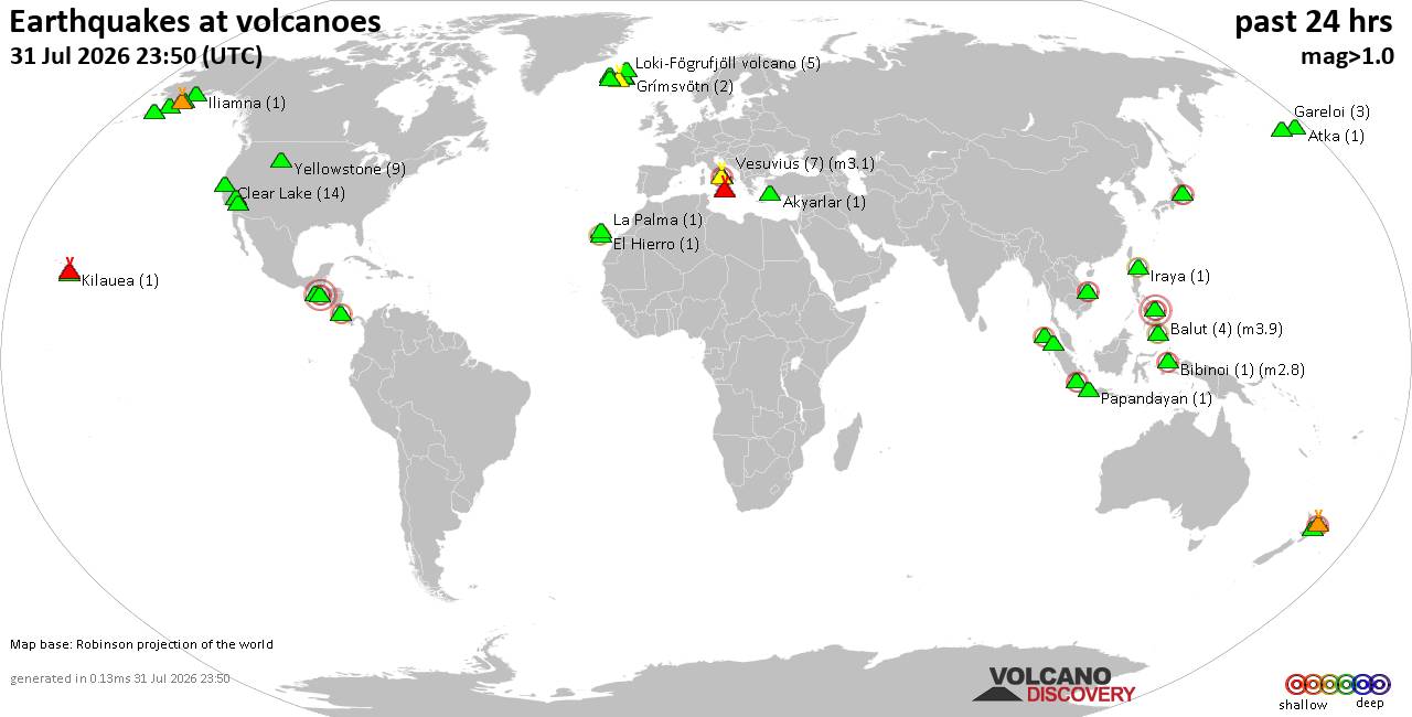
Volcano earthquake report for Friday, 31 Jul 2026
• World Earthquake Report for Friday, 31 July 2026
• Light mag. 3.9 earthquake - Philippine Sea, 57 km east of Sulangan, Philipp...
• Small tremor of magnitude 3.1 just reported 10 km southwest of Naples, Ital...
• Seismic-like event, possible earthquake, reported few minutes ago near Napl...
• Strong mag. 5.0 earthquake - 65 km northeast of Pu'er, Yunnan Sheng, China,...
|

#813811
Thu 28 May 2026 05:48:AM
|
Joined: Feb 2001
Posts: 678,976
Launch Director
|
OP

Launch Director
Joined: Feb 2001
Posts: 678,976 |
SPC Day 1 Fire Weather OutlookSPC Day 1 Fire Weather Outlook 
Day 1 Fire Weather Outlook
NWS Storm Prediction Center Norman OK
1247 AM CDT Thu May 28 2026

Valid 281200Z - 291200Z

...Synopsis...
A high amplitude blocking pattern will continue as an upper low
remains centered over the western CONUS with downstream ridging
across the northern High Plains/Upper Midwest. The main trough axis
will gradually lift into the central Plains while moisture advection
occurs ahead of the upper low, encouraging additional chances for
precipitation across the central CONUS. As upper troughing pushes
down the Eastern Seaboard, a cold front is expected to progress
southward through the Mid-Atlantic, bringing below-normal
temperatures and more opportunities for spotty precipitation.

...Great Basin and Southwest...
An upper-level low anchored over the Sierra Nevada and corresponding
surface low over western ID will bolster dry and breezy southerly
flow across portions of the Great Basin and Southwest this
afternoon. South winds of 15-25 mph, RH values of 15-20% (as low as
10% in valleys), and dry/cured fuels in lower elevations will
support Elevated to locally critical fire weather concerns across
portions of AZ and far western NM into the eastern Great Basin and
CO Western Slope.

...Northeastern Montana...
Surface troughing extending across the northern High Plains into the
Northern Rockies and surface high pressure over the Great Lakes
region will reinforce dry southeasterly flow atop recently receptive
fuels in northeastern MT. Elevated fire weather conditions are
expected as daytime relative humidity declines to around 20% and
southeasterly sustained winds increase to 15-25 mph.

..Elizalde-Garcia.. 05/28/2026

...Please see www.spc.noaa.gov/fire for graphic product...
Read morehttps://www.spc.noaa.gov/products/fire_wx/fwdy1.html
|
|



CMS The Best Conveyancing solicitors conveyancing quotes throughout the UK
For any webhosting enquiries please email webmaster@aus-city.com
|
|
Entire Thread
|
 SPC Day 1 Fire Weather Outlook
|
Webmaster
|
Thu 28 May 2026 05:48:AM
|
|
Forums60
Topics793,765
Posts828,551
Members2,960
| |
Most Online102,106
Jul 10th, 2026
|
|
|
|
|

|