|
|
|
0 members (),
821
guests, and
23
robots. |
|
Key:
Admin,
Global Mod,
Mod
|
|
S |
M |
T |
W |
T |
F |
S |
|
|
|
1
|
2
|
3
|
4
|
5
|
|
6
|
7
|
8
|
9
|
10
|
11
|
12
|
|
13
|
14
|
15
|
16
|
17
|
18
|
19
|
|
20
|
21
|
22
|
23
|
24
|
25
|
26
|
|
27
|
28
|
29
|
30
|
|
|
|
|
There are no members with birthdays on this day. |
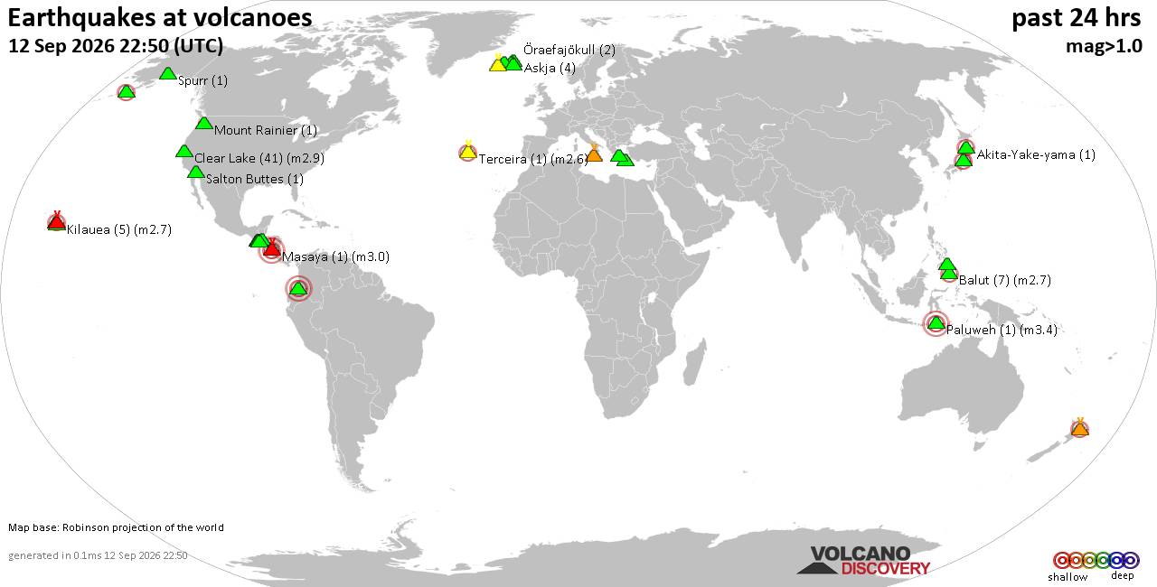
Volcano earthquake report for Saturday, 12 September 2026
• World Earthquake Report for Saturday, 12 September 2026
• Moderate but deep magnitude 5.3 quake hits 74 km southeast of Nakanoshima, ...
• Strong mag. 5.3 earthquake - Ryukyu Islands, Japan, on Sunday, Sep 13, 2026...
• Seismic-like event, possible earthquake, reported minutes ago near Pasto, N...
• Moderate mag. 4.3 earthquake - Philippine Sea, 34 km south of Miyake, Tokyo...
|

#824992
Tue 14 Jul 2026 07:22:AM
|
Joined: Feb 2001
Posts: 678,977
Launch Director
|
|
Launch Director
Joined: Feb 2001
Posts: 678,977 |
SPC Jul 14, 2026 0730 UTC Day 3 Severe Thunderstorm OutlookSPC 0730Z Day 3 Outlook 
Day 3 Convective Outlook
NWS Storm Prediction Center Norman OK
0220 AM CDT Tue Jul 14 2026

Valid 161200Z - 171200Z

...NO SEVERE THUNDERSTORM AREAS FORECAST...

...SUMMARY...
Organized severe thunderstorms are currently not expected on
Thursday.

... Synopsis ...

The closed mid-level low off the coast of the Pacific Northwest will
begin to lift north/northeast on Thursday. As it does, strong
southerly mid-level flow will force height rises across the northern
US Rockies and southwest Canada. These rising heights will allow the
mid-level ridge across much of the US to redevelop northwestward
--from the Midwest toward the northern US Rockies.

At the same time, the second strong mid-level trough this week will
move across New England, bringing with it a reinforcing shot of
seasonably cool and dry air. A surface cold front will push
southward through New England, ending up in the vicinity of the
Mid-Atlantic by Friday morning.

The airmass across much of the US, especially areas east of the
Rockies, will be very warm and moist with afternoon temperatures
generally 5-15 degrees above normal outside of areas with widespread
cloud cover and precipitation. Mid-level flow will be generally weak
across areas of the US with adequate buoyancy for thunderstorm
development. Thus, the severe weather potential on Thursday remains
too low to warrant unconditional severe weather probabilities.

..Marsh.. 07/14/2026
Read morehttps://www.spc.noaa.gov/products/outlook/day3otlk_0730.html
|
|



CMS The Best Conveyancing solicitors conveyancing quotes throughout the UK
For any webhosting enquiries please email webmaster@aus-city.com
|
|
Entire Thread
|
 SPC Jul 14, 2026 0730 UTC Day 3 Severe Thunderstorm Outlook
|
Webmaster
|
Tue 14 Jul 2026 07:22:AM
|
|
Forums60
Topics825,435
Posts860,228
Members2,960
| |
Most Online102,106
Jul 10th, 2026
|
|
|
|
|

|





































