|
0 members (),
1,408
guests, and
24
robots. |
|
Key:
Admin,
Global Mod,
Mod
|
|
S |
M |
T |
W |
T |
F |
S |
|
|
|
|
|
1
|
2
|
3
|
|
4
|
5
|
6
|
7
|
8
|
9
|
10
|
|
11
|
12
|
13
|
14
|
15
|
16
|
17
|
|
18
|
19
|
20
|
21
|
22
|
23
|
24
|
|
25
|
26
|
27
|
28
|
29
|
30
|
31
|
|
There are no members with birthdays on this day. |
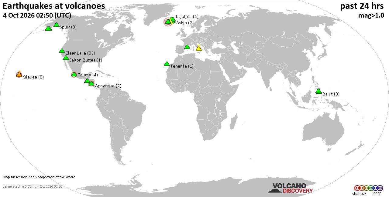
Volcano earthquake report for Sunday, 4 October 2026
• M 0.3 - 9 km SW of Beaumont, CA
• M 0.8 - 8 km NW of The Geysers, CA
• M 4.5 - 57 km S of Buala, Solomon Islands
• M 2.0 - 2 km NE of Almanor, CA
• M 0.9 - 15 km N of California City, CA
• M 1.9 - 22 km SSE of Pāhala, Hawaii
|

#826679
Wed 22 Jul 2026 04:21:AM
|
Joined: Feb 2001
Posts: 678,977
Launch Director
|
|
Launch Director
Joined: Feb 2001
Posts: 678,977 |
SPC MD 1707MD 1707 CONCERNING SEVERE THUNDERSTORM WATCH 509... FOR PARTS OF CENTRAL AND EASTERN VIRGINIA 
Mesoscale Discussion 1707
NWS Storm Prediction Center Norman OK
1101 PM CDT Tue Jul 21 2026

Areas affected...parts of central and eastern Virginia

Concerning...Severe Thunderstorm Watch 509...

Valid 220401Z - 220530Z

The severe weather threat for Severe Thunderstorm Watch 509
continues.

SUMMARY...A localized damaging wind and tornado threat may persist
into the overnight hours. As such, the watch has been extended until
05Z.

DISCUSSION...Satellite and radar data suggest multiple waves of
forcing for ascent moving through the region, which are supporting
more isolated storms now emerging from the Blue Ridge and a larger
complex of storms approaching the Tidewater Region. A warm and very
moist air mass resides within the inflow to these storms with latest
objective analysis indicating MLCAPE as high as 1000-2000 J/kg with
minimal convective inhibition. Moreover, the current KAKQ VWP is
sampling quite strong low-level shear with 0-1 km SRH of 400-450
m2/s2. The low-level shear decreases with westward extent, with the
KFCX indicating a respectable 0-1 km SRH of around 200 m2/s2.

It remains unclear whether the current storms are truly rooted
within the moist, unstable boundary layer, or slightly elevated. On
the condition storms are surface based, the potential exists for a
couple tornadoes along with locally damaging winds. As such, the
watch has been extended until 05z.

..Mead.. 07/22/2026

...Please see www.spc.noaa.gov for graphic product...

ATTN...WFO...AKQ...LWX...RNK...

LAT...LON   37667956 37977947 38137718 38077626 37677594 37437633
            37377816 37527946 37667956

MOST PROBABLE PEAK TORNADO INTENSITY...85-110 MPH
MOST PROBABLE PEAK WIND GUST...55-70 MPH
Read morehttps://www.spc.noaa.gov/products/md/md1707.html
|
|



CMS The Best Conveyancing solicitors conveyancing quotes throughout the UK
For any webhosting enquiries please email webmaster@aus-city.com
|
|
Entire Thread
|
 SPC MD 1707
|
Webmaster
|
Wed 22 Jul 2026 04:21:AM
|
|
Forums60
Topics856,655
Posts891,450
Members2,960
| |
Most Online102,106
Jul 10th, 2026
|
|
|









































