|
0 members (),
1,178
guests, and
73
robots. |
|
Key:
Admin,
Global Mod,
Mod
|
|
S |
M |
T |
W |
T |
F |
S |
|
|
|
|
|
|
|
1
|
|
2
|
3
|
4
|
5
|
6
|
7
|
8
|
|
9
|
10
|
11
|
12
|
13
|
14
|
15
|
|
16
|
17
|
18
|
19
|
20
|
21
|
22
|
|
23
|
24
|
25
|
26
|
27
|
28
|
29
|
|
30
|
31
|
|
|
|
|
|
|
There are no members with birthdays on this day. |
|
|
|
|
|
|
|
|
|
|
|
|
by Webmaster - Wed 05 Aug 2026 03:55:PM
|
by Webmaster - Wed 05 Aug 2026 03:55:PM
|
by Webmaster - Wed 05 Aug 2026 03:55:PM
|
|
|
|
|
|
|
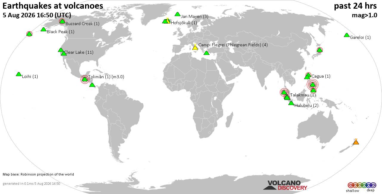
Volcano earthquake report for Wednesday, 5 Aug 2026
• World Earthquake Report for Wednesday, 5 August 2026
• Significant 5.3 quake hits near Tasikmalaya, Kota Tasikmalaya, Jawa Barat, ...
• Moderate mag. 4.1 earthquake - Near North Coast of West Papua on Wednesday,...
• Strong mag. 5.0 earthquake - Java, Indonesia, on Wednesday, Aug 5, 2026, at...
• Moderate mag. 4.0 earthquake - Banda Sea on Wednesday, Aug 5, 2026, at 10:3...
|
|
|
Joined: Feb 2001
Posts: 678,976
Launch Director
|
OP

Launch Director
Joined: Feb 2001
Posts: 678,976 |
SPC Day 1 Fire Weather OutlookSPC Day 1 Fire Weather Outlook 
Day 1 Fire Weather Outlook
NWS Storm Prediction Center Norman OK
1015 AM CDT Wed Aug 05 2026

Valid 051700Z - 061200Z

The forecast remains on track, and please see the previous
discussion for more details.

..Nauslar.. 08/05/2026

.PREV DISCUSSION... /ISSUED 1207 AM CDT Wed Aug 05 2026/

...Synopsis...
Upper-level troughing over the north/central U.S. will gradually
shift eastward into the Great Lakes region, while upper ridging
strengthens and lifts northward across the western CONUS. A dry
airmass will persist in the Interior West amid a very dry fuelscape,
with stronger flow aloft remaining over the northern Colorado
Plateau into southwest Wyoming. Elevated highlights have been
maintained where west-northwesterly sustained winds of 10-20 mph
(gusts of 20-30 mph) are likely amid minimum RH values of 5-15% this
afternoon. Farther west, daytime high temperatures of 100+ degrees F
and 5-15% RH will occur across the California valleys and
surrounding terrain. The spatial extent of sustained 15+ mph winds
for 3 hours or greater will be limited, precluding an introduction
of fire weather highlights; however, periods of onshore flow
exceeding 15 mph are possible across localized interior regions and
terrain-favored areas, supportive of locally elevated fire concerns
where fuels are receptive.

...Please see www.spc.noaa.gov/fire for graphic product...
Read morehttps://www.spc.noaa.gov/products/fire_wx/fwdy1.html
|
|



CMS The Best Conveyancing solicitors conveyancing quotes throughout the UK
For any webhosting enquiries please email webmaster@aus-city.com
|
|
Entire Thread
|

 SPC Day 1 Fire Weather Outlook
|
Webmaster
|
5 hours ago
|
|
Forums60
Topics794,211
Posts828,999
Members2,960
| |
Most Online102,106
Jul 10th, 2026
|
|
|