|
|
|
0 members (),
1,505
guests, and
26
robots. |
|
Key:
Admin,
Global Mod,
Mod
|
|
S |
M |
T |
W |
T |
F |
S |
|
1
|
2
|
3
|
4
|
5
|
6
|
7
|
|
8
|
9
|
10
|
11
|
12
|
13
|
14
|
|
15
|
16
|
17
|
18
|
19
|
20
|
21
|
|
22
|
23
|
24
|
25
|
26
|
27
|
28
|
|
29
|
30
|
|
|
|
|
|
|
There are no members with birthdays on this day. |
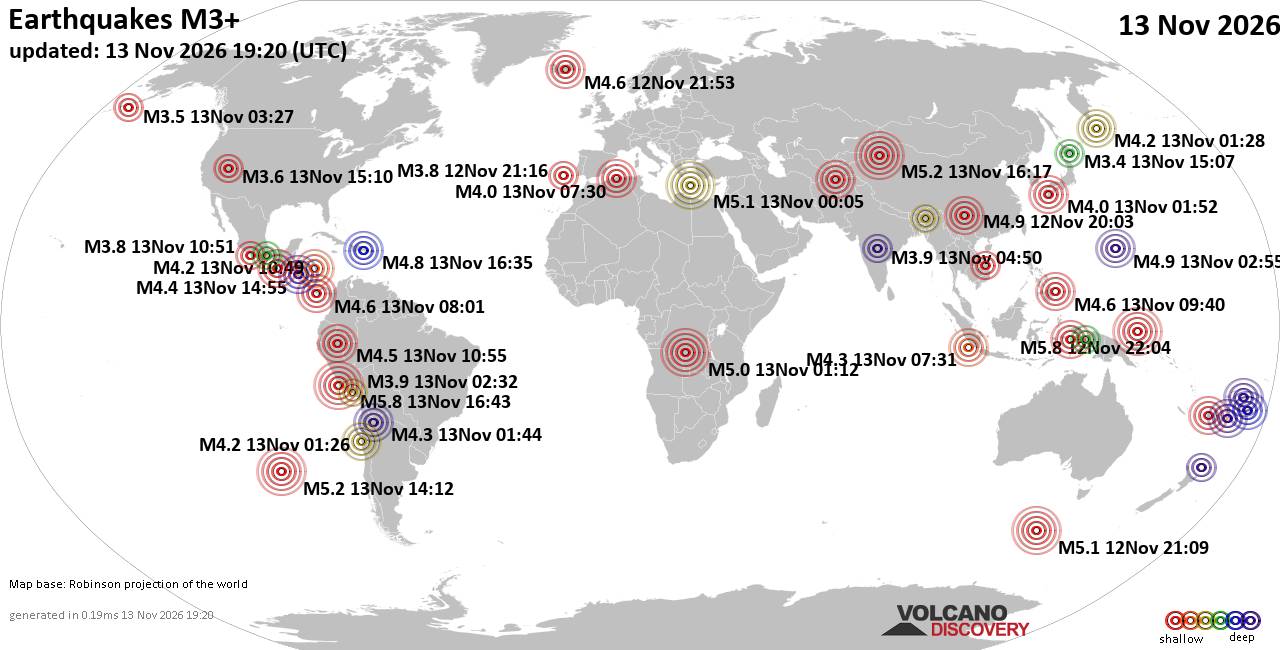
World Earthquake Report for Friday, 13 November 2026
• M 0.5 Other Event - 62 km ENE of Pedro Bay, Alaska
• M 0.5 Other Event - 64 km ENE of Pedro Bay, Alaska
• M 0.4 Other Event - 65 km ENE of Pedro Bay, Alaska
• M 4.5 - Mid-Indian Ridge
• M 0.4 Other Event - 63 km ENE of Pedro Bay, Alaska
• M 1.6 - 89 km NNW of Rachel, Nevada
|

#833398
Sat 15 Aug 2026 05:43:PM
|
Joined: Feb 2001
Posts: 800,656
Launch Director
|
|
Launch Director
Joined: Feb 2001
Posts: 800,656 |
000 ABNT20 KNHC 151743 TWOAT Tropical Weather Outlook NWS National Hurricane Center Miami FL 200 PM EDT Sat Aug 15 2026 For the North Atlantic...Caribbean Sea and the Gulf of America: Central Tropical Atlantic (AL94): A tropical wave located over the central tropical Atlantic about midway between the Cabo Verde Islands and the Lesser Antilles is producing a limited area of disorganized showers and thunderstorms. The system is moving into an area of less favorable environmental conditions and development of this system is not expected. * Formation chance through 48 hours...low...near 0 percent. * Formation chance through 7 days...low...near 0 percent. $$ Forecaster Brown Source: Atlantic Tropical Weather Outlook
|
|



CMS The Best Conveyancing solicitors conveyancing quotes throughout the UK
For any webhosting enquiries please email webmaster@aus-city.com
|
|
Entire Thread
|
 Atlantic Tropical Weather Outlook |
Webmaster
|
Sat 15 Aug 2026 05:43:PM
|
|
Forums60
Topics926,339
Posts961,136
Members2,960
| |
Most Online102,106
Jul 10th, 2026
|
|
|
|
|

|









































