|
0 members (),
1,435
guests, and
23
robots. |
|
Key:
Admin,
Global Mod,
Mod
|
|
S |
M |
T |
W |
T |
F |
S |
|
|
|
|
|
1
|
2
|
3
|
|
4
|
5
|
6
|
7
|
8
|
9
|
10
|
|
11
|
12
|
13
|
14
|
15
|
16
|
17
|
|
18
|
19
|
20
|
21
|
22
|
23
|
24
|
|
25
|
26
|
27
|
28
|
29
|
30
|
31
|
|
There are no members with birthdays on this day. |
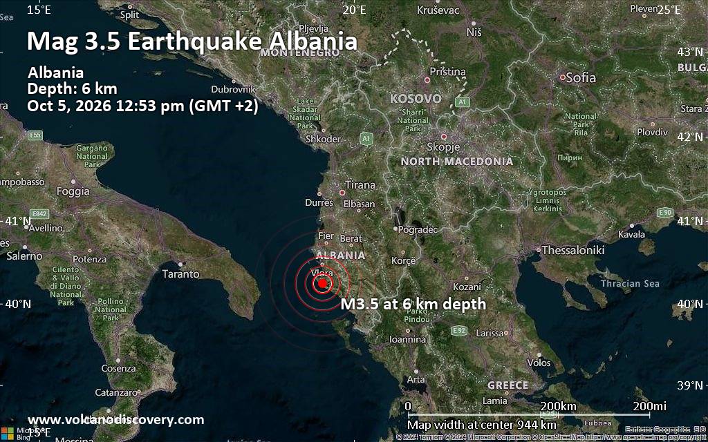
Magnitude 3.5 earthquake strikes near Vlore, Bashkia Vlorë, Qarku i Vlores, Albania
• M 2.1 - 2 km S of Forest Park, Georgia
• M 5.0 - Mariana Islands region
• M 1.2 - 10 km WSW of Shamrock, Oklahoma
• M 3.5 - 137 km NNE of Vieques, Puerto Rico
• M 2.1 - 69 km NE of Chignik, Alaska
• M 5.0 - 187 km ENE of Saipan, Northern Mariana Islands
|

#833469
Sun 16 Aug 2026 07:39:PM
|
Joined: Feb 2001
Posts: 678,977
Launch Director
|
|
Launch Director
Joined: Feb 2001
Posts: 678,977 |
SPC Day 2 Fire Weather OutlookSPC Day 2 Fire Weather Outlook 
Day 2 Fire Weather Outlook
NWS Storm Prediction Center Norman OK
0238 PM CDT Sun Aug 16 2026

Valid 171200Z - 181200Z

On Day 2/Monday, forecast 80-90th percentile ERCs will expand across
northern California, the Pacific Northwest, portions of Idaho into
far northwestern Montana. On a broader scale, 72-hr cumulative
observed rainfall has been minimal (up to 0.2") in southern Idaho
and the Panhandle, with only the central Idaho higher-terrain
receiving 0.5-0.9". A receptive fuelscape remains, proven by several
new starts across southwestern ID and eastern OR. Depending on the
timing and location of the approaching shortwave trough, an isolated
thunderstorm over dry fuels is possible, albeit low (5-10% chance).
Dry thunderstorm highlights were not introduced in this update,
though may be needed in the next outlook cycle if high resolution
guidance indicates increased probabilities of isolated dry
thunderstorms over dry fuels. The rest of the forecast remains on
track; please see the previous discussion for more information.

..Elizalde-Garcia.. 08/16/2026

.PREV DISCUSSION... /ISSUED 0152 AM CDT Sun Aug 16 2026/

...Synopsis...
The upper ridge over the central and western US is forecast to
continue weakening as the upper trough deepens over the northern US
and another moves onshore over the West Coast. The increase in
westerly flow aloft will bolster surface winds over parts of
northern CA and the Great Basin with dry and breezy conditions
possible. Additionally, scattered thunderstorms are expected over
much of the Rockies, though likely with wetting rainfall.

...Northern Great Basin and northeast CA...
As the shortwave moves onshore over the West, dry and breezy
conditions are expected over parts of the northern Great Basin into
northeastern CA on Day 2/Monday. Largely devoid of recent rainfall
over the last several days, fuels remain quite dry. Warm afternoon
temperatures and dry westerly flow of 15-20 mph are expected ahead
of the upper trough. Afternoon RH minimums of 12-20% are also
likely. This will support several hours of elevated fire-weather
conditions from northeastern CA into parts of NV and southern OR.

...Northern Rockies...
Ascent from the approaching upper trough will support another round
of showers and thunderstorms over parts of ID, MT and northern WY.
Despite more limited monsoon moisture (PWATS 0.6-0.9 inches) several
days of wetting rainfall have tempered fuels such that dry storms
and lightning ignitions are expected to be sporadic.

...Please see www.spc.noaa.gov/fire for graphic product...
Read morehttps://www.spc.noaa.gov/products/fire_wx/fwdy2.html
|
|



CMS The Best Conveyancing solicitors conveyancing quotes throughout the UK
For any webhosting enquiries please email webmaster@aus-city.com
|
|
Entire Thread
|
 SPC Day 2 Fire Weather Outlook
|
Webmaster
|
Sun 16 Aug 2026 07:39:PM
|
|
Forums60
Topics857,689
Posts892,484
Members2,960
| |
Most Online102,106
Jul 10th, 2026
|
|
|









































