|
|
|
1 members (Alisa),
2,530
guests, and
26
robots. |
|
Key:
Admin,
Global Mod,
Mod
|
|
S |
M |
T |
W |
T |
F |
S |
|
|
|
1
|
2
|
3
|
4
|
5
|
|
6
|
7
|
8
|
9
|
10
|
11
|
12
|
|
13
|
14
|
15
|
16
|
17
|
18
|
19
|
|
20
|
21
|
22
|
23
|
24
|
25
|
26
|
|
27
|
28
|
29
|
30
|
|
|
|
|
There are no members with birthdays on this day. |
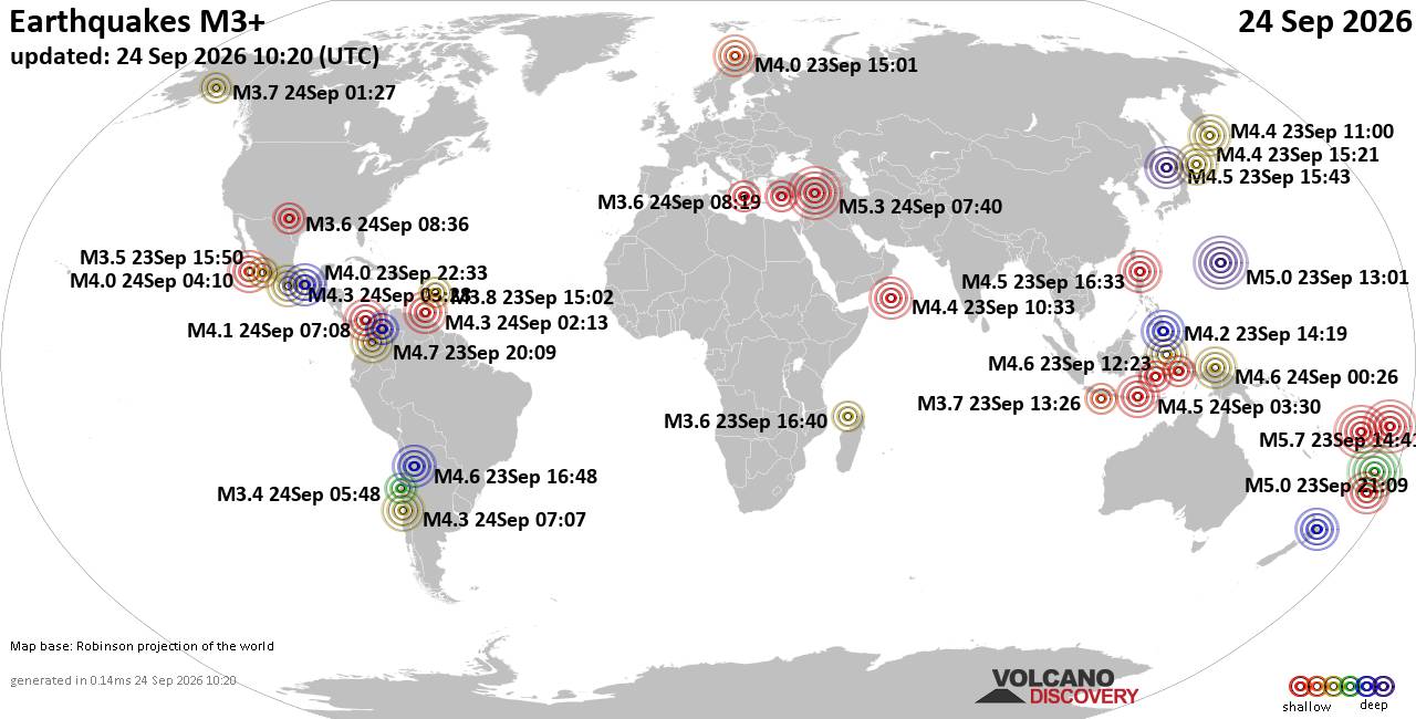
World Earthquake Report for Thursday, 24 September 2026
• Moderate mag. 4.3 earthquake - Madagascar: Mozambique Channel on Thursday, ...
• Small magnitude 3.9 earthquake hits near Hastings, Hastings District, Hawke...
• Volcano earthquake report for Thursday, 24 September 2026
• Light mag. 3.9 earthquake - South Pacific Ocean, 10.2 km south of Hastings,...
• Moderate magnitude 4.1 quake hits 31 miles southeast of Midland, Texas, Uni...
|

#837186
Fri 21 Aug 2026 07:33:AM
|
Joined: Feb 2001
Posts: 678,977
Launch Director
|
|
Launch Director
Joined: Feb 2001
Posts: 678,977 |
SPC Aug 21, 2026 0730 UTC Day 3 Severe Thunderstorm OutlookSPC 0730Z Day 3 Outlook 
Day 3 Convective Outlook
NWS Storm Prediction Center Norman OK
0231 AM CDT Fri Aug 21 2026

Valid 231200Z - 241200Z

...THERE IS A MARGINAL RISK OF SEVERE THUNDERSTORMS ACROSS SOUTHWEST
TO CENTRAL MONTANA AND ACROSS PARTS OF THE NORTHEAST...

...SUMMARY...
Strong to severe thunderstorms capable of large hail and wind gusts
are possible in portions of the Northeast and across parts of
southwest and central Montana.

...Southwest into central Montana...
A mid-level shortwave trough will move across the Pacific Northwest
and into eastern British Columbia. While the parent trough is
forecast to deamplify through the period, moderate mid-level flow is
forecast to remain across much of Montana. Weak to potentially
moderate instability is forecast to develop across southwest into
central Montana. The moderate mid-level flow should provide ample
shear for storm organization including some supercell potential.
Strong heating will support steep low-level lapse rates and some
severe wind gust threat with the strongest storms.

...Portions of the Northeast...
A mid-level trough will become negatively tilted as it pivots from
the Great Lakes to the Northeast on Sunday. A broad 1006-1010mb
surface low is forecast somewhere in the vicinity of western New
York, southeast Ontario and southern Quebec. Storms are forecast by
mid-day along a cold front that should extend from New York into
central Pennsylvania on Sunday morning and move eastward through the
day. The environment ahead of this front is forecast to have
moderate to strong shear and relatively weak instability. Forecast
soundings show a lower storm top environment due to warmer
temperatures aloft. However, despite the weak instability, the
expectation for at least some supercell threat, combined with decent
instability within the hail growth zone and strong shear may support
some large hail and damaging wind gusts Sunday afternoon/evening.

..Bentley.. 08/21/2026
Read morehttps://www.spc.noaa.gov/products/outlook/day3otlk_0730.html
|
|



CMS The Best Conveyancing solicitors conveyancing quotes throughout the UK
For any webhosting enquiries please email webmaster@aus-city.com
|
|
Entire Thread
|
 SPC Aug 21, 2026 0730 UTC Day 3 Severe Thunderstorm Outlook
|
Webmaster
|
Fri 21 Aug 2026 07:33:AM
|
|
Forums60
Topics840,505
Posts875,300
Members2,960
| |
Most Online102,106
Jul 10th, 2026
|
|
|
|
|

|





































