|
0 members (),
2,460
guests, and
26
robots. |
|
Key:
Admin,
Global Mod,
Mod
|
|
S |
M |
T |
W |
T |
F |
S |
|
|
|
1
|
2
|
3
|
4
|
5
|
|
6
|
7
|
8
|
9
|
10
|
11
|
12
|
|
13
|
14
|
15
|
16
|
17
|
18
|
19
|
|
20
|
21
|
22
|
23
|
24
|
25
|
26
|
|
27
|
28
|
29
|
30
|
|
|
|
|
There are no members with birthdays on this day. |
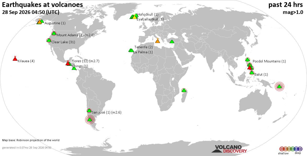
Volcano earthquake report for Monday, 28 September 2026
• M 5.4 - north of Svalbard
• M 2.4 - 70 km SSW of Nikolski, Alaska
• M 4.1 - 105 km SSW of Nikolski, Alaska
• M 1.3 - 11 km SSE of Portola Valley, CA
• M 1.5 - 28 km WNW of Enoch, Utah
|
|
|
Joined: Feb 2001
Posts: 678,977
Launch Director
|
|
Launch Director
Joined: Feb 2001
Posts: 678,977 |
Issued at 600 AM CST Mon Sep 28 2026 000
WTPZ33 KNHC 281125
TCPEP3
BULLETIN
Tropical Storm Rachel Intermediate Advisory Number 5A
NWS National Hurricane Center Miami FL EP182026
600 AM CST Mon Sep 28 2026
...RACHEL EXPECTED TO BECOME A HURRICANE LATER THIS WEEK...
SUMMARY OF 600 AM CST...1200 UTC...INFORMATION
----------------------------------------------
LOCATION...13.4N 100.9W
ABOUT 250 MI...405 KM SSW OF ACAPULCO MEXICO
ABOUT 450 MI...720 KM SSE OF MANZANILLO MEXICO
MAXIMUM SUSTAINED WINDS...45 MPH...75 KM/H
PRESENT MOVEMENT...WNW OR 290 DEGREES AT 8 MPH...13 KM/H
MINIMUM CENTRAL PRESSURE...1001 MB...29.56 INCHES
WATCHES AND WARNINGS
--------------------
CHANGES WITH THIS ADVISORY:
None.
SUMMARY OF WATCHES AND WARNINGS IN EFFECT:
A Tropical Storm Watch is in effect for...
* Punta San Telmo to Playa Perula
A Tropical Storm Watch means that tropical storm conditions are
possible within the watch area, generally within 48 hours.
For storm information specific to your area, please monitor
products issued by your national meteorological service.
DISCUSSION AND OUTLOOK
----------------------
At 600 AM CST (1200 UTC), the center of Tropical Storm Rachel was
located near latitude 13.4 North, longitude 100.9 West. Rachel is
moving toward the west-northwest near 8 mph (13 km/h). An increase
in forward speed is expected by mid-week while the cyclone
continues on a west-northwestward heading. Although the center of
Rachel is forecast to remain well offshore of the coast of southern
Mexico, tropical storm conditions are possible along the coast of
Mexico within the tropical storm watch area by Tuesday.
Maximum sustained winds are near 45 mph (75 km/h) with higher
gusts. Gradual strengthening is expected during the next few days,
and Rachel is forecast to become a hurricane by mid-week.
Tropical-storm-force winds extend outward up to 140 miles (220 km)
from the center.
The estimated minimum central pressure is 1001 mb (29.56 inches).
HAZARDS AFFECTING LAND
----------------------
WIND: Tropical storm conditions are possible within the watch
area by Tuesday.
SURF: Swells generated by Rachel will begin affecting portions of
southern coast of Mexico during the next couple of days. These
swells are likely to cause life-threatening surf and rip current
conditions. Please consult products from your local weather office.
NEXT ADVISORY
-------------
Next complete advisory at 900 AM CST.
$$
Forecaster Roberts Source: Tropical Storm Rachel Public Advisory Number 5a
|
|



CMS The Best Conveyancing solicitors conveyancing quotes throughout the UK
For any webhosting enquiries please email webmaster@aus-city.com
|
|
Entire Thread
|

 Tropical Storm Rachel Public Advisory Number 5a
|
Webmaster
|
3 hours ago
|
|
Forums60
Topics844,598
Posts879,393
Members2,960
| |
Most Online102,106
Jul 10th, 2026
|
|
|





































