|
1 members (Alisa),
1,499
guests, and
27
robots. |
|
Key:
Admin,
Global Mod,
Mod
|
|
S |
M |
T |
W |
T |
F |
S |
|
|
|
|
|
1
|
2
|
3
|
|
4
|
5
|
6
|
7
|
8
|
9
|
10
|
|
11
|
12
|
13
|
14
|
15
|
16
|
17
|
|
18
|
19
|
20
|
21
|
22
|
23
|
24
|
|
25
|
26
|
27
|
28
|
29
|
30
|
31
|
|
There are no members with birthdays on this day. |
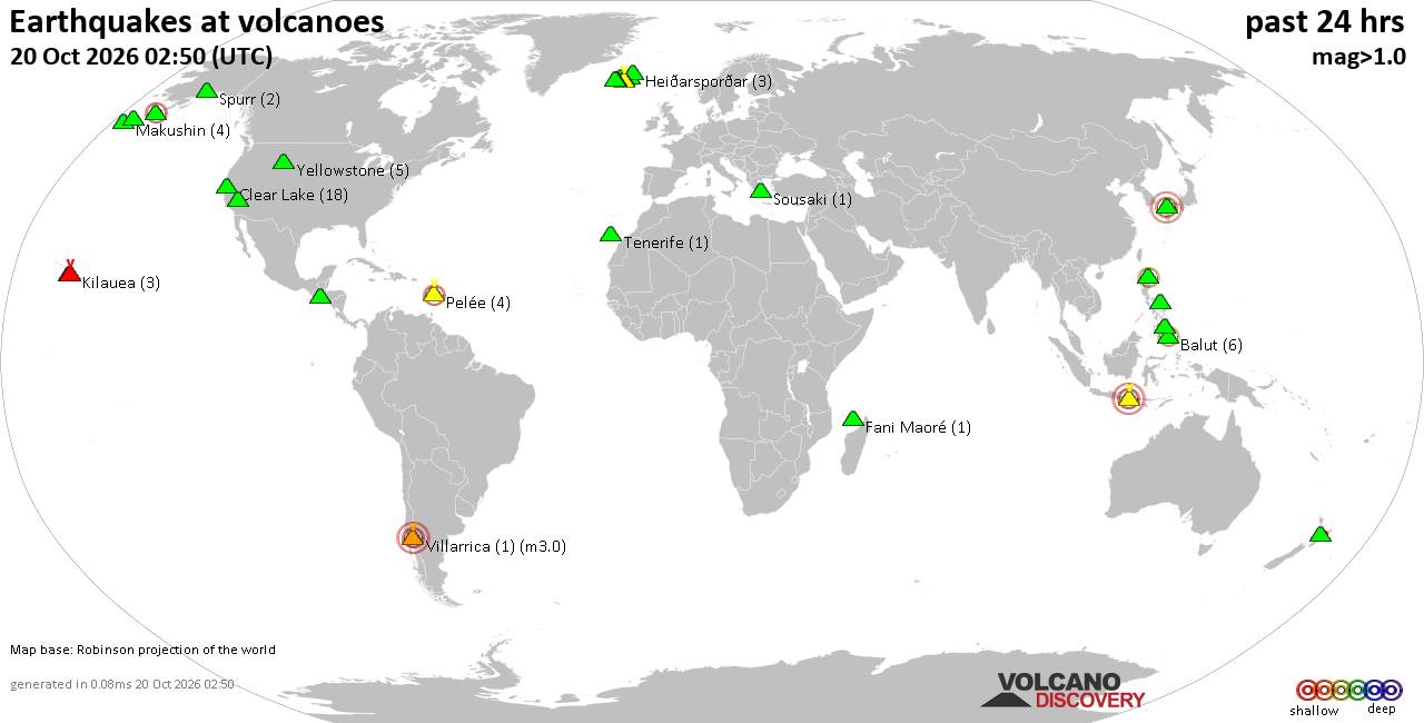
Volcano earthquake report for Tuesday, 20 October 2026
• M 0.7 - 3 km NW of The Geysers, CA
• M 0.7 - 62 km ENE of Pedro Bay, Alaska
• M 4.6 - 67 km N of Namuac, Philippines
• M 1.7 - 79 km W of Karluk, Alaska
• M 0.4 - 10 km WNW of Cobb, CA
|

#881409
Mon 28 Sep 2026 02:53:PM
|
Joined: Feb 2001
Posts: 678,977
Launch Director
|
|
Launch Director
Joined: Feb 2001
Posts: 678,977 |
Issued at 500 AM HST Mon Sep 28 2026 000
WTPA42 PHFO 281453
TCDCP2
Hurricane Nolo Discussion Number 32
NWS Central Pacific Hurricane Center Honolulu HI EP152026
Issued by NWS National Hurricane Center Miami FL
500 AM HST Mon Sep 28 2026
Increasing westerly wind shear is beginning to affect the structure
of Nolo this morning. Recent infrared satellite imagery indicate a
slight increase in asymmetric convection, with a decrease in
convection to the north and east of the well-defined and very warm
eye, and a larger area of convection to the south and west. Recent
subjective Dvorak intensity estimates were 6.5/127 kt, while
objective intensity estimates range from 121-133 kt. However, Nolo
continues to have an annular structure, so the intensity has likely
changed little since the previous advisory. Therefore, the initial
intensity is maintained at 135 kt for this advisory.
Nolo is moving toward the west-northwest, or 290/11 kt, along the
southwest periphery of a mid-level ridge centered well north of the
Hawaiian Islands. A turn toward the northwest then north is expected
through the next 36-48 h as an intensifying upper-level low
approaches the hurricane from the northwest. The track forecast
becomes more complicated around midweek, as the progression and
strength of the aforementioned upper-low will influence the motion
of Nolo. A stronger low will likely be less progressive and pull
Nolo farther north, while a weaker and more transient low will
result in a faster turn toward the west. The latest NHC forecast
follows the latter scenario and calls for Nolo to turn back toward
the west-northwest then west around midweek, with this general
motion continuing into this weekend. This is consistent with the
previous forecast advisory, and is similar to the HCCA and Google
DeepMind solutions.
The major hurricane has likely peaked in strength while over very
warm waters and beneath favorable upper-level winds. However,
increasing wind shear due to the aforementioned upper-level low
should support gradual weakening by tonight, followed by more rapid
weakening beyond 24 h through the middle of the week. In 4-5 days,
the models suggest a more favorable upper-level flow pattern, which
could allow for some re-strengthening. The latest NHC forecast
remains near the upper-end of the model intensity guidance, though
has been lowered slightly at all forecast times.
FORECAST POSITIONS AND MAX WINDS
INIT 28/1500Z 17.1N 162.3W 135 KT 155 MPH
12H 29/0000Z 18.3N 163.3W 135 KT 155 MPH
24H 29/1200Z 20.0N 163.9W 120 KT 140 MPH
36H 30/0000Z 21.7N 164.0W 100 KT 115 MPH
48H 30/1200Z 22.6N 164.0W 75 KT 85 MPH
60H 01/0000Z 22.8N 164.4W 65 KT 75 MPH
72H 01/1200Z 23.1N 165.3W 65 KT 75 MPH
96H 02/1200Z 23.7N 167.2W 65 KT 75 MPH
120H 03/1200Z 24.1N 170.0W 70 KT 80 MPH
$$
Forecaster Adams Source: Hurricane Nolo Forecast Discussion Number 32
|
|



CMS The Best Conveyancing solicitors conveyancing quotes throughout the UK
For any webhosting enquiries please email webmaster@aus-city.com
|
|
Entire Thread
|
 Hurricane Nolo Forecast Discussion Number 32
|
Webmaster
|
Mon 28 Sep 2026 02:53:PM
|
|
Forums60
Topics884,251
Posts919,048
Members2,960
| |
Most Online102,106
Jul 10th, 2026
|
|
|









































