|
0 members (),
1,975
guests, and
29
robots. |
|
Key:
Admin,
Global Mod,
Mod
|
|
S |
M |
T |
W |
T |
F |
S |
|
|
|
1
|
2
|
3
|
4
|
5
|
|
6
|
7
|
8
|
9
|
10
|
11
|
12
|
|
13
|
14
|
15
|
16
|
17
|
18
|
19
|
|
20
|
21
|
22
|
23
|
24
|
25
|
26
|
|
27
|
28
|
29
|
30
|
|
|
|
|
There are no members with birthdays on this day. |
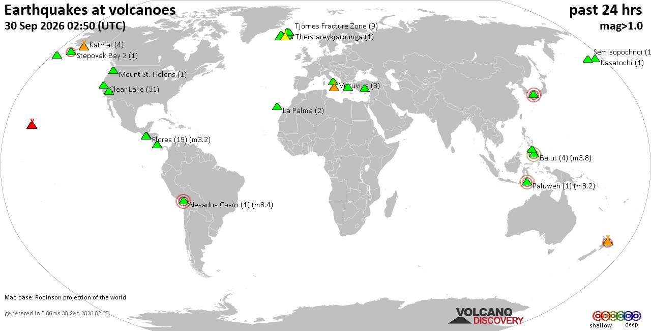
Volcano earthquake report for Wednesday, 30 September 2026
• Strong mag. 5.7 earthquake - 69 km Al Suroeste De Rosario, Costa Rica, on 2...
• M 0.9 - 4 km W of Devore, CA
• M 4.6 - 131 km SE of Itoman, Japan
• M -1.1 - 66 km ENE of Pedro Bay, Alaska
• M 1.6 - 8 km ESE of Cloverdale, CA
• M 3.0 - 8 km ESE of Cloverdale, CA
|
|
|
Joined: Feb 2001
Posts: 678,977
Launch Director
|
|
Launch Director
Joined: Feb 2001
Posts: 678,977 |
SPC Sep 30, 2026 2000 UTC Day 1 Convective OutlookSPC 2000Z Day 1 Outlook 
Day 1 Convective Outlook
NWS Storm Prediction Center Norman OK
0258 PM CDT Wed Sep 30 2026

Valid 302000Z - 011200Z

...THERE IS A SLIGHT RISK OF SEVERE THUNDERSTORMS ACROSS PORTIONS OF
THE SOUTHERN AND CENTRAL PLAINS...

...SUMMARY...
The potential for a few tornadoes and localized wind damage will
exist across Kansas and possibly far southeast Nebraska this
afternoon and evening. Thunderstorms capable of severe wind
gusts/some hail and a brief tornado are also expected across the
southern Plains this afternoon into tonight, including portions of
west Texas into southwest Oklahoma.

...20z Update...
The Level 1/Marginal Risk was expanded slightly eastward across
portions of southeastern Kansas, eastern Oklahoma, and northeastern
Texas based on latest observation and HRRR/RRFS trends. Similarly,
the 5% hail probability area (and the corresponding Level 1/Marginal
Risk area) was expanded westward based on observed thunderstorm
development across portions of northeastern New Mexico. Elsewhere,
no changes were made to the existing severe probabilities as the
forecast remains generally on track. See MCDs #2337 and #2338 as
well as the discussion below for additional details.

..Chalmers/Thornton.. 09/30/2026

.PREV DISCUSSION... /ISSUED 1126 AM CDT Wed Sep 30 2026/

...Synopsis...
Currently satellite imagery shows a deep cyclone centered over the
central NM/AZ border vicinity. Recent surface analysis places the
surface low associated with this system over the northwest TX
Panhandle/western OK Panhandle vicinity. A broad warm sector
precedes this low from the southern Plains into the Upper Midwest.
Ample low-level moisture exists within this warm sector, with low
70s dewpoints currently reaching far south-central OK and upper 60s
dewpoints reaching as far north as the Omaha, Nebraska vicinity.
Widespread cloud cover currently persists across much of the warm
sector, with more scattered clouds in place across central and east
TX.

General expectation is for the cyclone to gradually shift eastward
across NM today as moderate/strong mid-level flow through the
eastern periphery of this cyclone expands from the southern High
Plains into the central Plains. At the same time, the attendant
surface low is forecast to shift gradually northeast into central
KS. Moderate low-level moisture advection will precede the low, with
70s dewpoints likely covering much of central and eastern KS by this
evening. Scattered to numerous thunderstorms are expected ahead of
the surface low from the southern Plains through the central Plains
into the Upper Midwest. Strong to severe thunderstorms appear most
likely in two areas within this broader region: across central and
eastern KS this afternoon and evening and farther south from
southwest OK/northwest TX through the TX Hill Country.

...Central/Eastern KS...
Cloud cover will likely persist throughout the day, with most of the
airmass destabilization driven by the low-level moisture advection
mentioned in the synopsis. Low 70s dewpoints are expected to cover
much of central and eastern KS by the late afternoon/early evening.
Even with limited heating and the tropical character to the airmass
keeping lapse rates poor, the ample low-level moisture is still
expected to support airmass destabilization and moderate buoyancy
this afternoon and evening. This destabilization looks to occur just
ahead of the stronger forcing for ascent attendant to the dry slot
progressing through the eastern periphery of the AZ/NM cyclone.

Additionally, a rather strong low-level jet (40 to 45 kt diurnally)
is forecast to slowly shift northeastward across parts of
central/eastern Kansas into western Missouri and southeast
Nebraska/southwest Iowa by evening. This will help to maintain
strong wind profiles across much of the region. RAP guidance
suggests 0-1 km SRH from 150 to 200 m2/s2 across central and eastern
KS.

Combination of these factors will result in a rather unique
mesoscale setup for tornadoes from central and eastern KS into far
southeast NE. Tornadoes within these environments are typically
brief, but there should be enough updraft depth in this case to
support the potential for a few longer-duration storms. This
potential appears to peak around 21Z to 00Z. After 00Z, the stronger
forcing for ascent should begin to extend north of the surface-based
buoyancy.

...Southern Plains...
Low 70s dewpoints will likely extend throughout the warm sector
covering much of the southern Plains this afternoon. This low-level
moisture will result in airmass destabilization, despite limited
heating and poor lapse rates. Primary thunderstorm development is
anticipated this evening along the modest surface troughing that
will extend south of the surface low moving into KS. An initially
supercellular mode appears possible from southwest Oklahoma into
northwest Texas and the Edwards Plateau, where heating of a very
moist airmass will result in MLCAPE near/above 1500 J/kg amid
moderate deep-layer vertical shear. Generally front-parallel flow
and increasing storm coverage will likely lead to more of a linear
mode with time. Strong to severe gusts appear to be the most likely
hazard, though isolated hail also appears possible across southwest
TX, where stronger destabilization is expected. Some increase in
effective SRH is expected during the evening, which could support a
localized tornado threat within the very moist environment. An
isolated severe threat could persist into parts of central
Texas/Oklahoma overnight, though diminishing buoyancy with time and
eastward extent should result in an eventual weakening trend.

A somewhat separate and more isolated severe potential is
anticipated throughout the day from central TX into central OK amid
increasing coverage of warm-air advection showers and thunderstorms
within the warm sector. Most of these storms will likely be brief
and/or weak, but the persistent low-level jet could result in a few
stronger storms capable of a damaging gusts and/or a brief tornado.

...South-Central High Plains...
Strong forcing for ascent attendant to the NM cyclone will interact
with cooling mid-level temperatures and modest low-level moisture
persisting on the back side of the surface low to support moderate
buoyancy amid moderate deep-layer vertical shear. A few strong to
locally severe lower-topped storms capable of large hail could
occur.
Read morehttps://www.spc.noaa.gov/products/outlook/day1otlk_2000.html
|
|



CMS The Best Conveyancing solicitors conveyancing quotes throughout the UK
For any webhosting enquiries please email webmaster@aus-city.com
|
|
Entire Thread
|

 SPC Sep 30, 2026 2000 UTC Day 1 Convective Outlook
|
Webmaster
|
3 hours ago
|
|
Forums60
Topics850,006
Posts884,801
Members2,960
| |
Most Online102,106
Jul 10th, 2026
|
|
|









































