|
0 members (),
2,073
guests, and
27
robots. |
|
Key:
Admin,
Global Mod,
Mod
|
|
S |
M |
T |
W |
T |
F |
S |
|
|
|
|
|
1
|
2
|
3
|
|
4
|
5
|
6
|
7
|
8
|
9
|
10
|
|
11
|
12
|
13
|
14
|
15
|
16
|
17
|
|
18
|
19
|
20
|
21
|
22
|
23
|
24
|
|
25
|
26
|
27
|
28
|
29
|
30
|
31
|
|
There are no members with birthdays on this day. |
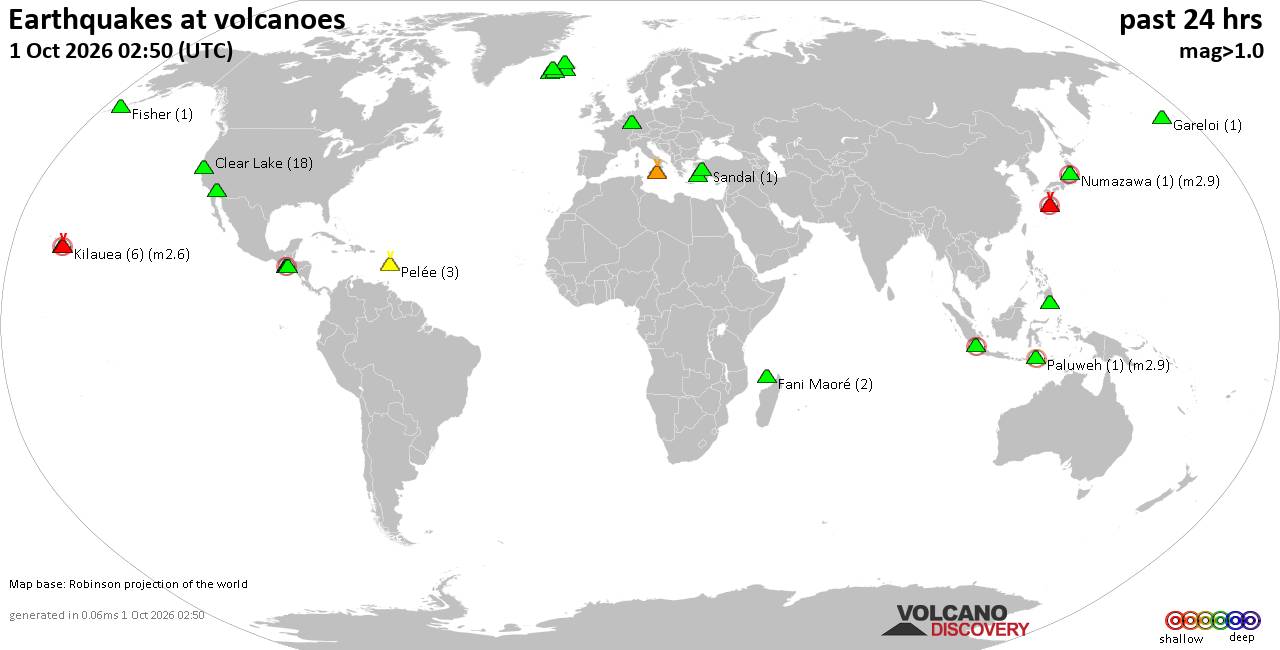
Volcano earthquake report for Thursday, 1 October 2026
• M 4.2 - 6 km WNW of Wauna, Washington
• Moderate mag. 4.0 earthquake - Estado de Oaxaca, Mexico, on Thursday, Oct 1...
• M 5.0 - 38 km WSW of Palimbang, Philippines
• M 5.0 - 38 km WSW of Palimbang, Philippines
• M 5.0 - 38 km WSW of Palimbang, Philippines
|
|
|
Joined: Feb 2001
Posts: 678,977
Launch Director
|
|
Launch Director
Joined: Feb 2001
Posts: 678,977 |
Issued at 500 PM HST Wed Sep 30 2026 000
WTPA42 PHFO 010245
TCDCP2
Tropical Storm Nolo Discussion Number 42
NWS Central Pacific Hurricane Center Honolulu HI EP152026
Issued by NWS National Hurricane Center Miami FL
500 PM HST Wed Sep 30 2026
Nolo's structure has degraded quite a bit over the last couple of
hours. The storm has lost its defined center, and convection across
the southern flank has weakened substantially based on satellite
imagery. Subjective Dvorak intensity estimates from HFO and JTWC
both assigned Nolo a Final T-Number of 2.5, and UW-CIMSS objective
intensity estimates range from 27 to 42 kt. Based on these data,
Nolo's initial intensity was lowered slightly to 40 kt.
The storm's forward motion has slowed to a crawl, and initial motion
was set at 270/1 kt, although confidence is low on Nolo's exact
motion at 0300 UTC since its center position has hardly moved over
the last two hours. Nolo's lack of motion is being driven by strong
high pressure to its northwest and an upper-level trough to its
northeast. Global models generally depict Nolo increasing in forward
speed as it moves westward over the course of the next several days,
as an upper-level low over the west Pacific weakens the
aforementioned high. So long as the current synoptic pattern is in
place, however, Nolo may appear nearly stationary at times. Little
was changed in the latest track forecast, other than to nudge it
toward the latest HCCA guidance.
Nolo continues to be in a hostile environment defined by strong
vertical wind shear, relatively dry mid-level air, and marginal
SSTs. Guidance generally depicts shear backing off as the storm
moves westward over warming SSTs, however, Nolo may struggle to
re-intensify in the meantime. The latest NHC intensity forecast
keeps Nolo's strength relatively steady overnight, before
environmental conditions are expected to allow for a gradual
increase in intensity starting late Thursday onward. This forecast
lies roughly near the middle of the guidance envelope.
FORECAST POSITIONS AND MAX WINDS
INIT 01/0300Z 21.5N 164.8W 40 KT 45 MPH
12H 01/1200Z 21.6N 165.3W 40 KT 45 MPH
24H 02/0000Z 21.9N 165.9W 45 KT 50 MPH
36H 02/1200Z 22.3N 166.6W 55 KT 65 MPH
48H 03/0000Z 22.6N 167.8W 60 KT 70 MPH
60H 03/1200Z 22.7N 170.0W 70 KT 80 MPH
72H 04/0000Z 22.8N 173.0W 80 KT 90 MPH
96H 05/0000Z 24.2N 179.8E 95 KT 110 MPH
120H 06/0000Z 25.5N 173.1E 90 KT 105 MPH
$$
Forecaster Evans/Gibbs Source: Tropical Storm Nolo Forecast Discussion Number 42
|
|



CMS The Best Conveyancing solicitors conveyancing quotes throughout the UK
For any webhosting enquiries please email webmaster@aus-city.com
|
|
Entire Thread
|

 Tropical Storm Nolo Forecast Discussion Number 42
|
Webmaster
|
3 hours ago
|
|
Forums60
Topics850,679
Posts885,474
Members2,960
| |
Most Online102,106
Jul 10th, 2026
|
|
|









































