|
0 members (),
1,316
guests, and
26
robots. |
|
Key:
Admin,
Global Mod,
Mod
|
|
S |
M |
T |
W |
T |
F |
S |
|
|
|
|
|
1
|
2
|
3
|
|
4
|
5
|
6
|
7
|
8
|
9
|
10
|
|
11
|
12
|
13
|
14
|
15
|
16
|
17
|
|
18
|
19
|
20
|
21
|
22
|
23
|
24
|
|
25
|
26
|
27
|
28
|
29
|
30
|
31
|
|
There are no members with birthdays on this day. |
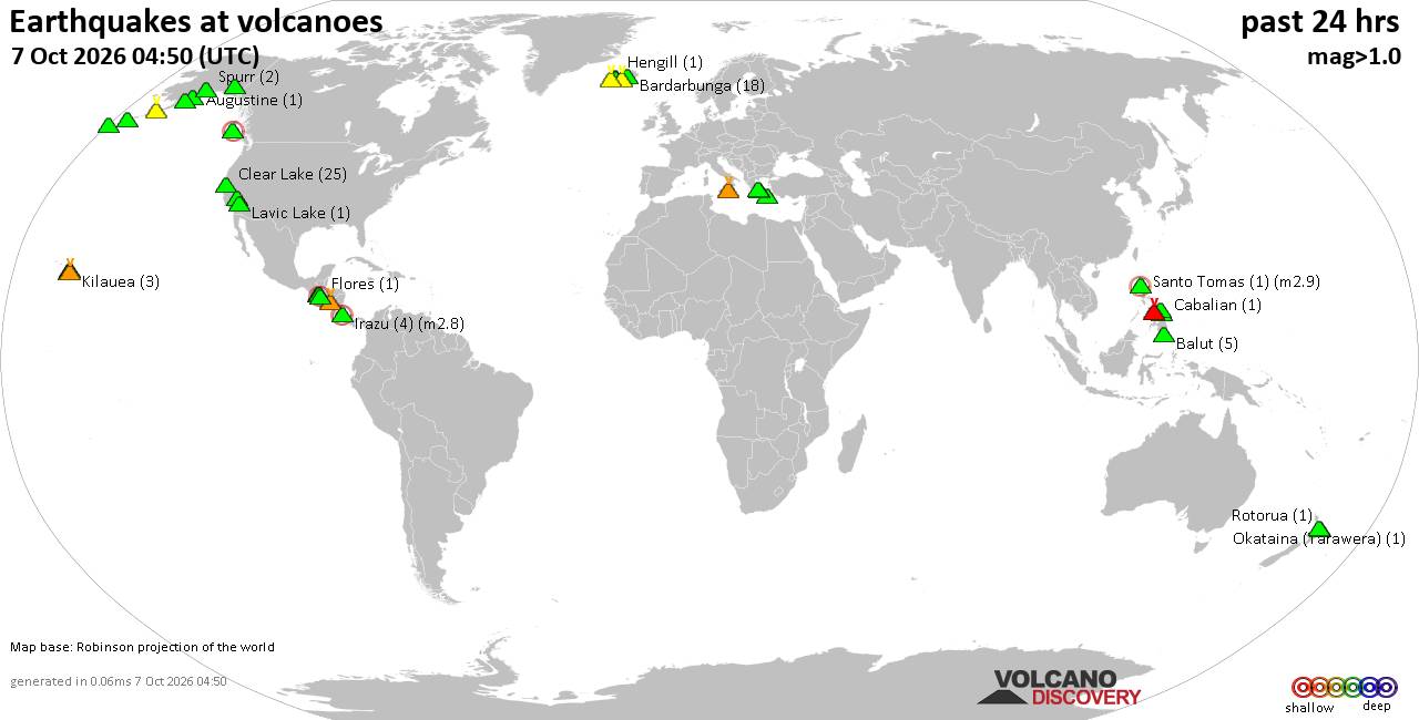
Volcano earthquake report for Wednesday, 7 October 2026
• M 5.1 - 20 km SW of Hilvan, Turkey
• M 0.8 - 10 km ENE of Coso Junction, CA
• M 4.1 - 145 km S of False Pass, Alaska
• M 4.6 - 8 km W of Port-Olry, Vanuatu
• M 0.9 - 14 km SSE of Livermore, CA
|
|
|
Joined: Feb 2001
Posts: 678,977
Launch Director
|
|
Launch Director
Joined: Feb 2001
Posts: 678,977 |
Eastern Pacific Tropical Weather Outlook


000
ABPZ20 KNHC 070511
TWOEP
Tropical Weather Outlook
NWS National Hurricane Center Miami FL
1100 PM PDT Tue Oct 6 2026
For the eastern and central North Pacific east of 180 longitude:
Active Systems:
The National Hurricane Center is issuing advisories on Hurricane
Rachel, located several hundred miles west-southwest of the
southern tip of the Baja California Peninsula.
South of Southern Mexico (EP92):
A broad area of low pressure located offshore of southern Mexico is
producing disorganized showers and thunderstorms. Environmental
conditions appear favorable for gradual development, and a tropical
depression is expected to form within the next day or so while the
system moves slowly west-northwestward to northwestward. Regardless
of development, heavy rainfall is forecast across portions of
southern and southwestern Mexico over the next few days. Interests
along the coast of southwestern Mexico should monitor the progress
of this system. For additional information, including Gale Warnings,
see High Seas forecasts issued by the National Weather Service.
* Formation chance through 48 hours...high...90 percent.
* Formation chance through 7 days...high...90 percent.
South of Guatemala:
An area of low pressure is forecast to form south of the coast of
Guatemala early next week. Environmental conditions appear conducive
for some gradual development of this system thereafter while it
moves generally west-northwestward around 10 mph.
* Formation chance through 48 hours...low...near 0 percent.
* Formation chance through 7 days...low...30 percent.
&&
High Seas Forecasts issued by the National Weather Service
can be found under AWIPS header NFDHSFEPI, WMO header FZPN02
KWBC, and on the web at ocean.weather.gov/shtml/NFDHSFEPI.php
$$
Forecaster Evans/Papin
|
|



CMS The Best Conveyancing solicitors conveyancing quotes throughout the UK
For any webhosting enquiries please email webmaster@aus-city.com
|
|
Entire Thread
|

 Eastern Pacific Tropical Weather Outlook
|
Webmaster
|
5 hours ago
|
|
Forums60
Topics861,457
Posts896,252
Members2,960
| |
Most Online102,106
Jul 10th, 2026
|
|
|









































