|
|
|
0 members (),
1,551
guests, and
22
robots. |
|
Key:
Admin,
Global Mod,
Mod
|
|
S |
M |
T |
W |
T |
F |
S |
|
|
|
|
|
1
|
2
|
3
|
|
4
|
5
|
6
|
7
|
8
|
9
|
10
|
|
11
|
12
|
13
|
14
|
15
|
16
|
17
|
|
18
|
19
|
20
|
21
|
22
|
23
|
24
|
|
25
|
26
|
27
|
28
|
29
|
30
|
31
|
|
There are no members with birthdays on this day. |
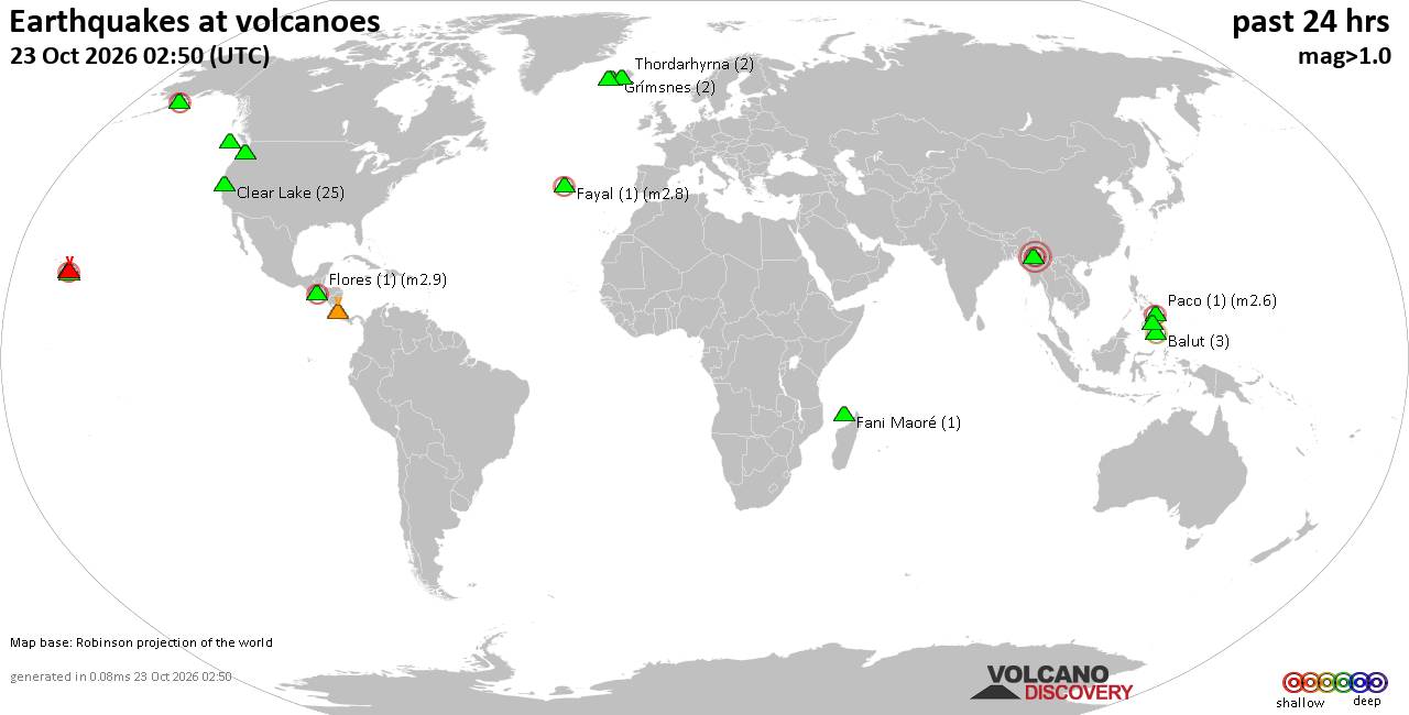
Volcano earthquake report for Friday, 23 October 2026
• M 1.9 - 4 km NE of Santa Rosa, CA
• Moderate mag. 4.2 earthquake - Provincia de Cachapoal, Region del Libertado...
• M 1.3 - 9 km SSW of Beaumont, CA
• Moderate mag. 4.8 earthquake - Taiwan on Friday, Oct 23, 2026, at 08:58 pm ...
• M 4.6 - south of the Kermadec Islands
• M 1.9 - 49 km NW of Toyah, Texas
|

#898854
Wed 07 Oct 2026 05:50:PM
|
Joined: Feb 2001
Posts: 678,977
Launch Director
|
|
Launch Director
Joined: Feb 2001
Posts: 678,977 |
Volcano earthquake report for Wednesday, 7 October 2026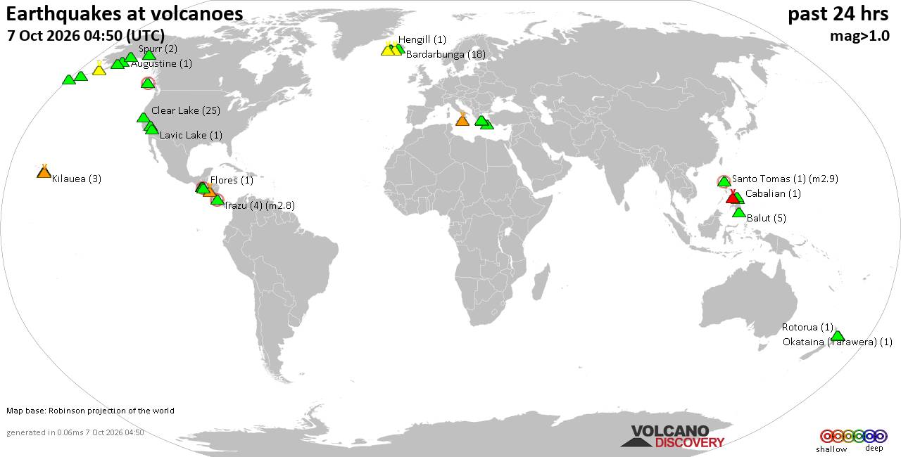 World map showing volcanoes with shallow (less than 50 km) earthquakes within 20 km radius during the past 24 hours on 7 Oct 2026 Number in brackets indicate nr of quakes. Quakes detected near: Balut (4 quakes between mag 1.7-2.6), Clear Lake (28 quakes between mag 0.2-2.1), Coso (2 quakes between mag 0.8-1.5), Cuilapa-Barbarena (1 quake mag 1.0), Etna (5 quakes between mag 0.9-1.8), Flores (5 quakes between mag 1.0-1.5)
Fourpeaked (1 quake mag 2.0), Irazu (4 quakes between mag 1.9-2.8), Kanlaon (1 quake mag 2.0), Katla (14 quakes between mag 0.3-1.8), Kilauea (2 quakes between mag 1.8-2.1), Kolumbo (2 quakes between mag 1.7-1.8), Kukak (1 quake mag 1.2), La Palma (1 quake mag 1.6), Lavic Lake (1 quake mag 1.7), Long Valley (2 quakes between mag 0.8-2.2), Mahagnao (1 quake mag 1.3), Mauna Kea (8 quakes between mag 1.3-3.1), Maunaloa (2 quakes between mag 2.1-2.2), Nisyros (1 quake mag 1.8), Okataina (Tarawera) (1 quake mag 1.5), Rincón de la Vieja (1 quake mag 1.2), San Cristobal (1 quake mag 1.9), Santiaguito (1 quake mag 1.8), Santo Tomas (1 quake mag 2.9), Sousaki (1 quake mag 1.4), Spurr (2 quakes between mag 0.4-1.0), Svartsengi (1 quake mag 1.9), Tana (1 quake mag 1.2) (updated 17h50)\n\nNote: Earthquakes within 20 km from and at depths less than 50 km under active volcanoes are reported. The list is not complete because many volcanoes are not monitored and/or seismic data in high resolution is not available publicly.\n
Volcanoes with recent earthquakes above magnitude 2 or more than 10 quakes are listed below:
Balut volcano (Mindanao): 4 earthquakes up to magnitude 2.64 earthquakes occurred near (under) the volcano during 21 hours, the last being recorded quake 2 hours ago. Hypocenter depths ranged between 31.00 and 7.00 km. Earthquake details: 2.6 quake Philippine Sea, 24 km southwest of Sarangani Island, Philippines, Oct 7, 2026 11:23 pm (GMT +8) (16 km S) 2.5 quake Celebes Sea, 24 km southwest of Sarangani Island, Philippines, Oct 7, 2026 02:51 am (GMT +8) (15 km SSW) 2.1 quake Davao Occidental, Davao, Philippines, Oct 7, 2026 03:51 am (GMT +8) (12 km SSW) 1.7 quake Celebes Sea, 24 km west of Sarangani Island, Philippines, Oct 7, 2026 09:13 am (GMT +8) (12 km W) All earthquakes at BalutBalut is an 840 m island stratovolcano south of Mindanao whose last known eruption occurred between about 2 million and 11,700 years ago. Hot springs and thermally altered ground occur on its western and southwestern flanks. Clear Lake volcano (California): 28 earthquakes up to magnitude 2.1Possible earthquake swarm: 28 earthquakes occurred near (under) the volcano during 22 hours, the last being recorded quake 1 hour 14 minutes ago. Hypocenter depths ranged between 8.87 and 0.66 km. Earthquake details: (only 5 largest) 2.1 quake Sonoma County, 15 mi southwest of Clearlake, Lake County, California, United States, Oct 6, 2026 10:49 pm (GMT -7) (18 km SSW) 1.4 quake 27 mi north of Santa Rosa, Sonoma County, California, United States, Oct 6, 2026 09:48 pm (GMT -7) (17 km S) 1.4 quake 26 mi north of Santa Rosa, Sonoma County, California, United States, Oct 6, 2026 11:22 am (GMT -7) (18 km S) 1.3 quake 28 mi north of Santa Rosa, Sonoma County, California, United States, Oct 7, 2026 12:39 am (GMT -7) (16 km SSW) 1.3 quake Lake County, 28 mi north of Santa Rosa, Sonoma County, California, United States, Oct 6, 2026 07:24 pm (GMT -7) (15 km S) All earthquakes at Clear LakeIrazu volcano (Costa Rica): 4 earthquakes up to magnitude 2.84 earthquakes occurred near (under) the volcano during 14 hours, the last being recorded quake 5 hours ago. Hypocenter depths ranged between 16.00 and 7.00 km. Earthquake details: 2.8 quake 19 km northeast of San Jose, Provincia de San Jose, Costa Rica, Oct 6, 2026 04:12 pm (GMT -6) (13 km WNW) 2.0 quake 19 km northeast of San Jose, Provincia de San Jose, Costa Rica, Oct 6, 2026 04:25 pm (Costa_Rica time) (12 km WNW) 1.9 quake 18 km northeast of San Jose, Provincia de San Jose, Costa Rica, Oct 7, 2026 06:28 am (Costa_Rica time) (13 km WNW) 1.9 quake 19 km northeast of San Jose, Provincia de San Jose, Costa Rica, Oct 6, 2026 04:25 pm (Costa_Rica time) (12 km WNW) All earthquakes at IrazuIrazú is an explosive stratovolcano immediately east of San José, Costa Rica. Its major 1963-65 eruption caused widespread ashfall and severe disruption, while its last confirmed eruption occurred in 1977. Katla volcano (Iceland): 14 earthquakes up to magnitude 1.8Possible earthquake swarm: 14 earthquakes occurred near (under) the volcano during 21 hours, the last being recorded quake 3 hours ago. Hypocenter depths ranged between 6.50 and 0.00 km. Earthquake details: (only 5 largest) 1.8 quake 5.8 km NNE of Hábunga Oct 6, 2026 06:27 pm (Universal Time) (0 km S) 1.7 quake Iceland: 4.5 km ENE of Goðabunga Oct 7, 2026 03:05 pm (Reykjavik time) (6 km WNW) 1.7 quake 2.6 km NNW of Hábunga Oct 7, 2026 08:54 am (Universal Time) (5 km SW) 1.4 quake Iceland: 5.6 km ENE of Goðabunga Oct 7, 2026 12:43 pm (Reykjavik time) (6 km NW) 1.3 quake Iceland: 5.0 km N of Hábunga Oct 7, 2026 09:34 am (Reykjavik time) (2 km WSW) All earthquakes at KatlaKilauea volcano (Hawai'i (Big Island)): 2 earthquakes up to magnitude 2.12 earthquakes occurred near (under) the volcano during 5 minutes, the last being recorded quake 16 hours ago. Hypocenter depths ranged between 32.55 and 32.01 km. Earthquake details: 2.1 quake 30 mi southwest of Hilo, Hawaii County, Hawaii, United States, Oct 6, 2026 03:50 pm (GMT -10) (10 km S) 1.8 quake 32 mi south of Hilo, Hawaii County, Hawaii, United States, Oct 6, 2026 03:55 pm (GMT -10) (13 km S) All earthquakes at KilaueaLong Valley volcano (California): 2 earthquakes up to magnitude 2.22 earthquakes occurred near (under) the volcano during 2 minutes, the last being recorded quake 13 hours ago. Hypocenter depths ranged between 3.00 and 2.91 km. Earthquake details: 2.2 quake 6.9 mi southeast of Mammoth Lakes, Mono County, California, United States, Oct 6, 2026 09:56 pm (GMT -7) (14 km S) 0.8 quake 6.5 mi southeast of Mammoth Lakes, Mono County, California, United States, Oct 6, 2026 09:58 pm (GMT -7) (13 km S) All earthquakes at Long ValleyLong Valley is a 17-by-32-kilometre caldera in eastern California, formed by the explosive Bishop Tuff eruption about 760,000 years ago. No eruption is known from approximately the past 12,000 years, although earthquakes, deformation and thermal activity continue. Mauna Kea volcano (Hawai'i (Big Island)): 8 earthquakes up to magnitude 3.18 earthquakes occurred near (under) the volcano during 1 hour 20 minutes, the last being recorded quake 19 hours ago. Hypocenter depths ranged between 11.07 and 0.39 km. Earthquake details: (only 5 largest) 3.1 quake 26 mi northwest of Hilo, Hawaii County, Hawaii, United States, Oct 6, 2026 12:30 pm (GMT -10) (17 km NNE) 2.8 quake 26 mi northwest of Hilo, Hawaii County, Hawaii, United States, Oct 6, 2026 11:57 am (GMT -10) (16 km NNE) 2.6 quake 25 mi northwest of Hilo, Hawaii County, Hawaii, United States, Oct 6, 2026 11:09 am (GMT -10) (18 km NNE) 2.5 quake 25 mi northwest of Hilo, Hawaii County, Hawaii, United States, Oct 6, 2026 11:59 am (GMT -10) (16 km NNE) 2.4 quake 26 mi northwest of Hilo, Hawaii County, Hawaii, United States, Oct 6, 2026 11:48 am (GMT -10) (16 km NNE) All earthquakes at Mauna KeaMauna Kea is Hawaiʻi’s highest volcano and last erupted about 4,500 years ago, producing cinder cones and lava flows. Numerous cones and astronomical observatories occupy its summit region. Maunaloa volcano (Hawai'i (Big Island)): 2 earthquakes up to magnitude 2.22 earthquakes occurred near (under) the volcano during 11 hours, the last being recorded quake 8 hours ago. Hypocenter depths ranged between 42.98 and 7.78 km. Earthquake details: 2.2 quake 39 mi southwest of Hilo, Hawaii County, Hawaii, United States, Oct 6, 2026 01:13 pm (GMT -10) (6 km SSE) 2.1 quake 12 mi north of Pāhala, Hawaii County, Hawaii, United States, Oct 7, 2026 12:03 am (GMT -10) (16 km SE) All earthquakes at MaunaloaMaunaloa is a huge, frequently active shield volcano on Hawaiʻi’s Big Island. Its predominantly lava-producing eruptions include a well-documented episode in November–December 2022. Santo Tomas volcano (Luzon Island): magnitude 2.9 earthquakeA magnitude 2.9 earthquake occurred at the volcano 17 hours ago. The quake, which might be volcanic in origin, was located at a depth of 13.00 km depth at 13 km distance N from the volcano. Earthquake details: 2.9 quake 5.2 km northwest of Baguio, Philippines, Oct 7, 2026 08:23 am (GMT +8) (13 km N) All earthquakes at Santo TomasSanto Tomas is a 2,260 m-high Philippine stratovolcano with numerous vents and fissures. Its last recognized eruption occurred more than approximately 11,700 years ago, while a reported event in 1641 remains ambiguous. https://www.volcanodiscovery.com/earthquakes-volcanoes/news/372907/Volcano-earthquake-report-2026-10-07.html
|
|



CMS The Best Conveyancing solicitors conveyancing quotes throughout the UK
For any webhosting enquiries please email webmaster@aus-city.com
|
|
Entire Thread
|
 Volcano earthquake report for Wednesday, 7 October 2026 |
Webmaster
|
Wed 07 Oct 2026 05:50:PM
|
|
Forums60
Topics891,075
Posts925,872
Members2,960
| |
Most Online102,106
Jul 10th, 2026
|
|
|
|
|

|









































