|
0 members (),
1,731
guests, and
26
robots. |
|
Key:
Admin,
Global Mod,
Mod
|
|
S |
M |
T |
W |
T |
F |
S |
|
|
|
|
|
1
|
2
|
3
|
|
4
|
5
|
6
|
7
|
8
|
9
|
10
|
|
11
|
12
|
13
|
14
|
15
|
16
|
17
|
|
18
|
19
|
20
|
21
|
22
|
23
|
24
|
|
25
|
26
|
27
|
28
|
29
|
30
|
31
|
|
There are no members with birthdays on this day. |
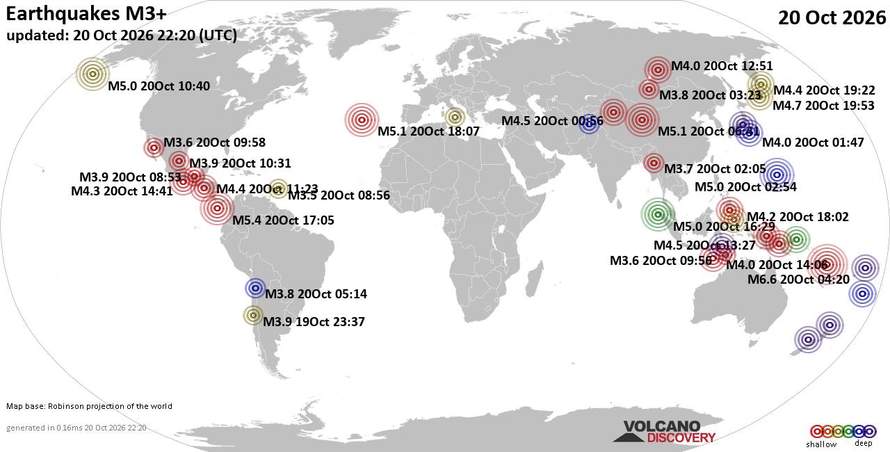
World Earthquake Report for Tuesday, 20 October 2026
• M 2.1 - 5 km SSW of Pāhala, Hawaii
• M 1.5 - 15 km NNE of Milford, Utah
• M 0.9 - 6 km WNW of Cobb, CA
• M 4.4 - 52 km S of Champerico, Guatemala
• M 1.9 - 8 km N of Redwood Valley, CA
|

#902236
Fri 09 Oct 2026 09:06:AM
|
Joined: Feb 2001
Posts: 678,977
Launch Director
|
|
Launch Director
Joined: Feb 2001
Posts: 678,977 |
SPC Oct 9, 2026 Day 4-8 Severe Weather OutlookDay 4-8 Outlook 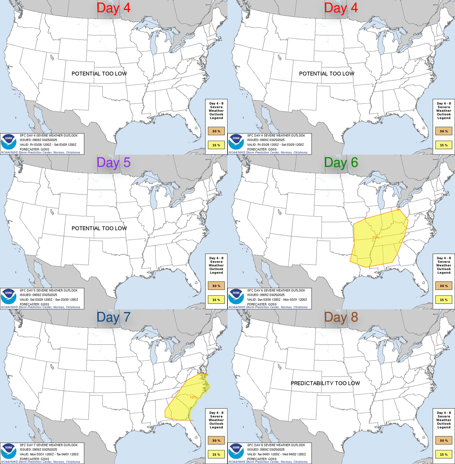
Day 4-8 Convective Outlook
NWS Storm Prediction Center Norman OK
0403 AM CDT Fri Oct 09 2026

Valid 121200Z - 171200Z

...DISCUSSION...
There is reasonably good agreement in 00Z deterministic and ensemble
guidance that a mid/upper-level low centered over the Sierra Nevada
or Great Basin on Day 4/Monday will evolve into an open wave while
progressing into the Great Plains on Day 6/Wednesday. Thereafter,
model spread increases in the evolution of the large-scale pattern.

...Day 4/Monday...

Some severe weather threat could materialize during the afternoon
along a surface boundary over the Upper Midwest where at least
modest instability will coincide with sufficiently strong deep-layer
shear to support organized storm modes. However, low-amplitude
ridging downstream from the western U.S. trough along with
uncertainty in the extent of air mass destabilization renders the
threat too questionable to include a 15% area.


...Day 5/Tuesday...

Increasing height falls and midlevel flow will overspread the
central and southern High Plains, which in turn will induce a
deepening lee cyclone, likely over southeast CO. At the surface, a
front is expected to stretch from the low through the OH Valley into
the Mid-Atlantic with a dryline trailing south from the cyclone into
eastern NM or western TX. Isolated strong to severe storms appear
possible along the length of the front from the Mid-Atlantic into
the central and southern Plains. Organized severe storm potential
appears most probable over the central and southern High Plains
Tuesday afternoon into evening in the vicinity of the lee cyclone
and strengthening low-level jet, where the strongest forcing for
ascent and vertical shear will coincide.


...Day 6/Wednesday...

As mentioned above, there is overall model agreement that a
short-wave trough and a strengthening deep-layer wind field will
advance into the Great Plains at this time. However, there are
slight timing and latitudinal differences in the track of the
midlevel system and the associated surface low. Despite these
differences, it does appear that a broad, moist, and unstable warm
sector will exist. As such, organized severe storms appear possible
with the highest confidence in occurrence over portions of eastern
KS into MO where guidance currently indicates the most favorable
overlap of instability and vertical shear. The currently delineated
area may move slightly and/or expand in the coming days as forecast
confidence increases.


...Days 7 and 8/Thursday and Friday...

Some severe weather threat could develop over the Great Lakes and OH
Valley on Thursday in association with the mid-level trough
discussed in the previous sections. However, confidence in organized
severe storm potential is currently too low given the model
variability in the specific details of the trough and associated
frontal system.
Read morehttps://www.spc.noaa.gov/products/exper/day4-8/
|
|



CMS The Best Conveyancing solicitors conveyancing quotes throughout the UK
For any webhosting enquiries please email webmaster@aus-city.com
|
|
Entire Thread
|
 SPC Oct 9, 2026 Day 4-8 Severe Weather Outlook |
Webmaster
|
Fri 09 Oct 2026 09:06:AM
|
|
Forums60
Topics885,562
Posts920,359
Members2,960
| |
Most Online102,106
Jul 10th, 2026
|
|
|









































