|
|
|
0 members (),
1,392
guests, and
26
robots. |
|
Key:
Admin,
Global Mod,
Mod
|
|
S |
M |
T |
W |
T |
F |
S |
|
|
|
|
|
1
|
2
|
3
|
|
4
|
5
|
6
|
7
|
8
|
9
|
10
|
|
11
|
12
|
13
|
14
|
15
|
16
|
17
|
|
18
|
19
|
20
|
21
|
22
|
23
|
24
|
|
25
|
26
|
27
|
28
|
29
|
30
|
31
|
|
There are no members with birthdays on this day. |
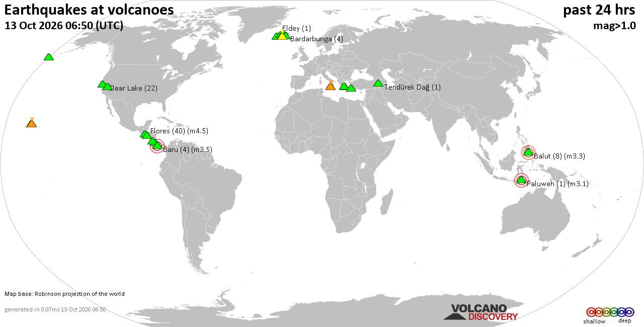
Volcano earthquake report for Tuesday, 13 October 2026
• M 2.7 - 19 km SSW of Leilani Estates, Hawaii
• M 2.5 - 5 km SSW of Pāhala, Hawaii
• M 1.9 - 15 km NE of Milford, Utah
• M 1.8 - 116 km E of Cordova, Alaska
• M 1.2 - 15 km NE of Little Lake, CA
• M 2.0 - 82 km ESE of Ugashik, Alaska
|

#905549
Sun 11 Oct 2026 08:20:AM
|
Joined: Feb 2001
Posts: 678,977
Launch Director
|
|
Launch Director
Joined: Feb 2001
Posts: 678,977 |
SPC Oct 11, 2026 Day 4-8 Severe Weather OutlookDay 4-8 Outlook 
Day 4-8 Convective Outlook
NWS Storm Prediction Center Norman OK
0316 AM CDT Sun Oct 11 2026

Valid 141200Z - 191200Z

...DISCUSSION...
A mid/upper-level low is forecast to progress from the eastern Great
Basin into the central Rockies on Day 4/Wednesday. By Day
5/Thursday, there is good model consensus in the break-up of the
low, with much of it being enveloped by an amplifying polar-branch
trough over the north-central CONUS. By Days 6 and 7/ Friday and
Saturday, there is general model agreement that a broader-scale
trough will spread from the MS Valley toward the Atlantic Coast.


...Day 4/Wednesday...

At least isolated severe storms appear most probable over the
southern Plains during the afternoon and evening, along and ahead of
a surface front extending from the southern High Plains through the
mid-MS Valley. The presence of a moist air mass will support
moderate instability by afternoon in areas that experience greater
daytime heating. Thunderstorms are expected to be ongoing Wednesday
morning within the warm sector, leading to uncertainty in where the
effective surface front will be located by afternoon to focus more
robust storm development.  While no 15% contour will be included in
this forecast, at least level-1/Marginal Risk probabilities will
likely be required in the subsequent Day 3 forecast for this time
period.

Elsewhere, a few strong to severe storms appear possible along the
remaining length of the front from the mid-MS Valley into the
Mid-Atlantic.


...Day 5/Thursday...

Some severe weather threat may materialize from the Ozark Plateau
into the OH Valley in the vicinity of a surface low and attending
frontal system. However, the potential for early-day storms and
model variability in the particular details of the upper-air pattern
evolution result in considerable uncertainty in the magnitude of the
threat.


...Days 6 to 8/Friday to Sunday...

A cold front on the leading edge of a prominent surface high will
push through most locations east of the Rockies by Saturday morning.
A strong storm or two appears possible along the front in the
Mid-Atlantic on Friday. Otherwise, the influx of a drier,
continental-polar air mass is expected to limit the threat for
severe storms.
Read morehttps://www.spc.noaa.gov/products/exper/day4-8/
|
|



CMS The Best Conveyancing solicitors conveyancing quotes throughout the UK
For any webhosting enquiries please email webmaster@aus-city.com
|
|
Entire Thread
|
 SPC Oct 11, 2026 Day 4-8 Severe Weather Outlook
|
Webmaster
|
Sun 11 Oct 2026 08:20:AM
|
|
Forums60
Topics873,200
Posts907,996
Members2,960
| |
Most Online102,106
Jul 10th, 2026
|
|
|
|
|

|









































