|
|
|
0 members (),
1,508
guests, and
24
robots. |
|
Key:
Admin,
Global Mod,
Mod
|
|
S |
M |
T |
W |
T |
F |
S |
|
|
|
|
|
1
|
2
|
3
|
|
4
|
5
|
6
|
7
|
8
|
9
|
10
|
|
11
|
12
|
13
|
14
|
15
|
16
|
17
|
|
18
|
19
|
20
|
21
|
22
|
23
|
24
|
|
25
|
26
|
27
|
28
|
29
|
30
|
31
|
|
There are no members with birthdays on this day. |
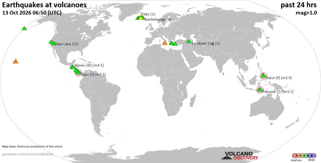
Volcano earthquake report for Tuesday, 13 October 2026
• M 0.7 - 77 km ENE of Akutan, Alaska
• M 1.3 - 34 km NE of Girdwood, Alaska
• M 2.0 - 24 km NE of Kelly, Wyoming
• M 1.9 - 18 km WSW of Gerlach, Nevada
• M 2.0 - 15 km NE of Milford, Utah
|
|
|
Joined: Feb 2001
Posts: 678,977
Launch Director
|
|
Launch Director
Joined: Feb 2001
Posts: 678,977 |
SPC Oct 13, 2026 0730 UTC Day 3 Severe Thunderstorm OutlookSPC 0730Z Day 3 Outlook 
Day 3 Convective Outlook
NWS Storm Prediction Center Norman OK
0208 AM CDT Tue Oct 13 2026

Valid 151200Z - 161200Z

...THERE IS A MARGINAL RISK OF SEVERE THUNDERSTORMS OVER PORTIONS OF
THE MID-MISSISSIPPI AND OHIO VALLEYS...

...SUMMARY...
Isolated severe storms appear possible over portions of the mid-
Mississippi and Ohio Valleys Thursday afternoon through night.

...Synopsis...

A short-wave trough over SK/MB Thursday morning is forecast to
undergo considerable amplification while translating into the Great
Lakes late Thursday night/early Friday. Ahead of that feature, an
upper low will weaken into an increasingly sheared open wave while
accelerating from the central High Plains into the Midwest. At the
surface, an area of low pressure is expected to develop along a
poleward-advancing warm front from central or eastern KS through the
mid-MS and OH Valleys to the lower Great Lakes. Meanwhile a trailing
cold front will surge south through much of the southern Plains and
into the lower-MS Valley.


...Mid-Mississippi and Ohio Valleys...

Showers and thunderstorms may be ongoing at 12Z Thursday from
portions of the central Plains into the mid-MS Valley within a zone
of warm-air and moisture advection preceding the surface low. A
subset of the early-day storms may persist through the day with
associated cloud cover limiting daytime heating and resultant air
mass destabilization in those areas. Where cloud breaks can occur,
stronger diabatic heating coupled with boundary-layer dewpoints in
the low to mid 70s may contribute to a corridor of moderate
instability by afternoon, which would become a preferred zone of
diurnally enhanced thunderstorm development.

Both vertical shear and forcing for ascent are forecast to steadily
strengthen from Thursday afternoon through night, leading to the
potential for a fast-moving complex of storms to traverse the region
with an associated risk for locally damaging wind gusts.

..Mead.. 10/13/2026
Read morehttps://www.spc.noaa.gov/products/outlook/day3otlk_0730.html
|
|



CMS The Best Conveyancing solicitors conveyancing quotes throughout the UK
For any webhosting enquiries please email webmaster@aus-city.com
|
|
Entire Thread
|

 SPC Oct 13, 2026 0730 UTC Day 3 Severe Thunderstorm Outlook
|
Webmaster
|
16 hours ago
|
|
Forums60
Topics873,543
Posts908,339
Members2,960
| |
Most Online102,106
Jul 10th, 2026
|
|
|
|
|

|









































