|
0 members (),
1,397
guests, and
26
robots. |
|
Key:
Admin,
Global Mod,
Mod
|
|
S |
M |
T |
W |
T |
F |
S |
|
|
|
|
|
1
|
2
|
3
|
|
4
|
5
|
6
|
7
|
8
|
9
|
10
|
|
11
|
12
|
13
|
14
|
15
|
16
|
17
|
|
18
|
19
|
20
|
21
|
22
|
23
|
24
|
|
25
|
26
|
27
|
28
|
29
|
30
|
31
|
|
There are no members with birthdays on this day. |
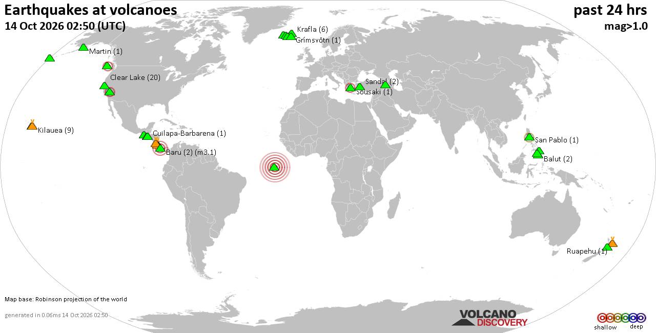
Volcano earthquake report for Wednesday, 14 October 2026
• M 1.0 - 12 km E of Julian, CA
• M 1.3 - 3 km NE of Susitna North, Alaska
• M 1.1 - 7 km NW of The Geysers, CA
• M 1.4 - 25 km N of Deltana, Alaska
• M 0.3 - 13 km N of Borrego Springs, CA
|
|
|
Joined: Feb 2001
Posts: 678,977
Launch Director
|
|
Launch Director
Joined: Feb 2001
Posts: 678,977 |
SPC Oct 14, 2026 0100 UTC Day 1 Convective OutlookSPC 0100Z Day 1 Outlook 
Day 1 Convective Outlook
NWS Storm Prediction Center Norman OK
0800 PM CDT Tue Oct 13 2026

Valid 140100Z - 141200Z

...THERE IS A SLIGHT RISK OF SEVERE THUNDERSTORMS ACROSS PARTS OF
THE SOUTHERN AND CENTRAL PLAINS INTO THE LOWER MISSOURI VALLEY...

...SUMMARY...
Scattered severe storms capable of large hail and severe gusts are
expected this evening into tonight over parts of the central and
southern Plains into the Lower Missouri Valley. Isolated large hail
may also occur in the southern Great Lakes.

...Southern and Central Plains...
The latest water vapor imagery shows an anticyclonic flow pattern in
place over the eastern two-thirds of the nation, with southwesterly
mid-level flow from the Desert Southwest into the southern and
central Plains. At the surface, a cold front is located from near
the Oklahoma Panhandle northeastward into north-central Missouri. A
1007 mb low is analyzed over the northeastern Texas Panhandle.
Low-convergence is maximized along the front over the central
Plains, where scattered thunderstorms are ongoing. The convergence
axis extends southward into the Low Rolling Plains of northwest
Texas, where a cluster of storms is also ongoing. Ahead of the
convergence axis, surface dewpoints are in upper 60s and lower 70s F
over much of the southern and central Plains, which is contributing
to moderate instability, with the RAP estimating MLCAPE mostly in
the 2000 to 2500 J/kg range.

In addition to the instability,the WSR-88D VWP at Wichita, KS has
0-6 km shear near 35 knots with 40 to 45 knots of southwesterly flow
in the mid-levels. Some directional shear is present in the boundary
layer. This environment will support a threat for supercells with
cells that remain discrete. Supercells will be capable of large
hail, severe wind gusts and perhaps a tornado or two. Severe wind
gusts are expected to become the primary severe threat as the
primary mode becomes linear, later this evening.

Further south into western Oklahoma and northwest Texas, the latest
WSR-88D VWP at Frederick has about 35 knots of 0-6 km shear. The RAP
also has steep mid-level lapse rates in the 7 to 7.5 C/km range.
This should support supercells with a potential for large hail and
severe wind gusts.

...Southern Great Lakes...
A minor shortwave trough appears to be moving into the western Great
Lakes early this evening. Ahead of this feature, thunderstorms have
developed over far southern Wisconsin. The storms will track
east-southeastward into the southern Great Lakes this evening into
the overnight. The RAP currently shows an axis of instability
analyzed from western Illinois northeastward into the southwestern
Great Lakes. Along and near this axis, RAP forecast soundings late
this evening have MUCAPE around 1500 J/kg with effective shear near
40 knots. This may be enough for an isolated large hail threat, with
the stronger elevated storms.

..Broyles.. 10/14/2026
Read morehttps://www.spc.noaa.gov/products/outlook/day1otlk_0100.html
|
|



CMS The Best Conveyancing solicitors conveyancing quotes throughout the UK
For any webhosting enquiries please email webmaster@aus-city.com
|
|
Entire Thread
|

 SPC Oct 14, 2026 0100 UTC Day 1 Convective Outlook
|
Webmaster
|
9 hours ago
|
|
Forums60
Topics874,397
Posts909,193
Members2,960
| |
Most Online102,106
Jul 10th, 2026
|
|
|









































