|
0 members (),
1,406
guests, and
21
robots. |
|
Key:
Admin,
Global Mod,
Mod
|
|
S |
M |
T |
W |
T |
F |
S |
|
|
|
|
|
1
|
2
|
3
|
|
4
|
5
|
6
|
7
|
8
|
9
|
10
|
|
11
|
12
|
13
|
14
|
15
|
16
|
17
|
|
18
|
19
|
20
|
21
|
22
|
23
|
24
|
|
25
|
26
|
27
|
28
|
29
|
30
|
31
|
|
There are no members with birthdays on this day. |
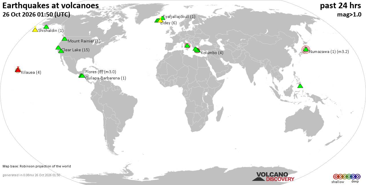
Volcano earthquake report for Monday, 26 October 2026
• M 2.3 - 27 km E of Honaunau-Napoopoo, Hawaii
• M 1.1 - 62 km WNW of Happy Valley, Alaska
• M 2.6 - 37 km ESE of Malaga, New Mexico
• M 2.1 - 57 km S of Whites City, New Mexico
• M 2.9 - 121 km SSW of Nikolski, Alaska
• M 4.9 - 100 km E of La Tirana, Chile
|

#915528
Fri 16 Oct 2026 04:37:PM
|
Joined: Feb 2001
Posts: 678,977
Launch Director
|
|
Launch Director
Joined: Feb 2001
Posts: 678,977 |
SPC Day 1 Fire Weather OutlookSPC Day 1 Fire Weather Outlook 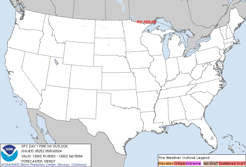
Day 1 Fire Weather Outlook
NWS Storm Prediction Center Norman OK
1135 AM CDT Fri Oct 16 2026

Valid 161700Z - 171200Z

...CRITICAL FIRE WEATHER AREA FOR WESTERN L.A. COUNTY...VENTURA
COUNTY...AND SOUTHEASTERN SANTA BARBARA COUNTY IN SOUTHERN
CALIFORNIA...

The forecast remains on track for an Elevated fire weather threat
across portions of CA, and critical conditions for a localized
region of southern CA. Wind gusts of 35-55 mph are being measured in
the wind-prone areas of L.A./Ventura/Santa Barbara counties amid RH
values of 15-20% this morning. As the offshore gradient relaxes
throughout the day, winds will gradually ease; however, a 700 mb
30-40 kt easterly jet will remain over the region into Day
2/Saturday morning, potentially allowing some stronger gusts to
reach the surface.

Farther east, a cold front will continue to traverse the lower MS
Valley/ArkLaTex today. Behind the front, northerly sustained winds
of 15-20 mph (gusts up to 30 mph) are depicted by 16z observations.
RH values will decline to 25-40% this afternoon where receptive
fuels exist, maintaining an Elevated fire weather threat.

..Elizalde-Garcia.. 10/16/2026

.PREV DISCUSSION... /ISSUED 0204 AM CDT Fri Oct 16 2026/

...Synopsis...
A mid/upper low will remain positioned just west of the northern
Baja Peninsula within a broader upper-level ridge over the western
U.S. In conjunction with a strong surface high pressure system (1044
mb per the 03 UTC WPC surface analysis) moving into the central
Great Plains, this upper low will continue to support dry, offshore
flow and elevated to critical fire weather conditions across
portions of California today. To the east, a robust upper-level
trough will pivot eastward across the eastern U.S., with an
attendant surface low deepening as it progresses northeastward
across the St. Lawrence River Valley and a strong cold front
advancing across the East/Southeast. Strong post-frontal flow in the
wake of this cold front will bring elevated fire weather concerns to
portions of the lower Mississippi River Valley and ArkLaTex today.

...Southern California...
A closed mid/upper low will aid in the maintenance of deep-layer
east-northeasterly flow across much of southern California, which
will continue to support an offshore wind event and elevated to
critical fire weather conditions today. A corridor of sustained
east-northeasterly 20-30 mph surface winds with gusts up to 50-60
mph (occasionally higher in terrain-favored and exposed elevated
areas) is forecast across western L.A, Ventura, and southeastern
Santa Barbara counties, with a peak during the late morning/early
afternoon hours before gradually diminishing beginning later this
afternoon. With minimum RH values likely dropping to near 15%
(locally lower), this will favor a critical fire weather threat.
Elevated to locally critical conditions are also expected farther
west towards the central CA coast where RH reductions to 15% and
sustained easterly winds of 15-20 mph are expected.

...Sierra Nevada, Sacramento Valley into the North Bay area...
Residual easterly/northeasterly downslope winds of 10-15 mph
(locally up to 20 mph) are expected today across the western slopes
of the Sierra Nevada. Poor overnight humidity recoveries are
observed as of 0600 UTC, with RH values noted to range from 15-25%
across portions of the western slopes. RH values should further
decrease to near 10% today. Coupled with receptive fuels and the
breezy east-northeast winds, this will help maintain an elevated
fire weather threat across this region today. North-northeast winds
of 10-15 mph and minimum RH values of 10-15% will also bring
elevated fire weather concerns to portions of the Sacramento Valley,
Napa Valley, and North Bay areas today.

...Lower Mississippi River Valley and ArkLaTex Region...
A strong surface high pressure system will build into the central
Plains today in the wake of the passage of a substantial surface
cold front advancing across the East/Southeast. The resultant
surface pressure gradient between these two features will favor
sustained northerly winds of 10-15 mph (with occasional gusts up to
around 30-35 mph possible) across portions of the lower Mississippi
River Valley and ArkLaTex within the dry, post-frontal air mass.
With RH reductions as low as ~25% over receptive fuels (ERCs up to
the 80-90th percentiles), elevated fire weather conditions are
expected for at least a few hours this afternoon. While RH will
improve into the overnight hours, gusty surface winds are expected
to continue into Saturday morning. Only a minor southward expansion
to the existing elevated area was made with this update.

...Please see www.spc.noaa.gov/fire for graphic product...
Read morehttps://www.spc.noaa.gov/products/fire_wx/fwdy1.html
|
|



CMS The Best Conveyancing solicitors conveyancing quotes throughout the UK
For any webhosting enquiries please email webmaster@aus-city.com
|
|
Entire Thread
|
 SPC Day 1 Fire Weather Outlook |
Webmaster
|
Fri 16 Oct 2026 04:37:PM
|
|
Forums60
Topics895,347
Posts930,144
Members2,960
| |
Most Online102,106
Jul 10th, 2026
|
|
|









































