|
|
|
0 members (),
1,194
guests, and
25
robots. |
|
Key:
Admin,
Global Mod,
Mod
|
|
S |
M |
T |
W |
T |
F |
S |
|
|
|
|
|
1
|
2
|
3
|
|
4
|
5
|
6
|
7
|
8
|
9
|
10
|
|
11
|
12
|
13
|
14
|
15
|
16
|
17
|
|
18
|
19
|
20
|
21
|
22
|
23
|
24
|
|
25
|
26
|
27
|
28
|
29
|
30
|
31
|
|
There are no members with birthdays on this day. |
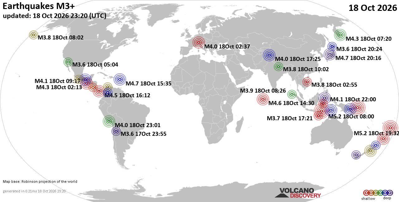
World Earthquake Report for Sunday, 18 October 2026
• M -0.9 - 65 km ENE of Pedro Bay, Alaska
• M 1.0 - 22 km SW of New Idria, CA
• M 2.7 - 18 km SW of Jal, New Mexico
• M 2.7 - 18 km SW of Jal, New Mexico
• M 1.1 - 2 km SSW of San Ramon, CA
• M 2.0 - 23 km NW of Fishhook, Alaska
|
|
|
Joined: Feb 2001
Posts: 678,977
Launch Director
|
|
Launch Director
Joined: Feb 2001
Posts: 678,977 |
SPC Oct 18, 2026 2000 UTC Day 1 Convective OutlookSPC 2000Z Day 1 Outlook 
Day 1 Convective Outlook
NWS Storm Prediction Center Norman OK
0240 PM CDT Sun Oct 18 2026

Valid 182000Z - 191200Z

...NO SEVERE THUNDERSTORM AREAS FORECAST...

...SUMMARY...
Severe thunderstorms are not forecast through tonight.

...20z Updates...

No changes are necessary for the Day 1 update. See previous
discussion below.

..Leitman.. 10/18/2026

.PREV DISCUSSION... /ISSUED 1114 AM CDT Sun Oct 18 2026/

...Synopsis...
Tranquil conditions will exist across much of the contiguous United
States through tonight.  Extensive surface high pressure influencing
much of the central and eastern U.S. will favor offshore flow into
the northern Gulf of America and feature a seasonably dry/stable
airmass.  A few weak thunderstorms are possible over south FL and
the Keys to the north of a surface front undergoing frontolysis
across the southern Gulf and FL Straits.  Farther west, an upper
trough migrating northeast across the Four Corners will be
associated with isolated showers/thunderstorms across parts of the
Southwest.
Read morehttps://www.spc.noaa.gov/products/outlook/day1otlk_2000.html
|
|



CMS The Best Conveyancing solicitors conveyancing quotes throughout the UK
For any webhosting enquiries please email webmaster@aus-city.com
|
|
Entire Thread
|

 SPC Oct 18, 2026 2000 UTC Day 1 Convective Outlook |
Webmaster
|
Yesterday at 07:43 PM
|
|
Forums60
Topics882,044
Posts916,841
Members2,960
| |
Most Online102,106
Jul 10th, 2026
|
|
|
|
|

|









































