|
1 members (Alisa),
1,769
guests, and
28
robots. |
|
Key:
Admin,
Global Mod,
Mod
|
|
S |
M |
T |
W |
T |
F |
S |
|
|
|
|
|
1
|
2
|
3
|
|
4
|
5
|
6
|
7
|
8
|
9
|
10
|
|
11
|
12
|
13
|
14
|
15
|
16
|
17
|
|
18
|
19
|
20
|
21
|
22
|
23
|
24
|
|
25
|
26
|
27
|
28
|
29
|
30
|
31
|
|
There are no members with birthdays on this day. |
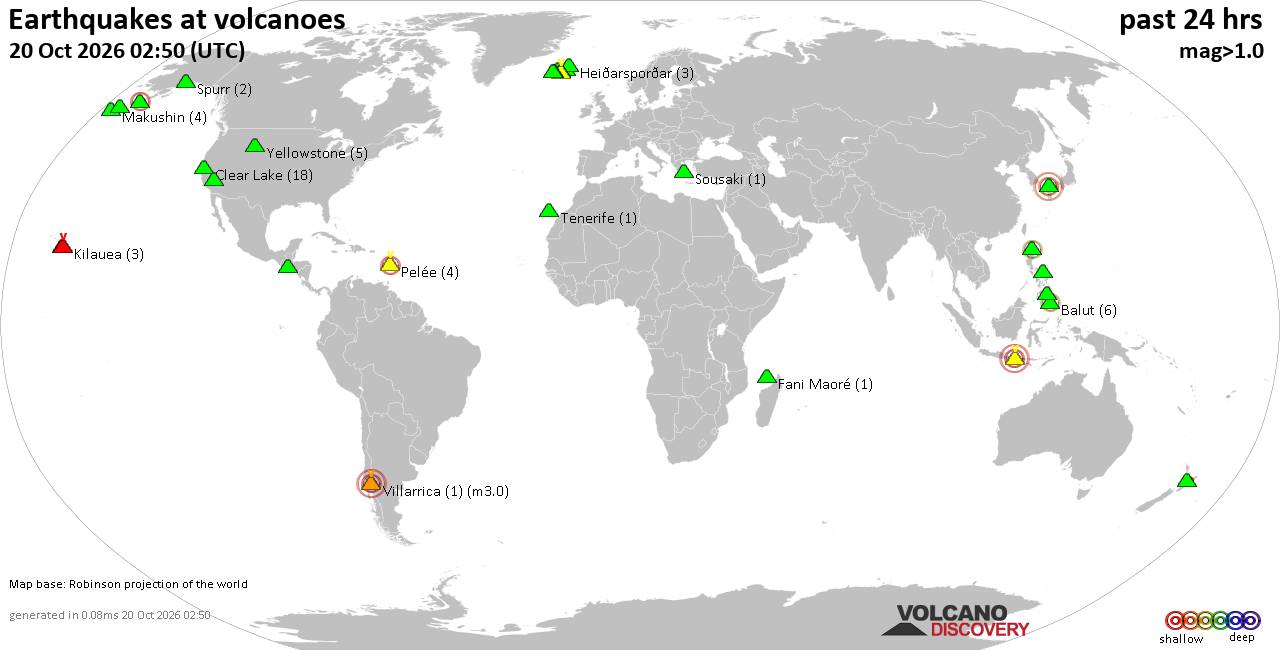
Volcano earthquake report for Tuesday, 20 October 2026
• Moderate mag. 4.0 earthquake - South OF Sumbawa, Indonesia, on Tuesday, Oct...
• M 1.6 - 6 km NE of Aguanga, CA
• M 1.5 - 21 km S of Lindsay, Texas
• M 2.6 - 18 km SSW of Jal, New Mexico
• M 2.0 - 19 km ESE of Naalehu, Hawaii
|
|
|
Joined: Feb 2001
Posts: 678,977
Launch Director
|
|
Launch Director
Joined: Feb 2001
Posts: 678,977 |
Atlantic Tropical Weather Outlook


822
ABNT20 KNHC 201150
TWOAT
Tropical Weather Outlook
NWS National Hurricane Center Miami FL
800 AM EDT Tue Oct 20 2026
For the North Atlantic...Caribbean Sea and the Gulf of America:
Off the East Coast of the United States (AL93):
A storm-force non-tropical low pressure area located a few hundred
miles off the North Carolina coast is producing some shower and
thunderstorm activity primarily west of its center. However,
overnight satellite wind data indicated the low was still attached
to an occluded front. Over the next couple of days, the low could
develop some organized deep convection and gradually lose its
frontal features while it moves slowly north-northeastward over the
Gulf Stream, allowing the system to briefly develop subtropical
characteristics. By the end of the week, the system is expected to
accelerate northeastward away from the the eastern United States,
where environmental conditions are expected to become unfavorable
for additional subtropical or tropical development.
Regardless of the status of the system, high winds, coastal
flooding, and dangerous surf are expected along portions of the U.S.
East Coast during the next few days. For more information, please
consult statements and warnings from local National Weather Service
offices and the Weather Prediction Center, along with High Seas
Forecasts and Storm Warnings issued by the National Weather Service.
* Formation chance through 48 hours...medium...40 percent.
* Formation chance through 7 days...medium...40 percent.
&&
High Seas Forecasts issued by the National Weather Service can be
found under AWIPS header NFDHSFAT1, WMO header FZNT01 KWBC, and
online at ocean.weather.gov/shtml/NFDHSFAT1.php
$$
Forecaster Papin
|
|



CMS The Best Conveyancing solicitors conveyancing quotes throughout the UK
For any webhosting enquiries please email webmaster@aus-city.com
|
|
Entire Thread
|

 Atlantic Tropical Weather Outlook |
Webmaster
|
5 hours ago
|
|
Forums60
Topics884,920
Posts919,717
Members2,960
| |
Most Online102,106
Jul 10th, 2026
|
|
|









































