|
0 members (),
1,410
guests, and
27
robots. |
|
Key:
Admin,
Global Mod,
Mod
|
|
S |
M |
T |
W |
T |
F |
S |
|
|
|
|
|
1
|
2
|
3
|
|
4
|
5
|
6
|
7
|
8
|
9
|
10
|
|
11
|
12
|
13
|
14
|
15
|
16
|
17
|
|
18
|
19
|
20
|
21
|
22
|
23
|
24
|
|
25
|
26
|
27
|
28
|
29
|
30
|
31
|
|
There are no members with birthdays on this day. |
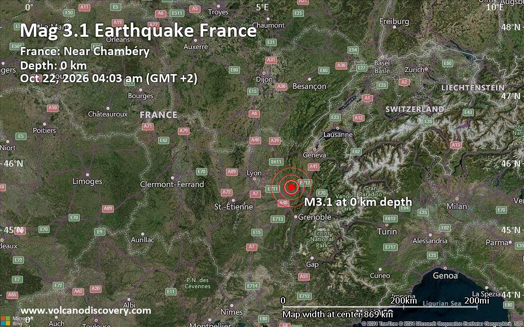
Magnitude 3.1 earthquake strikes near Chambery, Savoy, Auvergne-Rhone-Alpes, France
• M -0.2 - 11 km WNW of Dutch Harbor, Alaska
• M 7.7 - 12 km WSW of Pitaloza Arriba, Panama
• M 2.0 - 71 km WNW of Happy Valley, Alaska
• M 3.3 - 14 km SE of Petrolia, CA
• M 4.4 - 30 km NW of Albardón, Argentina
• M 2.0 - 62 km SE of Adak, Alaska
|
|
|
Joined: Feb 2001
Posts: 678,977
Launch Director
|
|
Launch Director
Joined: Feb 2001
Posts: 678,977 |
SPC MD 2390MD 2390 CONCERNING TORNADO WATCH 688... FOR CENTRAL AND EASTERN ARIZONA 
Mesoscale Discussion 2390
NWS Storm Prediction Center Norman OK
0605 PM CDT Wed Oct 21 2026

Areas affected...Central and Eastern Arizona

Concerning...Tornado Watch 688...

Valid 212305Z - 220100Z

The severe weather threat for Tornado Watch 688 continues.

SUMMARY...Large hail, severe wind gusts and a tornado threat will be
possible across parts of central and eastern Arizona this evening.

DISCUSSION...The latest surface analysis has a 1006 mb low over the
Lower Colorado River Valley, with a trough extending
east-northeastward across south-central Arizona. Low-level
convergence is maximized near this surface trough and will be a
potential location for cell initiation. Further to the north,
low-level convergence is maximized along the Mogollon Rim due to
upslope flow. To the south of the rim, surface dewpoints across much
of central Arizona are in the upper 50s to lower 60s F, with the RAP
showing SBCAPE from 1000 to 2000 J/kg. Over the top of this moist
and unstable airmass, a mid-level jet is analyzed by the RAP over
west-central Arizona. Large-scale ascent is likely maximized to the
east of this feature over central Arizona, which will support
continued scattered convective development this evening.

This mid-level jet is creating strong deep-layer shear over much of
Arizona, which will be favorable for supercells this evening. The
latest RAP forecast soundings early this evening between Phoenix and
Flagstaff have 0-6 km shear of 50 to 60 knots. Hodographs are long
and straight, which will be favorable for supercells with large
hail. In addition, forecast soundings have 0-3 km storm-relative
helicity in the 250 to 300 m2/s2 range, suggesting that supercells
will also have tornado potential. Isolated severe wind gusts will
also be possible.

..Broyles.. 10/21/2026

...Please see www.spc.noaa.gov for graphic product...

ATTN...WFO...TWC...FGZ...PSR...

LAT...LON   33691270 34151287 34651300 34901306 35251305 35621294
            35861272 36021245 36111195 36141118 36031059 35771002
            35150964 34270941 33590947 32930990 32711047 32801152
            33051225 33691270

MOST PROBABLE PEAK TORNADO INTENSITY...85-110 MPH
MOST PROBABLE PEAK WIND GUST...55-70 MPH
MOST PROBABLE PEAK HAIL SIZE...1.50-2.50 IN
Read morehttps://www.spc.noaa.gov/products/md/md2390.html
|
|



CMS The Best Conveyancing solicitors conveyancing quotes throughout the UK
For any webhosting enquiries please email webmaster@aus-city.com
|
|
Entire Thread
|

 SPC MD 2390 |
Webmaster
|
4 hours ago
|
|
Forums60
Topics887,792
Posts922,589
Members2,960
| |
Most Online102,106
Jul 10th, 2026
|
|
|









































