|
|
|
0 members (),
1,547
guests, and
23
robots. |
|
Key:
Admin,
Global Mod,
Mod
|
|
S |
M |
T |
W |
T |
F |
S |
|
|
|
|
|
1
|
2
|
3
|
|
4
|
5
|
6
|
7
|
8
|
9
|
10
|
|
11
|
12
|
13
|
14
|
15
|
16
|
17
|
|
18
|
19
|
20
|
21
|
22
|
23
|
24
|
|
25
|
26
|
27
|
28
|
29
|
30
|
31
|
|
There are no members with birthdays on this day. |
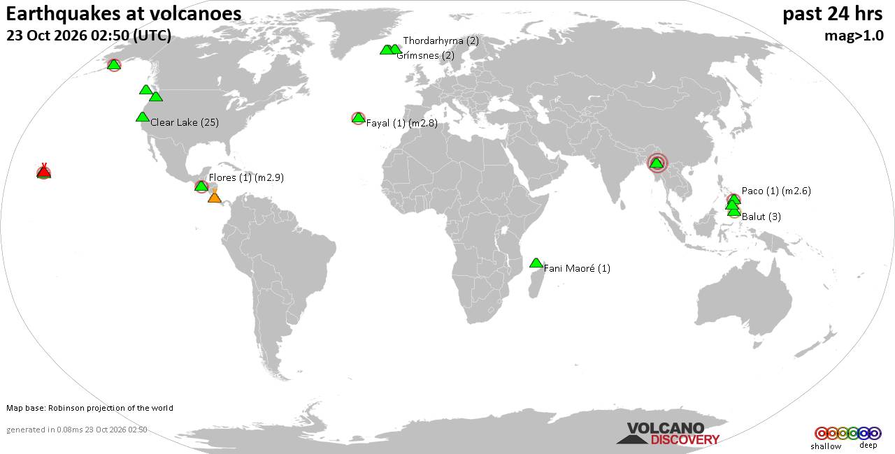
Volcano earthquake report for Friday, 23 October 2026
• M 4.0 - 42 km SSE of Acajutla, El Salvador
• M 3.2 - 23 km WSW of Gustine, CA
• M 0.6 - 22 km WSW of Dutch Harbor, Alaska
• M 0.6 - 43 km ENE of Pedro Bay, Alaska
• M 4.8 - 131 km ENE of Tadine, New Caledonia
|
|
|
Joined: Feb 2001
Posts: 678,977
Launch Director
|
|
Launch Director
Joined: Feb 2001
Posts: 678,977 |
SPC Oct 23, 2026 0730 UTC Day 3 Severe Thunderstorm OutlookSPC 0730Z Day 3 Outlook 
Day 3 Convective Outlook
NWS Storm Prediction Center Norman OK
0151 AM CDT Fri Oct 23 2026

Valid 251200Z - 261200Z

...THERE IS A MARGINAL RISK OF SEVERE THUNDERSTORMS ACROSS PARTS OF
SOUTHERN NEW MEXICO AND FAR WESTERN TEXAS...

...SUMMARY...
Isolated strong to severe thunderstorms, posing mainly a risk for
hail, are possible on Sunday across portions of southern New Mexico
and Far West Texas.

...Synopsis...

An upper cyclone/trough over UT/AZ will lift northeast across the
southern/central Rockies on Sunday into early Monday. A belt of
enhanced southwesterly flow aloft will persist across the southern
Rockies and adjacent High Plains. Modest southeasterly low-level
flow will maintain 50s F surface dewpoints across western TX into
southern/eastern NM to the south of a stalled surface boundary
oriented from northeast NM into western KS.

Convection is likely to be ongoing Sunday morning, lending to some
uncertainty in northward extent of low severe probabilities. Further
south across southern/southeast NM into Far West Texas, forecast
guidance suggests muted daytime heating could occur across the
modestly moist airmass, resulting in weak destabilization. Supercell
wind profiles will again be present given vertically veering winds
and increasing southwesterly flow with height. Cool midlevel
temperatures and elongated hodographs suggest hail will be the main
risk with stronger convection.

..Leitman.. 10/23/2026
Read morehttps://www.spc.noaa.gov/products/outlook/day3otlk_0730.html
|
|



CMS The Best Conveyancing solicitors conveyancing quotes throughout the UK
For any webhosting enquiries please email webmaster@aus-city.com
|
|
Entire Thread
|

 SPC Oct 23, 2026 0730 UTC Day 3 Severe Thunderstorm Outlook |
Webmaster
|
2 hours ago
|
|
Forums60
Topics889,849
Posts924,646
Members2,960
| |
Most Online102,106
Jul 10th, 2026
|
|
|
|
|

|









































